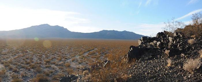
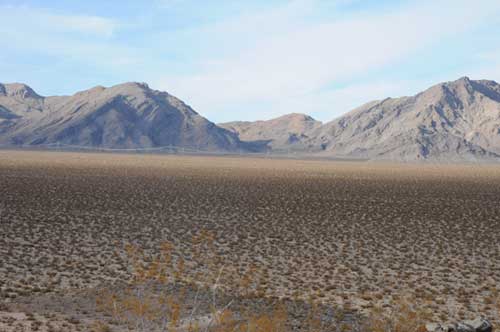
^View of Clark Mountain from the Metamorphic Hill. Ivanpah 3 heliostat field would lie on the flat.
Visual Impacts
The Bureau of Land Management (BLM) and California Energy Commission (CEC) concluded that the proposed Ivanpah Solar Electric Generating System project would result in a "substantial adverse impact to existing scenic resource values" as seen from the Ivanpah Valley and Clark Mountains.
 The project directly adjoins a national park unit and two designated wilderness areas, and a recreational land-sailing site of regional or greater importance on Ivanpah Playa.
BLM and CEC (Staff) were uncertain as to the level of discomfort or disability glare from the solar tower receivers, and were concerned about the cumulative visual effects of renewable projects on the California Desert Conservation Area and Mojave Desert as a whole.
"Staff also concludes that the proposed ISEGS project, particularly the solar receiver
units atop the solar power towers, would generate conspicuously bright levels of glare
for most or all viewers. This glare, while not representing a hazard, could represent a
strong, visually dominant feature as seen from the viewpoints named above, and could
strongly alter the character of views of Clark Mountain from the valley floor, interfering
with the public’s ability to enjoy those views. Staff concludes solar radiation and light
reflected from proposed project heliostats could cause a significant human health and
safety hazard to observers in vehicles on adjacent roadways or air traffic flying above
the site, and could cause a distraction of drivers on I-15 that would lead to road hazards
and to pilots of aircraft flying over the site" (page 1-31).
"A feature of this desert landscape is the potential for large projects to be seen over great distances where elevated viewpoints exist, due to the large open areas of level topography and absence of intervening landscape features" (page 6.12-8).
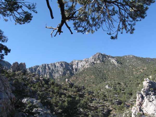
^Clark Mountain north face, in pinyon-juniper woodland, Mojave National Preserve.
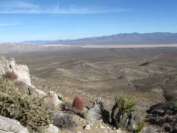
^View from east slope of Clark Mountain foothills looking east over the ISEGS site proposal.
"Both the Mojave National Preserve (MNP) and BLM Wilderness Areas (WAs) are
regarded as high viewer concern locations due to their special designated status. This
fact is amplified by the high visitor numbers reported by the National Park Service in
surveys of visitors to the Clark Mountains cited below. This, in combination with the
exceptional scenic quality of the mountains in both the MNP and WAs, and the high
project visibility from these elevated viewpoints, would result in a high overall sensitivity
rating" (page 6.12-10). The National Park Service estimates that 576,840 people visit Mojave National Preserve, and as many as 51,915 visit Clark Mountain.
"The overall area of the three proposed project phases would be approximately 6.4
square miles or 4,073 acres, most of which would be occupied by mirror fields. Under the modified project plan, there would be one power tower each at Ivanpah 1 and 2, and five towers at Ivanpah 3. All proposed towers would have an overall height of
approximately 459 feet (140 meters), with an additional 5 to 10 feet of FAA-required
lighting. Mirror array units would be approximately 12 feet (4 meters) tall.... Power towers would require day and night FAA strobe lighting. Other visually prominent structures would include steam turbine generators, air-cooled condensers, water storage tanks, a 16-acre substation, administrative and maintenance facilities, and new transmission lines and towers (described below). Of these the most prominent would be the Ivanpah 1 air-cooled condenser (approximately 92 feet in height)...; and new transmission towers" (page 6-12-12). We are unclear on the structure and size of any evaporation ponds.
BrightSource contractors gave the area a low visual rating, of Visual Resource Inventory (VRI) Class IV. But BLM and "Energy Commission staff’s independently-conducted visual inventory also resulted in an evaluation that is consistent with a VRI Class III rating of the area. In general, recreational destinations with high use levels within relatively scenic natural settings such as KOP 1 would not be considered VR Inventory Class IV, the lowest possible rating and one that implies either low viewer sensitivity or low scenic quality, neither of which apply to this site" (page 6-12-14).
>Mesquite Mountain Wilderness and Stateline Wilderness as seen from the Metamorphic Hill. ISEGS Ivanpah 3 would cover much of the ground to within a mile of the hills with a vast mirror field.
"Although no designated scenic vistas were identified in the study area, various viewpoints, particularly those in the Clark Mountains within the Mojave Preserve and Stateline Wilderness Area would qualify as such due both to their very high scenic quality and high levels of recreational use. Both representative KOPs [Key Observation Points] within the Clark Mountains, KOPs 9 and 10, would experience substantial adverse visual effects as a result of the proposed project. Panoramic elevated views of the valley would change from a relatively undisturbed desert floor landscape dominated by striking views of the Ivanpah dry lake bed, to an industrial, highly man-altered one dominated by roughly four square miles of mirror-arrays and 459-foot tall solar collector towers topped with brightly lit receiver units, a large graded area, as well as light rays reflected off of ambient atmospheric dust. The mirror fields would display a high degree of visual unity due to their orientation in large-scale circular patterns of high regularity around the collector towers, lending the view a higher level of visual quality than that of many other forms of intensive development. Reflected light rays, when present, would create striking, tent-like patterns, also with high visual unity, which some viewers might consider attractive or interesting. Nevertheless, since the existing intact natural landscape is considered one of the primary attractions for visitors to these mountains, the resulting dramatic alteration of landscape character, particularly as seen from high sensitivity recreational viewpoints in the Clark Mountains, is considered to represent a substantial adverse visual effect. These effects are discussed in further detail below, in the discussion of individual KOPs 9 and 10 under CEQA Criterion C" (page 6-12-15).
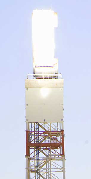
The Energy Commission disagrees with BrightSource's simulations of how the ISEGS plant would appear, calling the images "understated." There would be more glare, industrial facilities, complex and vivid patterns of light and dark, and "the heated solar receiver units at the top of the power towers would appear brightly lit in daylight. That brightness cannot be accurately depicted in graphic simulations" (page 6-12-16).
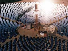
<Central receiver "power tower" collecting sunlight reflected from surrounding mirrors. Water in the external cylindrical tubular receiver boils and is piped to steam turbine generators (Daggett Solar 1). ISEGS towers would be 459 feet tall, or as tall as a 45-story building.
When dust is hanging in the air, the glare surrounding the towers would create a bright illumination.
"In addition to this strong level of contrast, the project would exhibit strong spatial and
scale dominance. The vast scale of the project would be such that it could not be taken
in in a single view....These factors together would result in a strong level of overall visual change. The project would demand attention, could not be overlooked, and would be dominant in the
landscape" (page 6-12-17).
"...within a landscape conservation-oriented frame of reference, the project would represent a
substantial change and impairment of a previously intact natural landscape" (page 6-12-20).
Individual heliostats would be 12 feet tall. "At certain times of day, diffused glare from the mirror surfaces would be prominent, similar to a lake surface in sunlight; at other times it would not, as in this simulation" (page 6-12-22).
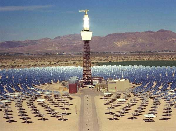
<Daggett Solar 2 in operation, a small plant compared to ISEGS.
Considering a Key Observation Point at Umberci Mine, a popular hiking destination in Stateline Wilderness Area, ther FDA/DEIS states: "Impact Significance –This strong level of overall project visual change contrast would not be compatible with the moderate overall visual sensitivity of the Ivanpah Valley, nor with the high overall visual sensitivity of the Stateline Wilderness Area in which this viewpoint is located. This level of impact is thus considered to be a significant visual impact" (page 6-12-25). No mitigation would be available.
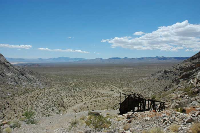
^Umberci Mine from the Stateline Wilderness mountains, looking south: most of the distant fan would be a sea of industrial mirrors if ISEGS is approved. The Metamorphic Hill is visible on the far left, with Ivanpah Playa beyond.
"The 120-acre construction area, and any graded or disturbed portions of the 257 acres used for temporary construction activities, however, could continue to have long-term adverse visual impacts. Graded areas could also result in adverse visual effects due to fugitive dust" (page 6-12-27).
"Glare is a major issue of concern for the ISEGS project, not only for aesthetic reasons,
but for navigation and safety reasons due to the proximity of Highway I-15, and to
aircraft flight paths associated with both existing facilities and with the anticipated future
Southern Nevada Supplemental Airport to be located a short distance north of the
project near Jean, Nevada. Potentially affected receptors would include aircraft,
motorists on I-15; hikers, climbers and other visitors in the Clark Mountains; and off-
road vehicle (ORV) motorists, wind sailors, hikers and others in the valley" (page 6-12-28).
"However, a third-party expert review commissioned by the Clark County Department of
Aviation (CCDOA) concluded that ‘glare from the heliostat mirrors could be a significant
hazard to air navigation.... CCDOA strongly urged the Energy Commission
to study the issue of potential glare on aircraft in more detail...."
"Subsequent to publication of the PSA, staff requested additional project data related in
particular to possible glare impacts from the solar receiver units atop the power towers.
Staff has also conducted additional analysis of the potential health and safety hazards
or potential for distraction from both the heliostats and power tower receivers as
provided in the Traffic and Transportation section of this document. Staff’s
subsequent independent analysis concludes solar radiation and light reflected from
proposed project heliostats could cause a significant human health and safety hazard to
observers in vehicles on adjacent roadways or air traffic flying above the site, and could
cause a distraction of drivers on I-15 that would lead to road hazards and to pilots of
aircraft flying over the site. Staff has proposed Condition of Certification TRANS-3 to
ensure solar radiation and light from the heliostats does not impair the vision of
motorists or pilots traveling near the site and that the potential for exposure of observers
does not cause a human health and safety hazard" (page 6.12-29).
The project would not conform with policies of the San Bernardino County General Plan Conservation and Open Space Elements as follows, calling for preservation of scenic vistas. Highway I-15 in the project vicinity is a County-designated scenic route.
Considering viewpoints of motoroists driving on I-15, the Energy Commission notes "...the very high number of viewers (up to 40,000 per day) makes it difficult to consider this KOP as having low sensitivity; under BLM guidelines, for example, 40,000 vehicles per year may indicate a high level of viewer sensitivity" (page 6.12-21).
The Visual Resources section of the FSA/DEIS lacks significant information about the potentially negative impacts that lighting from the facility would have on the wilderness values of the adjacent Mojave National Preserve, Stateline Wilderness Area and the Mesquite Mountains Wilderness Area. Potential impacts to recreational activities such as star gazing to visitors of these conservation areas is left out.
"Nighttime construction lighting, without adequate mitigation, could result in light pollution
affecting the Mojave National Preserve," says the FSA/DEIS (page 6-12-27). "FAA-required aircraft safety lighting, which is anticipated to include bright strobe lighting atop the 7 project towers, could not be shielded to prevent upwardly directed light" (page 6.12-30).
The FSA/DEIS underestimates how many Mojave National Preserve visitors stay in Primm hotels. We also think more analysis is needed on how the project would affect the viewscape of Nipton, a popular tourist hotel on the edge of Mojave National Preserve.
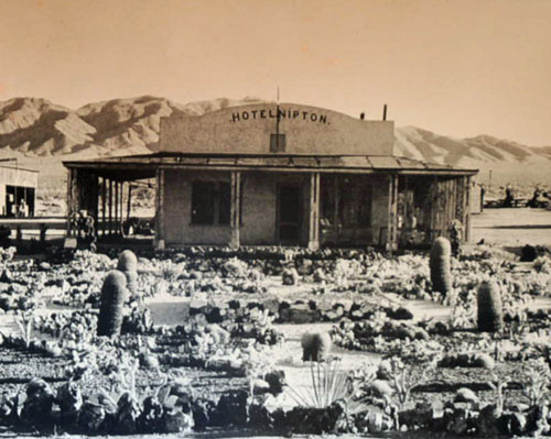
^Nipton Hotel in the early 1930s.
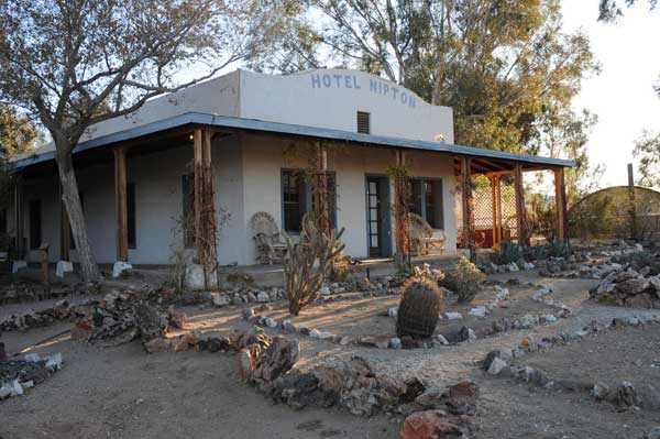
^Nipton Hotel today.
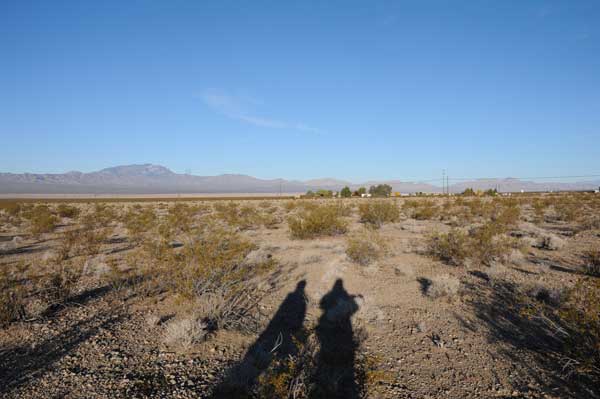
^View from Mojave National Preserve of Nipton, and beyond it the fan below Clark Mountain where the ISEGS project is proposed.
Cumulative impacts to visual quality of desert landscapes in Ivanpah Valley are called "considerable" (page 6.12-34). Cumulative light pollution for night skies would occur, and Ivanpah Valley would become "urbanized." Not only this area, but the Mojave Desert California Desert Conservation Area would be regionally affected, according to the Energy Commission.
"The Mojave Desert and California Desert Conservation Area (CDCA) within which the ISEGS project is located are a unique and highly valued scenic resource of national importance, as reflected by the presence of three national parks and numerous Wilderness Areas within its boundaries. Cumulative Impacts Table 1 identifies 66 solar projects and 63 wind project applications with a total overall area of over one million acres within the CDCA, which is indicative of the interest in public lands for renewable energy generation at a regional level. This figure does not include renewable projects within the Nevada and Arizona portions of the Mojave Desert."
"With this very high number of renewable energy applications currently filed with BLM,
the potential for profound widespread cumulative impacts to scenic resources within the
CDCA is clear. These cumulative impacts could include a substantial decline in the
overall number and extent of scenically intact, undisturbed desert landscapes, and a substantially more urbanized character in the overall southern California Mojave Desert landscape. Viewed in the cumulative context of the Southern California Mojave Desert as a whole, potential visual impacts of renewable energy projects are thus considered to be cumulatively considerable and potentially significant" (pages 6.12-33-34).
The Wilderness Society and National Resources Defense Council commented on visual resources in a letter, recommending that CEC and BLM consider whether the benefits of
the ISEGS project outweigh the visual and other effects. They urged the CEC and BLM to consider the desert-wide cumulative visual and other impacts from renewable energy and transmission projects. They asked that projects not be approved on lands in VRM Classes I and II, and that they be systematically prioritized for siting on already impaired landscapes. The Sierra Club also expressed concern with visual impacts to Mojave National Preserve.
The FSA/DEIS responded" "Comments are noted. Both Energy Commission and BLM will weigh in its respective license and ROW permit decisions the potential benefits of the project against the potential environmental impacts, including visual impacts. The desert-wide cumulative visual impacts of the project are discussed in the FSA/DEIS under the Cumulative Impacts discussion in the visual analysis. It is unlikely that any project application could be accepted by BLM on VRM Class I lands, since within the CDCA these would virtually all fall within Desert Protection Act-designated Wilderness Areas or National Park Service lands. Staff strongly concurs with the recommendation that projects not be sited on lands with VR (Inventory) Class II lands, as well as the recommendation to prioritize siting on already impaired or, by implication, VRI Class IV, lands. (There are no assigned VRM Classes within the CDCA). One important question that cannot be
answered at this time is whether sufficient visually impaired (VRI Class IV) lands are
available to meet demand for renewable energy applications on BLM lands within the
CDCA. Commentors should also note that assigned VR Management (VRM) Classes
do not necessarily reflect existing scenic quality of a landscape but, rather, visual
objectives for a land unit that are established in relation to other land use objectives" (pages 6.12-39-40).
Air Quality
Without adequate fugitive dust mitigation, the project would have the potential to exceed the General Conformity PM10 (particulate matter) applicability threshold during construction and operation, and could cause potential localized exceedances of the PM10 levels during construction. This potential exceedance of federal air quality standards would be considered a direct, adverse significant impact under NEPA.
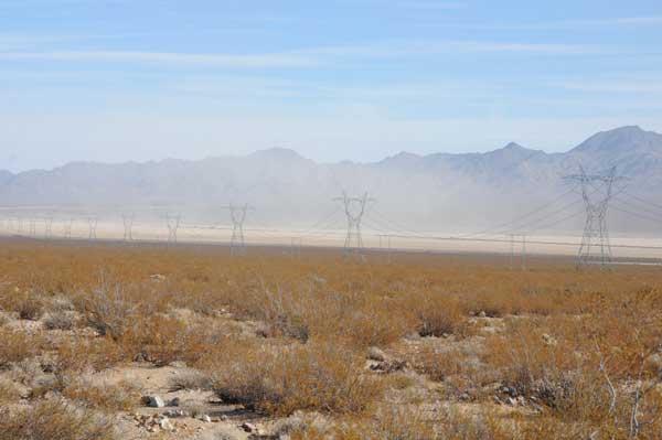
^December 2009 dust storm blowing up from both Roach Lake playa and Ivanpah playa from wind gusts, as seen from Ivanpah 2 near Yates Well Road. The transmission line running through the middle of the ISEGS project is visible.
Maximum Annual Emissions from the project estimated by the Energy Commission:
• Three natural gas fueled boilers, two 231.1 MMBtu/hr boilers (ISEGS 1 and ISEGS 2), and one 462.2 MMBtu/hr boiler (ISEGS 3) used for daily startup, each limited to no more than 4 hours of use per day and no more than 1,460 hours of use per year; All boilers operate for 1,460 hours per year.
• Three 240-bhp diesel-fired emergency fire water pump engines, one for each plant,
that will operate in non-emergency mode no more than 50 hours per year or no more
than required by National Fire Protection Association, whichever is greater; All four emergency generator engines operate 50 hours per year for testing
purposes.
• Four 3,750-bhp diesel-fired emergency generator engines fire water pump engines,
one each for ISEGS 1 and 2, and two for ISEGS 3 that will operate in non- emergency mode no more than 50 hours per year; All three emergency fire pump engines operate 50 hours per year for testing purposes.
• The heavy duty mirror washing vehicles travel 120,000 miles per year and the on-site pickup trucks travel 30,000 miles per year.
• 66 employees traveling 100 mile round trips to/from the site during the day and three heavy-duty delivery vehicle travel 100 mile round trips to/from the site during the day. There is a total of 2.34 million employee vehicle miles traveled and a total of 12,000 heavy-duty delivery vehicle miles traveled annually.
To mitigate for these emmissions, the CEC and BLM require All unpaved roads and disturbed areas in the project and linear construction sites will be watered until sufficiently wet to ensure that no visible dust plumes leave the project site. Wind erosion control techniques such as windbreaks, water, chemical dust suppressants, and vegetation will be used on all construction areas that may be disturbed. Any windbreaks used will remain in place until the soil is stabilized or permanently covered with vegetation (after 50 years?). Construction equipment will be shut down to avoid excessive idling emissions. Construction equipment will use low sulfur, low aromatic diesel fuel. Apply and maintain a non-toxic soil binder to the onsite unpaved roads to create a durable stabilized surface. Require the use new model year vehicles at the time of purchase for onsite maintenance, or equivalently low emitting vehicles as long as those vehicles can be demonstrated to have a similar or lower emission profile than new model year vehicles. Limit vehicle speeds within the facility to no more than ten miles per hour on unpaved areas that have not undergone soil stabilization, and up to 25 miles per hour on stabilized unpaved roads as long as no visible dust plumes are observed, to address fugitive PM emissions from the site.
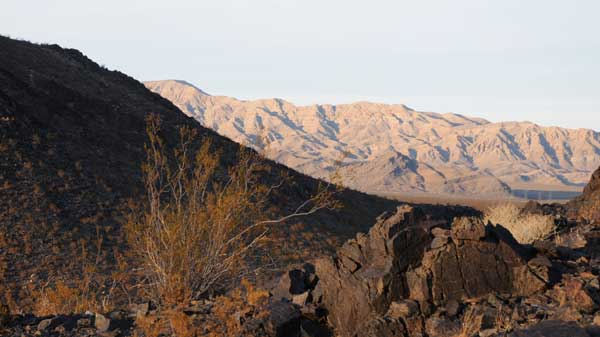
^Fall colors in the desert: view north from the Metamorphic Hill, to Stateline Wilderness and Devil Peak in Nevada.
Carbon Balance and Greenhouse Gases
Carbon balance is not discussed as a section in the FSA/DEIS, but we want to point out some discrepencies about utility-scale industrial renewable energy as an offset for the burning of carbon.
Air pollution emissions from the combustion of natural gas in the start-up boiler would
be controlled using best available control technology. Each boiler would be equipped
with low-Nitrogen Oxide (NOx) burners for NOx control. Carbon Monoxide (CO) would
be controlled using good combustion practices such as burner and control adjustment
based on oxygen continuous monitoring, operator training and proper maintenance.
Particulate and Volatile Organic Compounds (VOC) emissions will be minimized
through the use of natural gas as the fuel.
Heat input from natural gas will not exceed 5 percent of the heat input from the sun.
CO2 will be emmitted as trucks drive around hours a day, every day, washing mirrors and doing maintenance chores. We question how much greenhouse gases will be cut by the project when this is factored in. Not an idle issue, the same problem was brought up at a workshop for Tessera's Solar 1 Stirling engine solar project near Barstow, California: Tessera agreed to look into using alternative fuel or even electric trucks for washing at the 8,230-acre site to reduce carbon emmissions (Transcript of September 16, 2009, Data Request and Issues Resolution Workshop in Barstow, Posted December 3, 200: 1.1 megabyte pdf >>here).
We would also like to know where each part is going to be made (will the mirrors be built in Europe or Israel?), and how much carbon will be released shipping these parts to the project site?
No Sulfur Hexafluoride (SH6) minimization is discussed regarding transmission line upgrades. SH6 is colorless and very powerful greenhouse gas used primarily in electrical transmission and distribution systems and as a dielectric in electronics. The EPA calls SF6 a "High Global Warming Potential gas."
From www.epa.gov: "Electrical Transmission and Distribution. The primary user of SF6 is the electric power industry. Because of its inertness and dielectric (non-conductive) properties, SF6 is the industry's preferred gas for electrical insulation, current interruption, and arc quenching in the transmission and distribution of electricity. SF6 is used extensively in circuit breakers, gas-insulated substations, and switchgear. The U.S. inventory report provides detailed descriptions on SF6 emissions from electrical transmission and distribution and how they are estimated (see the Chapter entitled “Industrial Processes"). EPA has also established a voluntary program, called the SF6 Emissions Reduction Partnership for Electric Power Systems, which works with the electric power industry to reduce SF6 emissions."

^Spring blooms of California buckwheat (Eriogonum fasciculatum), a common shrub on the project site.

^Pancake cactus (Opuntia chlorotica), which grows on higher ground just above the site.

^Flower of Calico cactus (Echinocereus engelmannii).

^Wavy dry stems of Galleta grass (Hilaria rigida), after the seeds have fallen.
Traffic
Repair of physical damage to area roadways caused during project construction will be ensured, according to the FSA/DEIS. Vehicle trips by workers during construction and operation of the project would contribute to a "significant adverse direct and cumulative impact" on I-15, especially on Fridays (6.10-1).
Controversy has been generated over the potential of the project to expose aircraft pilots, motorists, and hikers to solar radiation reflected from project heliostats and/or
power tower receivers. Potential glare from the project must be minimized to the
maximum extent possible to not pose a health and safety risk, says the Energy Commission. In addition, because the project would place structures greater than 200 feet in height in the vicinity of military flight training routes and air traffic from the proposed Southern Nevada Supplemental Airport, staff has proposed Condition of Certification measures are placed to ensure the project complies with FAA recommendations for lighting of tall structures.When the ISEGS is operating, heat exhaust from the air cooled condensers would have the potential to cause turbulence to low flying aircraft. A condition of certification would require notifying the FAA of potential air hazards from turbulence at an altitude of 1,350 feet above the ground surface above the ISEGS site during daylight hours.
Sandia National Laboratories analyzed the Solar 1 Daggett solar power tower and determined that the "maximum permissible exposure" (MPE) for reflected sunlight would be:
• for momentary exposure (for a period of 0.25 second or less) is 10 kw/m.
• for continuous exposure (for a period greater than 0.25 second) is 1 kw/m2 (page 6.10-14).
The FSA/DEIS states: "With regard to heliostat safety, the highest intensity of solar radiation that could be directly reflected from a single heliostat would occur at its focal distance of 500 meters and would be 3.125 kw/m2.... Because this level of solar radiation is well below the MPE for momentary exposure of 10 kw/m2, an observer, such as a motorist or pilot, would not experience retinal injury in the event of sunlight being directed away from the power tower receiver and reflected towards an observer as a momentary
exposure. However, this solar radiation would exceed the MPE for continuous exposure
of 1 kw/m2, and the potential would exist for a person to experience injury if he or she
stared directly into the reflected solar radiation without blinking or looking away" (page 6.10-14).
"During daylight hours, the heliostats would normally pivot within the range of the stowed
position (mirrors facing vertically upwards) to the track position (various angles ranging
from facing horizontally to nearly vertical). At night, the heliostats would normally be
maintained in the stowed position. Approximately every 2 weeks, the heliostat would
pivot from the stowed position to the wash position for night-time mirror washing
(mirrors facing horizontally). Daily positioning of the heliostats would occur as follows:
"1. At dawn, when likely all heliostats would be moved from stowed to track position to
begin reflecting solar energy to the receiver/boiler;
"2. During mid-day, when some heliostats would be returned to the stowed position to
not exceed solar energy capacity limits of the receiver/boiler;
"3. During late-afternoon or evening, when the stowed heliostats would be returned to
track position to increase solar energy directed to the receiver/boiler as the sun’s
position begins to lower in the western horizon and be less optimal for energy
production;
"4. At nightfall, when all heliostats would be returned to the stowed position or to the
wash position for mirror washing at a frequency of about once every two weeks" (page 6.10-14).
"The aiming control system of the heliostats uses optimization software to instruct the
solar field controller where each heliostat should aim to maximize solar energy
collection and output. The software accounts for the light flux intensity and distribution
required for the four faces of the receiver/boiler and various other conditions such as
sun radiation, wind, air pressure, and the number of heliostats available for tracking.
When computing the optimal aiming policy, the control system factors in the differences
between heliostats with respect to their tracking accuracy, the intensity of the beam they
reflect, the shape of the beam and other relevant aspects. The applicant has indicated
that the optimization software would also prevent the mirrors from being aimed toward
the freeway or the Primm Valley Golf Course at an angle that would reflect sunlight near
the ground surface..." (page 6.10-15).
"Assuming all mirrors are returned to the stowed position (facing vertically upwards)
before dawn, staff has identified three circumstances under which an observer could
potentially be exposed to reflected solar radiation from one or more heliostats, including:
"1. Energy Capacity Regulation. During mid-day, when some heliostats would be returned to the stowed position to avoid exceeding the solar energy capacity limits of the receiver/boiler, which would result in the potential for sunlight to be reflected upward at angles that could be observed by pilots of aircraft flying over or past the site. Depending on the time of day at which a mirror is in the stow position and the orientation of the mirror, solar radiation could be reflected toward offsite site observers on roadways, in the airspace above the site, or at elevated positions on the ground (such as in foothills near the site);
" 2. Technical Malfunction. Solar radiation could be reflected offsite as a result of a
technical malfunction if the mirror position was such that it would reflect sunlight toward an observer;
"3. Maintenance. During day-time maintenance if the heliostat was moved from the stowed to the wash position and passed momentarily through a position that would reflect sunlight to an observer;
"Staff expects that for all of the scenarios described above, in most cases, exposure to
solar radiation reflected from heliostats would be momentary because the observers
would most likely be in motion—traveling either by vehicle or aircraft. The applicant has
indicated that in the event that a heliostat was not aimed at the receiver/boiler, never
would more than one heliostat be aimed at a single location or angle in the sky...Circumstances when an observer at ground level may not be in motion
and could be exposed to longer than momentary (continuous) reflection could occur
when hikers are in the Clark Mountains, motorists on I-15 are stationary or moving
slowly in congested traffic such as during Friday afternoons and evenings, or if an
observer is hiking or on a local road in the vicinity of the project and within 1,000
meters. Should any of these potential exposure conditions occur at ground level, this
reflected solar radiation would not be expected to exceed the MPE for continuous
exposure of 1 kw/m2, for hikers in the Clark Mountains and motorists on I-15, because
they would be beyond 1,000 meters from the heliostat. If observers were on-foot or in a
vehicle within 1,000 meters of heliostats that were misdirected, then they could be
exposed to reflected solar radiation exceeding the MPE for continuous exposure. While the brightness of light reflected from heliostats would likely cause observers to avoid
looking directly into the light for longer than a fraction of a second, it is not conclusive to
staff that personal reaction to bright light would adequately mitigate this risk of exposure
that could cause retinal injury to one’s eyes" (pages 6.10-15-16).
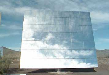
<Heliostat from Almena, Spain.
"The highest intensity of luminance expected to be reflected from a single heliostat, at its surface, would be 1.34 billion candelas/m2...(page 6.10-18)." The luminance of the sun is 1.6 billion cd/m2.
"...it is not conclusive to staff that personal reaction to bright light would adequately mitigate this risk of exposure that could cause temporary blindness and compromise safety of an observer who may be responsible to navigate an aircraft or vehicle" (page 6.10-19).
The Energy Commission proposes a " Heliostat Operating Plan" that would avoid potential for human health and safety hazards, and monitoring would be done for the first 5 years to verify operational safety and respond to any "complaints."
What liability measures will be taken for recreational visitors who might accidentally get eye damage? This is a strange new hazard for hikers in Mojave National Preserve and nearby wilderness areas. How will recreational drivers on the re-routed dirt roads that access Clark Mountain, Stateline Wilderness, and Mesquite Mountain Wilderness be protected if they cross the fan slowly and a "malfunction" happens? Such a giant experimental project should not be placed so close to high-use recreational areas and major highways.
"With regard to power tower receiver safety, the highest intensity of solar radiation
expected to be reflected from a single power tower receiver at its surface would be as
high as 688 kw/m2. However, as noted above, the intensity of reflected light and solar
radiation diminishes as distance from the source increases. Each tower on which each
power tower receiver would be installed would be approximately 140 meters tall (459
feet). Each power tower receiver would be approximately 20 meters high, therefore the
bottom of each power tower receiver would be located approximately 120 meters (394
feet) from the ground surface" (page 6.10-17). Brightness of light reflected at the surface of each power tower receiver would be approximately 555,000 cd/m2. The Energy Commission says this would be too far away for highway motorists to be affected, and would be equivalent to the brightness of a 100-watt light bulb as viewed from a distance of 115 feet. The Energy Commission admits, however, that this may be a distraction to drivers.
If, after measruements are taken of the glowing receiver towers in operation, luminance exceeds 89 cd/m2 at any of the nearest roads and power plant boundaries to each north, south, east and west face of each power tower, the Energy Commission proposes mitigation measures. We want to know what mitigation measures these would be? Apparently the receivers would have to reduce any luminance below this dangerous threshold, thus reducing powerplant efficeincy as well.
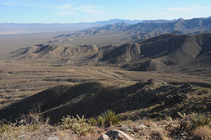
^View looking across the southern Ivanpah Valley from the Clark Mountain foothills. Colosseum Canyon lies below, with a 4x4 access road to the Preserve. Interstate Highway 15 comes down from these hills in the distance heading north through Ivanpah Valley.
Socioeconomics
It is anticipated that the construction period for the proposed ISEGS would occur from
first quarter 2009 through fourth quarter 2012. There will be an average of about 474 daily construction workers, with a peak daily workforce of 959, depending on the month and the work required. Research shows that construction workers would commute as much as two hours each direction from their communities rather than relocate.
Operational workers often commute as much as one hour to a power plant site from their homes rather than relocate, according to the FSA/DEIS. 90 permanent full-time employees would work at the site (management, engineering, and administrative staff; skilled workers; and operators). The FSA/DEIS says that most of the operational workforce will be drawn from the City of Las Vegas within Clark County, Nevada, as well as parts of surrounding rural areas in San Bernardino County, California. Controversy arose, however, and this changed recently, as BrightSource agreed to hire only San Bernardino County labor and hire unions. Bechtel would be the construction company.
We note thst most workers will probably find temporary housing in Las Vegas, not helping California's economy.
On a December 24, 2009, interview on News 3 at 6 (NBC), past Nevada Attorney General Brian Sandoval, who is making a bid for the governor's seat, admitted there won't be a lot of jobs in Nevada with solar power plants, after construction. He said Nevada needs factories where the solar panels and other technologies are built, if the state wants more jobs.
Our comments center on the number of urban workers that could be hired on a long-term basis if distributed generation were used as an alternative, in the cities. For example, Richmond, California has a solar training and placement school that gives training to urban at-risk residents on how to place solar panels on rooftops, among other training. Richmond BUILD Pre-Apprenticeship Construction Skills & Solar Installation Training program gives hands-on training in construction. The nonprofit Solar Richmond is another training program. The company has goals of buulding 5 MW of solar photovoltaic on rooftops in the city, as well as for low-income households, securing 100 new jobs in the process by 2010. Half the trainees are black, 15% latinos, 10% Asian, all residents of Richmond, getting a chance to break into the "green economy." The job placement system helpd trainees find jobs -- some have been hired by such companies as SunEdison to place photovoltaic panels on BART stations (the local train). Trainees are also installing solar water heating systems on rooftops. As of fall 2009, Solar Richmond has installed 4.87 MW of rooftop solar, making Richmond one of the top cities for watts per capita in the Bay Area. No desert scraped! The company also works to forge Power Purchase Agreements where solar companies install and own the panels on the rooftops of buildings, and even a church in Walnut Creek, so that the bills are paid not to PG&E, but to the solar installer company iteself -- no upfront costs for buying solar panels. (Solar Today September/October 2009)
The pay for biologists that will be used at ISEGS for surveys, tortoise clearances, and other jobs should also be considered. Most biological contractors are paid $50 per hour (sometimes more), and can make $500 per day with per diem (I know, I was one of them in the past). This extreme pay, partly filtered out of federal grants given to the companies that will be building these solar projects, would not need to be paid if power generation originated in cities and did not have to disturb rich habitats with threatened and endangered species.
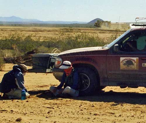
>Tortoise biological contractors at work on a clearance survey on a large project in tortoise habitat. Tortoise are translocated simultaneous to construction activities.
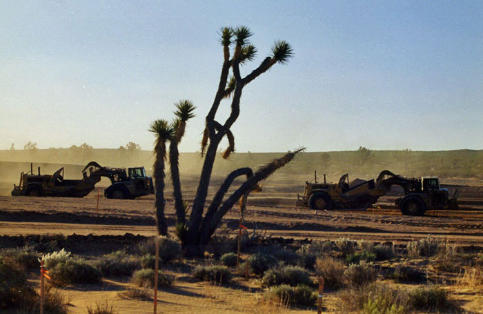
^The "green economy" in action?
Hazardous Materials, Health and Safety
"During the construction phase of the project, the only hazardous materials proposed for
use include paint, cleaners, solvents, gasoline, diesel fuel, motor oil, welding gases, and
lubricants. Any impact of spills or other releases of these materials would be limited to
the site because of the small quantities involved, the infrequent use and hence reduced
chances of release, and/or the temporary containment berms used by contractors.
Petroleum hydrocarbon-based motor fuels, mineral oil, lube oil, and diesel fuel all have
very low volatility and would represent limited off-site hazards, even in larger quantities.
During operations, hazardous chemicals such as cleaning agents, lube oil, sulfuric acid,
sodium hydroxide, ammonium hydroxide, diesel fuel and other various chemicals..." (page 6.4-9). Mitigation measures are recommended by the Energy Commission and BLM to prevent hazards from spills and accidents.
Security measures to prevent access to hazardous materials would include perimeter fencing and breach detectors, possibly guards, alarms, site access procedures for employees and vendors, site personnel background checks, and law enforcement contact in the event of a security breach. Site access for vendors would be strictly controlled. Consistent with current state and federal regulations governing the transport of hazardous materials, hazardous materials vendors would have to maintain their transport vehicle fleets and employ only drivers who are properly licensed and trained. The project owner would be required, through its contractual language with vendors, to ensure that vendors supplying hazardous materials strictly adhere to the U.S. DOT requirements that hazardous materials vendors prepare and implement security plans..." (page 6.4-12).
When calling renewable energy projects like this "clean" and "green" we would like to note how in reality many toxins may inadvertently enter the environment and possibly affect tortoises, plant life, and even humans in the vicinity. No form of energy does not have consequences.
A fire protection system would be designed to protect personnel and limit property
loss and plant downtime in the event of a fire. The primary source of fire protection
water would be the 250,000 gallon raw water storage tank to be located in each power
block. Approximately 100,000 gallons would be usable for plant process needs and
150,000 gallons would be reserved for fire protection. All fire protection systems would be focused on the power blocks, administration/warehouse building, and other areas of
active operations. The project would not include any specific facilities to address
potential wild fires. This would put the burden on the counties.
"The possibility exists that an earthquake could cause the failure of a hazardous
materials storage tank. A quake could also cause the failure of the secondary
containment system (berms and dikes), as well as electrically controlled valves and
pumps. The failure of all these preventive control measures might then result in a vapor
cloud of hazardous materials that could move off-site and impact residents and workers
in the surrounding community" (page 6.4-11). The Stateline Fault runs through the area, but CEC/BLM decided that modern storage tanks would not be in danger of exploding.
Burros
Wild burros are present. In the NEMO Plan Amendments, the Appropriate Management
Level (AML) for burros in the Clark Mountain HMA was reduced from 44 to 0, and
approximately 100 burros were removed from the area in January 2007. Cumulative impacts on burros may result from the combination of this proposed project
with other current and reasonably foreseeable future land uses, including other solar
energy projects.
Cumulative Impacts - Huge!
In a recent phone converstation with CEC, we were told that ISEGS is "the tip of the iceberg." In the California Deserts the current dozen or so solar thermal projects with applications in represents a mere 4% of the coming applications. That would mean more than 200 industrial-scale solar thermal projects are looking to build on the Mojave and Colorado Deserts in the state. And that does not include large photovoltaic projects on valley floors and utility-scale wind projects on hills and ridges.
The FSA/DEIS says government incentives are likely to encourage more renewable energy projects:
● "U.S. Treasury Department's Payments for Specified Energy Property in Lieu of Tax
Credits under §1603 of the American Recovery and Reinvestment Act of 2009 (Public Law 111-5) - Offers a grant (in lieu of investment tax credit) to receive funding for 30% of their total capital cost at such time as a project achieves commercial operation (currently applies to projects that begin construction by December 31, 2010 and begin commercial operation before January 1, 2017)."
● "U.S. Department of Energy (DOE) Loan Guarantee Program pursuant to §1703 of Title XVII of the Energy Policy Act of 2005 - Offers a loan guarantee that is also a low interest loan to finance up to 80% of the capital cost at an interest rate much lower than conventional financing. The lower interest rate can reduce the cost of financing and the gross project cost on the order of several hundred million dollars over the life of the project, depending on the capital cost of the project" (pages 5.3-4).
BrightSource argues with the Energy Commission and BLM on there use of a large regional land area for evaluating cumulative impacts. Many renewable energy and other projects are planned for not just Ivanpah Valley but across the California Desert Conservation Area (CDCA).
In a comment, the applicant BrightSource states that while solar and wind development applications for use of BLM land have been submitted for approximately one million acres of the CDCA, a Plan of Development letter does not mean that the project is a reasonably foreseeable project. BLM and the Energy Commission argue back that a Plan of Development is a formal proposal, and thus qualifies these projects as "reasonably foreseeable."
Solar Energy projects in the California Desert so far total 66 projects over 602,987 acres, and wind totals 63 projects over 458,941 acres of public land (page 5-11).
In Ivanpah Valley some potential future projects include:
--OptiSolar GEN 3 Solar, Inc., (recently bought by FirstSolar) 300 MW Photovoltaic solar energy project on 4,160 acres just north of the ISEGS.
--Ivanpah Airport (Southern Nevada Supplemental Airport), Clark County Department of
Aviation. Draft EIS in progress, Scoping Report available. International Airport to supplement the McCarran International Airport in Las Vegas. On 5,934 acre site on Roach Dry Lake, with 17,000 acre sphere of influence.
--DesertXpress Enterprises, Victorville-Las Vegas High Speed Train, along the I-15, but conflicts with both ISEGS and OptiSolar. The track proposal crosses both solar energy site proposals. No resolution yet.
--Joint Port of Entry, CALTRANS, California Dept of Food and Ag. Between Yates Well Road and Nipton Road, San Bernardino County. Agricultural Inspection Facility and a Commercial Vehicle Enforcement Facility.
--Mixed-use Development 166 acres near Jean, Nevada by MGM Mirage and
Jeanco Realty Development, LLC.
--Wind energy power plant, Mountain Pass, PPM Energy. 75 MW wind energy project on 2,330 acres.
--Power Partners SW Solar, west of Jean, NV. Power Partners Southwest LLC, Solar Power Plant to generate 250 MW, located on approximately 10,814 acres near Jean, NV. Adjacent to Largescale Translocation Site for tortoises in Clark County.
--Upgrade to existing 115-kV transmission line from El Dorado substation, along northern
transmission lines of Southern California Edison (SCE). Construct a new Ivanpah Substation sized to accommodate 220/115 kV facilities. Remove approximately 36 miles of a portion of the Eldorado-Ivanpah leg of the existing Eldorado-Baker-Cool Water-Dunn Siding-Mountain Pass 115 kV line and construct a double circuit 220 kV line. According to the Las Vegas Management Plan, the SCE 220 kV transmission line upgrade would cross desert bighorn sheep habitat, Gambel's quail habitat, and would be north of mule deer
winter rangeland, all of which are considered species of concern. The upgrades would
be located north of the Piute-El Dorado desert tortoise Desert Wildlife Management Area (DWMA).
--NextLight Renewable Power, LLC. Silver State North and South, just south of Primm, Nevada, on the California/ Nevada border, on excelent tortoise habitat. Two photovoltaic power plants. The FSA/DEIS mistakenly describes these as solar trough power plants (page 5-17).
--Cogentrix Solar Services LLC (owned by Goldman-Sachs), southeast of Jean, Nevad. Solar thermal energy facility for approximately 19,849 acres. Mining claims identified in the same area.
BrightSource objected to the Nevada projects being included, but since they are in the same watershed and ecological setting, we agree that CEC/BLM needs to look at them.
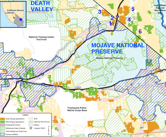
^Cumulative impacts to the region around Ivanpah Valley. Orange solid areas are solar proposals, green solid are wind, green hatched areas are wilderness, blue hatched are tortoise DWMAs. 1-ISEGS proposal, 2-FirstSolar (OptiSolar), 3-Power Partners SW, 4-NextLight Silver State North and South (this was left off the FSA/DEIS map page 5-36; we put it in here), 5-Cogentrix, 6-Castle Peak wind projects.

^Young Barrel cactus (Ferocactus cylindraceus).
