Biologcal Issues Debated
May 3 and 4, 2010, Ridgecrest, California - Page 1: Tortoise Issues, Page 2: Mojave Ground Squirrel.
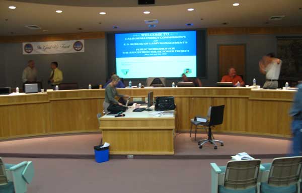
Biologists for and against the Ridgecrest Solar Power Project faced off during the California Energy Commission (CEC) workshop to try to resolve issues around the Solar Millennium parabolic trough solar thermal project on Mojave Desert public land west of Ridgecrest. The Bureau of Land Management was present, as they will be granting a Right-of-Way independently of the CEC. US Fish and Wildlife Service and California Department of Fish and Game were also attending. The issues covered formed the focus of why the CEC was recommending against the project.
CEC biologist Dick Anderson defended the commission's stance that the project should not be certified. He said there was confusion about the "conditions of certification" that the Energy Commission provided to Solar Millennium, pointing out that they did not fully mitigate impacts that the project would have on the environment, just provide ways to salvage resources in a better way.
He called the habitat for Desert tortoise "high quality" but said that Dr. Alice Karl, Solar Millennium's contracting biologist, described it as low quality. "We may agree to disagree," Anderson acknowledged. He stated that impacts of the project will not end at the fenceline.
Arguments on the first day centered around how to interpret differing tortoise survey data across the range of the reptile, and how to compare tortoise density on different areas of different sizes.
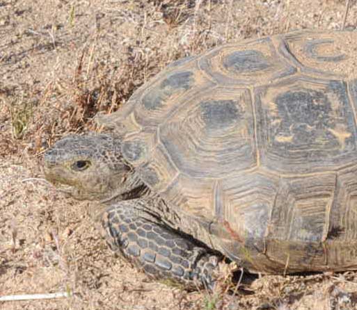 Forty tortoises were counted on the project site, including 23 adults, 12 juveniles, and 5 animals not measured. Whether these last were included in density estimates or not resulted in a number ranging from 8.1 to 9.8 tortoises per square kilometer, giving a population estimate of 57 to 69 tortoises, respectively.
>Female tortoise found in El Paso Wash in May 2010.
Comparing this to other areas, Anderson gave figures ranging from 3.8 to 6.1 tortoises per square kilometer during surveys carried out from 2001 to 2007. The Northeastern Mojave had estimates of from 1.7 to 3.7 tortoise per square kilometer in 2001 to 2007. Raw data from the Ivanpah Valley solar project site gave an estimate of 1.6. The Calico Solar Project site east of Barstow had a total count so far of 115 tortoises over 8,000 acres, still less than the Ridgecrest site in density. Fremont Valley in the West Mojave had a density estimate (all sizes of tortoise) of over 100 per square kilometer in 1981; in 2007 the number fell to about 10, a 90% decline. Fremont Peak fell from 39 in 1980 to zero in 2007.
Anderson said the Ridgecrest project site is a "hotspot" patch of density, with a high number of juveniles, indicating a productive site. Direct, indirect, and cumulative impacts would be all be significant. "The solution," he emphasized, "select an alternative brownfield site."
Anderson warned that using current data was very important, as steep declines are observed as you go back in time. Dr. Karl, representing Solar Millennium, countered that the available data on tortoise density was "very slim," so old data had to be used. She showed various survey numbers, using only adult counts, from old and new years, such as the Desert Tortoise Natural Area (Kern County) from 1982 giving a density estimate of 92 tortoise per square kilometer. This dropped to 5 in 1996. The 18.3 square kilometer Hyundai Test Track near the town of Mojave had 1.5 tortoises per square kilometer in 2004. Fort Irwin expansion plots gave from 0 to 14 per square kilometer in 2001 and 2002. The mean of all her sites was about 8 tortoise per square kilometer, and thus Ridgecrest was rather low she concluded. But this included old dates. Anderson accused her of "cherry-picking" survey data to get at this high mean. "You probably searched hard for those sites," he said of her list.
Much time was spent arguing whether the large sampling units used by US Fish and Wildlife Service (up to 10,000 square kilometers) to survey for tortoises across large areas of the Mojave Desert, using Line Distance Sampling methods, were actually comparable to small project surveys. But the latter results were intended by FWS to be compared to the large surveys.
What is Line Distance Sampling?
Tortoise surveyors walk a straight line across the landscape using a compass to stay on track, and count tortoises found on the line. The survey can be grueling when rocky hills get in the way, but in the end after specific mathematical equations are applied to the data, an estimate of tortoises can be determined, even taking into account tortoises hiding below ground in their burrows.
From US Fish and Wildlife Service website:
The Desert Tortoise (Mojave Population) Recovery Plan (US Fish and Wildlife Service, Portland, Oregon, 1994) requires monitoring of desert tortoises to assess changes in status with the best available data. Line distance sampling (Buckland et al., Introduction to Distance Sampling, Oxford University Press, 2001) has been chosen as the standard method for conducting range-wide monitoring of tortoises in the Mojave Desert. Distance sampling generates a detection function based on the perpendicular distance of objects (tortoises) from the center of a transect. The detection function provides a correction for the number of tortoises occurring per kilometer walked along the transect. A further correction is provided by estimating the proportion of tortoises that are visible during the monitoring period. Tortoises equipped with radio transmitters are monitored each day to assess the proportion of encounters when they would be deep in a burrow or thick vegetation and not visible. The encounter rate and the two correction factors provide an estimate of the overall population density within each monitoring area. (http://www.deserttortoise.gov/lds/ldsindex.php)
Long-term monitoring areas were selected because they are managed to recover the desert tortoise in the Mojave and Colorado Deserts. These tortoise conservation areas are managed under designations such as Desert Wildlife Management Areas, USFWS critical habitat, and BLM Areas of Critical Environmental Concern, or they occur on national parklands or national wildlife refuges.
Karl also tried to use "sign-count" survey data from the West Mojave planning area, where surveyors count tortoise droppings and burrows to try to guess numbers. These, she said, showed higher densities across the area. But tortoise sign is variable from year-to-year depending on rainfall, and how much tortoises eat (during a drought year tortoises may eat very little and stay in their burrow).
Dr. Karl concluded that the Ridgecrest project site was not in tortoise critical habitat (designated by FWS), not in a Desert Wildlife Management Area (DWMA), and was on the edge of the tortoise range. No question, she admitted, that the tortoise is in trouble. "But we have to decide if the project will affect recovery." She further admitted that the project will disrupt tortoise social systems and behavior; "some tortoise will die." But the project could actually provide opportunities to "help tortoises." They could still move through the area in El Paso Wash, provided off-roaders were not funneled through the wash. Solar Millennium would offer to fence Highway 395 nearby with tortoise exclusion fencing to prevent road-kills, and this, it was claimed, could increase tortoise populations there. But Michael Connor of Western Watersheds Project had looked at the area near the highway and found good numbers of tortoise sign here already.
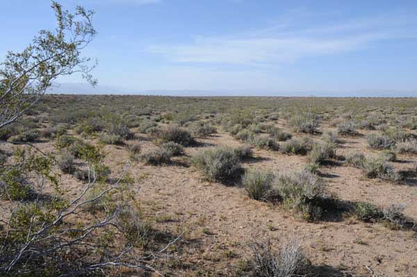
<The wide El Paso Wash along the western edge of the North Unit of the Solar Millennium project.
To counter Karl, the Energy Commission invited Dr. Kristin Berry of the United States Geological Survey at the Western Ecological Research Center, University of California at Riverside, one of the preeminent tortoise biologists who helped to list the tortoise as Federally Threatened. She mentioned three recent studies in the area not discussed by Karl. A 2001-2008 tortoise survey from Jawbone Canyon to Highway 395 showed very low density except on Kiavah Fan and in Red Rock Canyon State Park. In Red Rock densities were 2.7 to 3.5 tortoise per square kilometer in 2008. Berry estimated a 67% death rate for adults and subadults over the course of the study, a rapid decline from even four years ago. Anecdotal reports suggest they were much more common in the 1970s.
A study done in the El Paso Mountains, including the south edge of the project site, covered 370 square kilometers -- a landscape level study. Tortoise densities overall were low, 4.5 adults per square kilometers. From 2004 to 2008 she recorded a 32% death rate, 12% of those tortoises dying from being shot or run over. The population was in rapid decline she thought.
In her best professional opinion, she stated, the project site was high quality.
The issue of what to use as a baseline was discussed. Berry said that shifting baselines for tortoise numbers used by different people can produce very different results. In the 1950s and 60s tortoises were very common in the Indian Wells Valley, said Berry. She talked with a Navy man, for instance, who recalled seeing 20 tortoises on a half-hour morning walk. Livestock grazing affected them, and by the 1970s, numbers were thought to be lowered. But what do scientists use as a baseline -- 1970? 1990? 2000? High quality detailed data for tortoises started to be collected only by the 1970s. Alice Karl argued that today should be the baseline, current data.
Climate Change is also a concern: where are tortoises going to live? Perhaps further north and at slightly higher elevation, Berry said. So these areas become more important, especially public lands such as the project site area.
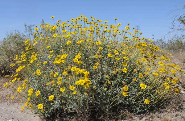
Brittlebush (Encelia farinosa) flowering on the southwestern part of the project site.
 Brian Croft of the US Fish and Wildlife Service (FWS), the agency responsible for recovering the Federally Threatened desert tortoise, said the project site was a high value site. They were currently revising the recovery plan, recognizing that land outside tortoise conservation areas could play a critical role, and that development could hamper recovery efforts. He said Line Distance Sampling (a type of survey method used to estimate populations, rather than just presence) was not a perfect way to compare densities, as FWS was using them over large areas to get an average. There may be pockets of higher density. But still, the Ridgecrest project site appears to have a higher density than almost every area sampled in the Mojave Desert. It is at least apparently above average, Croft indicated. There may be certain high-value pockets in Indian Wells Valley that can play a role in future recovery.
Dave Hacker of the California Department of Fish and Game (DFG) agreed. Line Distance Sampling produces the most comparable data to construction site surveys. It is perfectly valid to compare site data to averages, he said -- "that's what we want to know." Using the best available information, the project site appears to be surrounded by areas with relatively low density. "We want to preserve these hotspots."
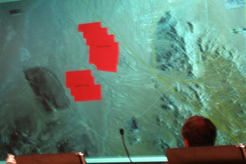
<The Ridgecrest Solar Power Project in red filling a connectivity corridor between Highway 395 and the El Paso Mountains.
Ileene Anderson, biologist with the Center for Biological Diversity, which is intervened in the case, said the site should be protected for tortoise conservation and recovery. It is a hotspot on the northern edge of their range, and the tortoise genetics here could be important in helping the species adapt to Climate Change.
Berry added that you can't have a population of tortoises without reproduction. Long ago Berry saw 50% adults and 50% younger tortoises, with cohorts (age groups) growing, coming along well. Now, at the Jawbone-Butterbredt Area of Critical Environmental Concern (to the west of Ridgecrest) she found only five tortoises during her last survey: four adults and one she could not see to determine its age. Some populations have only large old adults currently. She emphasized looking at shell remains to try to study the mortality of young animals. She said it was exciting to see so many juveniles and immature tortoises on the project site -- "somethings' right."
Alice Karl countered that juvenile tortoise carcasses are often consumed completely by predators. Berry answered that you can still juvenile scutes in predator scat.
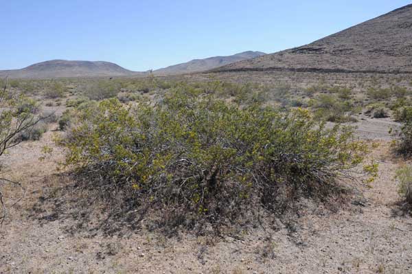
>Creosote ring, an ancient shrub potentially thousands of years old, on the southwestern corner of the project site.
Scott Galati, attorney representing Solar Millennium, the applicant trying to get approval for the solar project, asked whether discussions about tortoise density were even the right questions? He stated they could mitigate for this high value. Examples they gave included fencing off roads and highways in the area, and purchasing land.
Dick Anderson of CEC reminded Galati that tortoise declines were still being noted within the protected, fenced area of the Desert Tortoise Natural Area nearby, albeit at a slower rate than other areas. He said there is no guarantee you can enhance an area to make up for a lost spot. If the spot is a good, strong one, "leave it alone."
Dr. Berry reminded everyone that translocation has not worked well in recent efforts. At the Fort Irwin expansion areas in San Bernardino County, she radio-tracked 158 tortoises that were translocated in spring 2008; as of last month only 65 were still known to be alive.
Disease is a continuing problem with tortoises as well, she pointed out. Upper Respiratory Tract Disease (URTD), a contagious illness causing nasal discharge, puffy eyelids, eyes recessed into the orbits, and dullness of the skin and scutes. Predisposing factors may include poor nutrition (resulting from habitat degradation), drought, and release of captive desert tortoises sick with URTD into the wild. Berry said as many as 70% of captive tortoise in Ridgecrest have URTD. Such data was not collected on the project site, and Berry recommended that in the future all tortoises encountered should have their eyes, beak, and carapace photographed (NOT handled). Some tortoise in the El Paso Mountains had clinical signs of URTD.
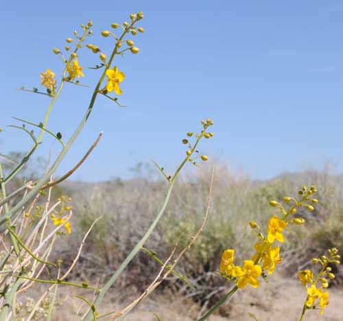
<Senna (Senna armata) shrub with brilliant yellow blooms, indicating a good rainy season. Southern project site, May 2010.
Mitigation
The discussion moved back to mitigation for tortoises. Dick Anderson, CEC biologist, again stressed that these biological resources cannot be fully mitigated, but noted that the commission could still approve the project, so mitigation measures need to be provided for reducing impacts.
Brian Croft of FWS said his agency was drafting new guidance. This would include: 1. Identify a translocation area at least the size of the project; 2. Survey during the tortoise active season (spring and fall) to determine density (the site can be sampled, and need not be 100% coverage); 3. Look for clinical signs of disease on all tortoises; 4. Agreement that the translocation plan is acceptable; 5. Translocate tortoises in spring or fall. If tortoises are moved greater than 5 kilometers, then an ELISA (enzyme-linked immunosorbent assay) test is required to detect URTD. If the move is less than 5 km, only an examination for clinical signs of disease is required.; 6. Five years of close monitoring of tortoises would be required, transmittering all translocated animals and an equal number of tortoises already on the site. In addition, to compare mortality, tortoises on a control site would also be transmittered and monitored. The window for conducting ELISA tests is mid May to mid October, so that the antibodies are easily observable as the tortoise is active.
The translocation site would need to be greater than 15 km from major highways to protect tortoises from road-kill. Otherwise tortoise-exclusion fencing would need to be put up along the highways.
There was still an issue, however, with the distance tortoises are moved that triggers the ELISA test. Sid Silliman of the Desert Tortoise Council commented that the ELISA test should be done on tortoises moved from 305 meters to 5 km as well as over this distance. This would better protect tortoise populations from the spread of disease. Croft of FWS answered that his science advisors had accepted the over 5 km rule, but could not specify why. Dr. Berry agreed that the guidance of 5 km does not follow data sets on Ft. Irwin and her Daggett study plot, and would not protect tortoises adequately in her professional opinion. The testing should be done under 5 km also. But the issue went unresolved.
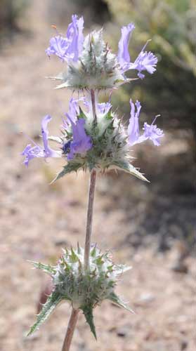
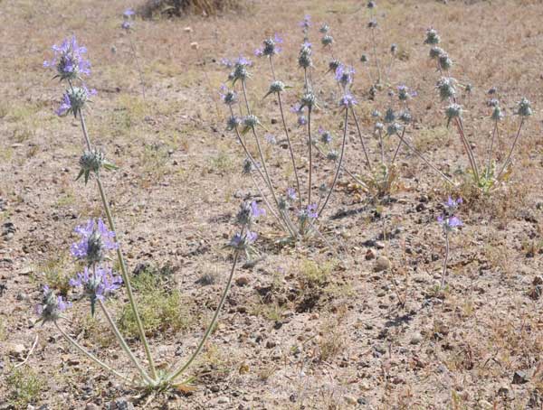
<Thistle sage (Salvia ), south project site, May 2010.
Brian Croft of FWS said they were not against moving tortoises to Areas of Critical Environmental Concern (ACECs) and Desert Wildlife Management Areas (DWMAs), areas often set aside specifically to protect tortoises. He said ideally tortoises would be kept as close as possible to the project site, but if they are moved to multiple-use BLM land this would provide no protection.
Dave Hacker of Fish and Game said this was also the core of their issue. They want to ensure long-term conservation on receiving lands, and not have solar projects in the future on lands set aside for tortoises translocation. The habitat must be protected. Edge effects, fragmentation, and the reduced value of habitat around large projects would be a problem. DFG recommended tortoise translocation plus habitat mitigation. Hacker seemed unsure about accepting translocation of tortoises into a DWMA, as there may be private lands within it.
Solar Millennium proposed Little Dixie Wash to the northwest of the project site as a potential tortoise translocation area. We note that parts of this area have wind energy applications pending, however.
Dick Anderson told Solar Millennium to revise their translocation plan to fit current guidance, and that they had "better look rapidly" for land so surveys could be done this fall, for spring 2011 translocations. Whether public or private lands be found for tortoise translocation, these need to be protected in perpetuity. He pointed to the I-10 corridor (Chuckwalla Valley) where the In Lieu mitigation bank was focusing. BLM could have land with conservation easements. The land could be deeded to BLM after a conservation easement was recorded on it. Public land could work, he said.
BLM declared that no tortoises should be translocated into Wilderness Areas.
In Lieu Fee Program
More discussions of the In Lieu mitigation program followed. (For more on this SBX 34 mitigation bill signed into law by Governor Schwarzenegger recently, see >>here.) Scott Galati of Solar Millennium asked whether the applicant could pay fees into this program and also get translocation sites? Then the Department of Fish and Game would take over. Dave Hacker of DFG said, no, the applicant must still identify specific measures. The agency would carry out the enhancement actions, but it does not defer land acquisition. The In Lieu Fee Program is still being hammered out by DFG, so confusion lingers. $10 million has been authorized for a fund to receive additional mitigation funds from applicants, but DFG does not yet know whether lands can receive tortoises. The whole program is not yet fully developed. Some of the $10 million has been earmarked already for the I-10 corridor (where Solar Millennium has two projects, Palen and Blythe, and NextEra has its Genesis project).
The applicant has to identify specific actions to mitigate, Hacker says. It is not a per-acre fee. The applicant pays the agencies to do the actions, instead of doing them itself, but it still must show how each project will be mitigated. Each impact should be quantified and then offset by a mitigation impact. A menu of actions, performance criteria, will have to be developed. The same California Environmental Quality Act (CEQA) analysis will be done, but the agencies implement the actions.
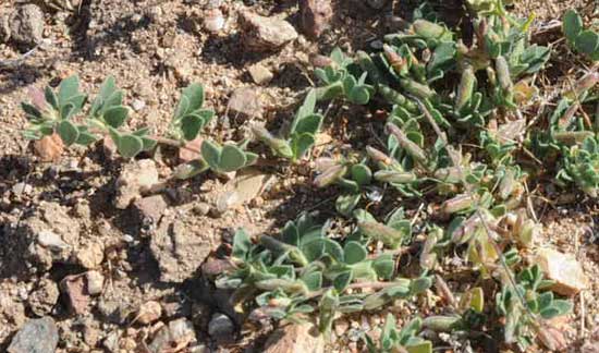
>Good food for juvenile tortoises: Lotus (Lotus sp.). South project site.
Dr. Larry LaPre, biologist for BLM, said many non-profits exist that could buy habitat, then turn it over to BLM with a conservation easement. Or these non-profits could keep the land. The SBX 34 program might be available for this project. DFG buys land, keeps it, gives it to a non-profit, or to BLM with a conservation easement, and the applicant reimburses the fund.
Each project creates a deposit document, and money for land acquisition, fencing, weed removal, specific mitigation actions, goes into the account. But, LaPre said nobody has yet figured out how many acres of weeds, for example, would equal a specific number of tortoises.
Eric Solorio, CEC project manager, said this needs to be reconciled quickly. He described the program as enabling the developer to put in a mitigation plan, hand the agency a check, then they are free to go.
LaPre said the program was voluntary for the applicant, who could choose to purchase land themselves. Solorio added that the program would help developers not compete for land. LaPre said, "They already are." Land values are already changing due to SBX 34.
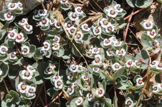
<Rattlesnakeweed (Chamaesyce albomarginata), southern project area.
BLM's mitigation ratios differed from those recommended for the project site by CEC. BLM says the applicant may purchase 1 acre of mitigation land for every 1 acre of project habitat on the northern solar field (north of Brown Road), but a higher ratio south of Brown Road: 5:1. This was due to the southern area being within the Mojave Ground Squirrel Conservation Area boundary. But it was pointed out that this boundary was an arbitrary one, politically drawn at an earlier time after negotiations with the city of Ridgecrest and Kern County. CEC wants the entire project site mitigated at a 5:1 ratio, as it is all good tortoise habitat. The Luz projects were mitigated at 5:1 according to Dick Anderson. The applicant argued for 3:1.
BLM recommended trying to find large areas of consolidated land to purchase, big blocks, not areas with sporadic widely-scattered conservation easements. Go in the direction of the Fremont-Kramer DWMA, they said.
 Anderson said they could explore other options of purchasing less land and paying for enhancement actions, such as a Headstart program (where tortoise juveniles are "farmed" in a pen out on the habitat to protect them from predators, then released -- this is a questionable option we feel), translocating tortoises into areas where roads have been fenced, fencing roads, and predator control (ravens and coyotes).
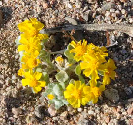
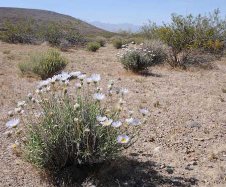
>Wallace (Eriophyllum wallacei), south project site.
But the Site is Unique
Dr Berry added that the project area is within the Cantil Commons Allotment, where sheep are grazed, and that one mitigation action could be to remove sheep grazing in translocation areas.
But she raised the question of how you mitigate for this actual land where the project is proposed. The food supply -- tortoises select for low-potassium plants, ratio of juveniles to adults, the topography and surficial geology. How long would it take to improve habitat with enhancement measures? At the Desert Tortoise Natural Area, protected and fenced from grazing for 30 years, you now see a big difference inside and outside from sheep and off-roading effects. "We've watched a lot of actions, but most have not been effective," she said. Will an action plan really be implemented? At Ft. Irwin, ravens have been going after more than just juvenile tortoises: they have been rolling adult tortoises over, and pulling their guts out through the cloaca. And in the 1930s there was a much higher biomass of good tortoise foods; now there are more "trash food" plants, weeds. Coyotes subsidized by towns would be a worry for translocated tortoises.
 Dave Hacker of DFG said it is not reasonable to think translocation will work well. He wanted to see more studies showing success. Scott Galati wondered if the Ridgecrest project site was just a short-lived hotspot.
<Thistle sage dense spot, south project area, May 2010.
Ileene Anderson of the Center for Biological Diversity, commented that they do not support translocation because of its relatively unsuccessful record. They want avoidance first. Fencing can also potentially disrupt genetic flow, separating tortoises into smaller areas. There has been no area of desert where large-scale removal of weeds has proved successful, she added. She said there were concerns about never-ending mitigation.
DFG's Dave Hacker reminded the panel that the California Endangered Species Act (CESA) required full mitigation for the Desert tortoise and Mojave ground squirrel, including all impacts of the project, to "take," habitat loss, and connectivity. How do you replace this? This is the difficult issue with this project: many of these qualities are site-specific. This particular part of the valley is the best linkage for populations of animals to remain connected north and south of the mountains. "How can you mitigate this?" he asked.
 The project would fragment the habitat with industrial use, create edge effects of disturbance beyond the project boundaries, making surrounding habitat lower quality.
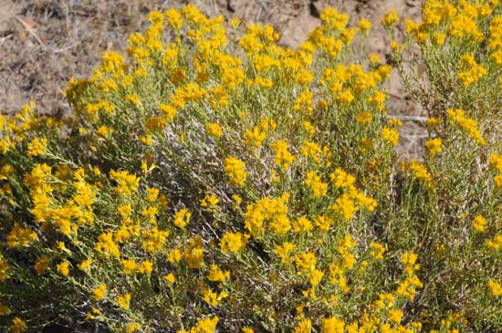
>Cooper goldenbush (Ericameria cooperi), south project site, May 2010.
Croft of FWS added that for genetic flow to occur over time a species has to live in the corridor -- it is not a matter of "migration" of animals, but a population persisting in the corridor.
Hacker agreed -- you want contiguous occupied habitat between two habitat patches, not sporadic dispersal.
Eric Solorio asked if they would consider improvements to connectivity with acquisition of Little Dixie Wash habitat and removal of grazing.
Hacker countered that you can't do this in the project location. The connectivity is here.
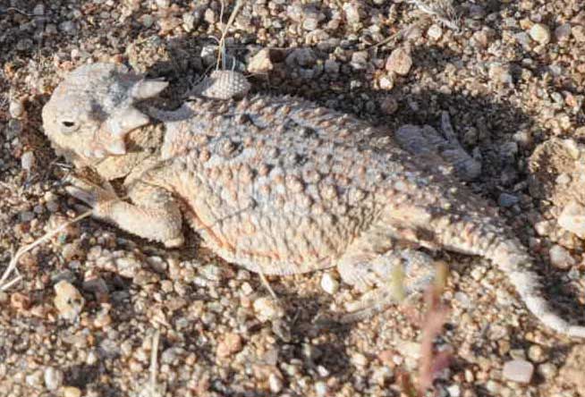
<Young Desert horned lizard (Phrynosoma platyrhinos) basking in the warn gravel of El Paso Wash at sunset, northwestern edge of the project site, May 2010.
Back to Money
Scott Galati, attorney for Solar Millennium, persisted that the mitigation habitat conservation plan is about the recovery of the species, and that a large amount of money would exist in the In Lieu Fee Program. From funds put in for the Ridgecrest, Palen, Blythe, and Genesis projects a lot of money could be made available for recovery. He said Solar Millennium supported the SBX 34 In Lieu Fee Program, and that it would be good to use a wide approach to conservation in a regional way.
Eric Solorio of CEC mentioned the number $26 million for mitigation was thrown out in the December workshop. Anderson said this might have changed since then, with land values rising.
Solorio continued, saying that the three Solar Millennium projects could put $50 million into the In Lieu Fee Program, five times the $10 million seed money. This could rise to $100 million with all projects contributing -- a large chunk of land could be bought for conservation.
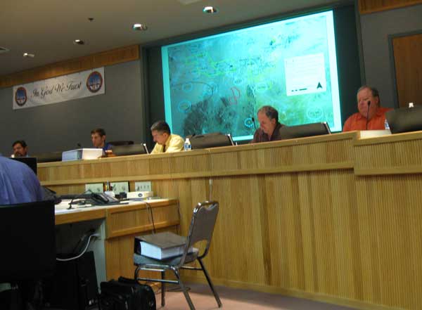
<California Energy Commission staff hold the workshop. BLM Ridgecrest Field Manager Hector Villalobos sits on the far left. Note the thick Staff Assessment for the project in the black binder on the front chair.
From there the conversation devolved back to mitigation details, seemingly ignoring the question of the uniqueness of the site, which would come up again the next day in discussions of Mojave ground squirrel.
FWS said for these really large projects they needed more detail on take, the resident tortoise population, and upfront translocation plan, location of translocation site, density of tortoises on the recipient site, and visual exams for clinical signs of disease. He recommended Solar Millennium survey a couple of possible sites to get an idea of density. Only then could they issue a Biological Opinion.
Galati said the timing was tricky. Auctioning private land for $2,000/acre was difficult to take to "higher management" when they were facing a "no" decision from CEC. He asked Solorio to allow them to have an approved translocation plan without a site "buttoned up."
Ileene Anderson spoke up that she had heard nothing today indicating a path forward. "We'll move tortoises, some will die, there will be less habitat, and that's OK. This is not acceptable."
Center for Biological Diversity explained that making a plea that mitigation funding will save tortoises is not true. More habitat will be damaged. By destroying additional habitat we will not save the species.
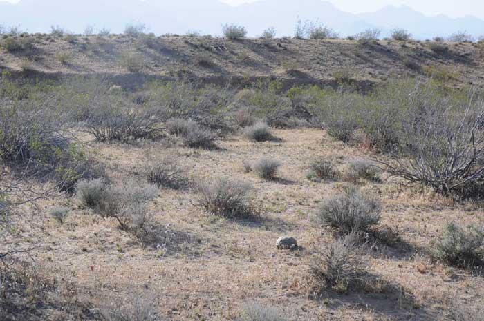
^Healthy adult female tortoise in El Paso Wash, May 2010.
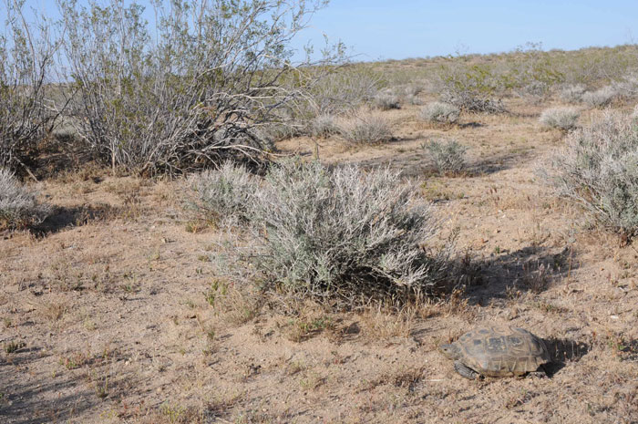
^The project boundary would rise along the wash edge along the skyline. Tortoises would be allowed to use this wash, but he issue of ORV traffic through the wash has yet to be resolved.
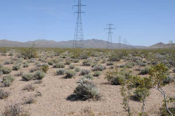
^Existing transmission line cutting through the southwestern edge of the project. This segment of line would have to be moved slightly to the west up against the lava hill.
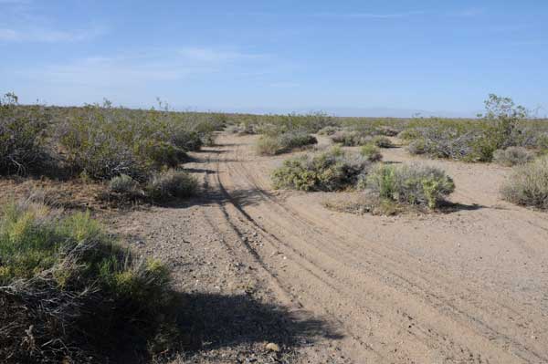
^El Paso Wash currently receives a moderate amount of off-road traffic. North of Brown Road, project would be to right. But this is tortoise and Mojave ground squirrel habitat. Will more ORVs be funneled into this habitat once the project is built?
HOME.....May 4 Workshop.....Ridgecrest Updates.....Project and Site
