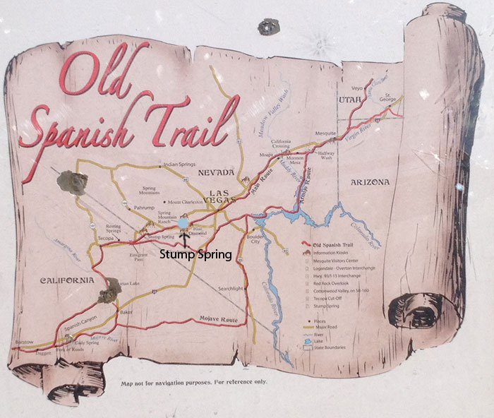
Stump Springs
June 2012 - Pahrump Valley, Nevada. Member of Basin and Range Watch visited Stump Springs Area of Critical Environmental Concern, a designation by the Bureau of Land Management that protects valuable and rare resources. The Pahrump Valley Pauite consider this area important, and part of a much larger sacred landscape. A historic trail also goes through this place.
^Old stream channel telling of higher spring flow at some time in the distant past.
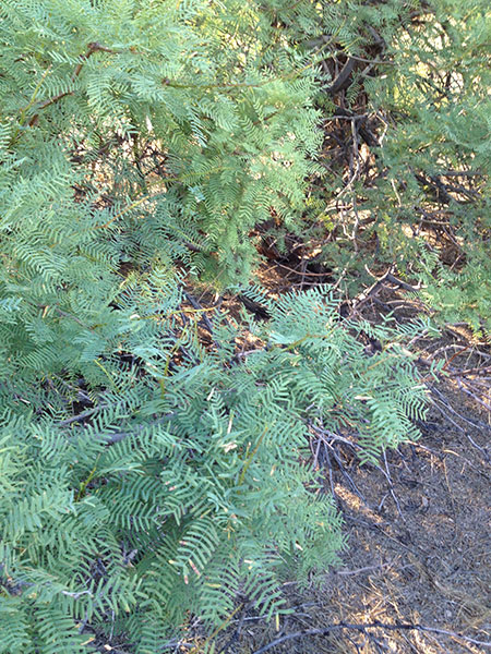
^Honey mesquite (Prosopis glandulosa).
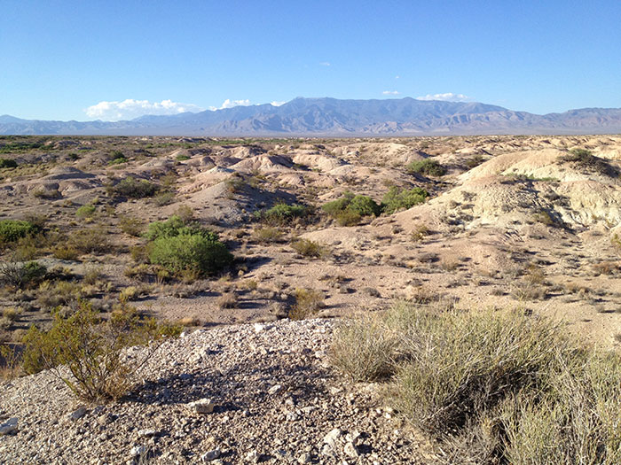
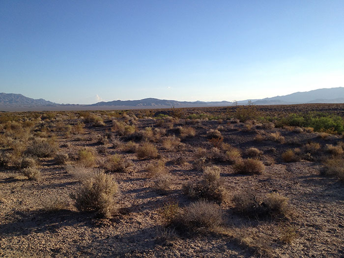
^View looking over the badlands of the Stump Springs area eastwards toward Mt. Charleston and the Spring Range.
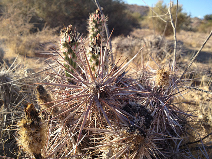
^The rare cactus Parish's club-cholla (Grusonia parishii).
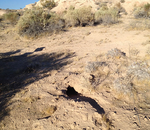
^A Desert tortoise (Gopherus agassizii) burrow next to the Grusonia cactus patch. We counted 6 tortoise burrows in this Stump Springs area. Burrows of Badger and Kit fox were also present here.
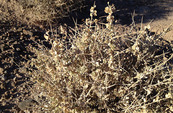
^Shadscale (Atriplex confertifolia), a type of saltbush, is common at Stump Springs. Tortoise burrows are also common in this area around the bushes, and tortoise density should not be judged on vegetation type such as creosote versus shadscale. Both area can have good tortoise habitat. What looks good to humans may not apply to what tortoises prefer.
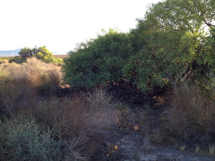
^Mesquite thickets are abundant here, along with five species of saltbush (Atriplex). This oasis in the arid desert is good bird habitat: Black-throated sparrows (Amphispiza bilineata) and Verdins (Auriparus flaviceps) filled the air with their calls.
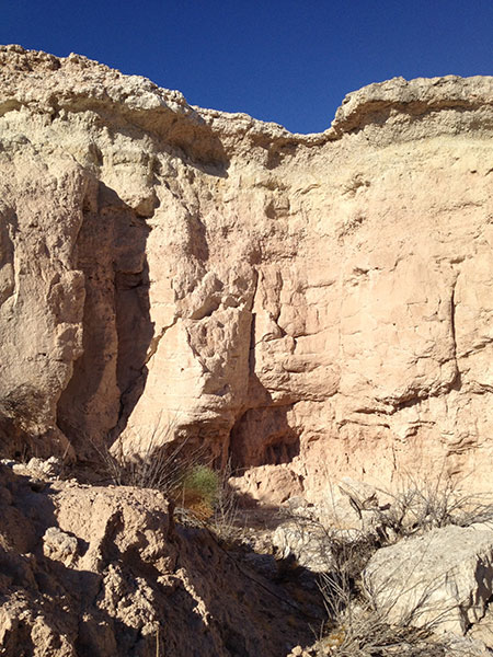
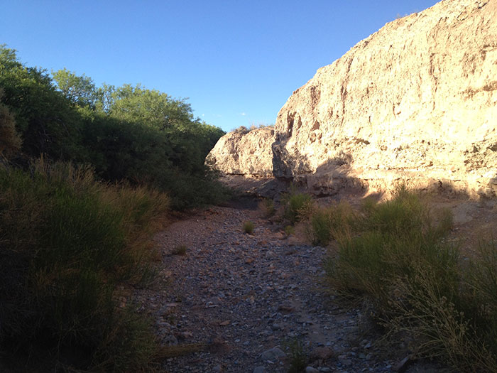
^Badland cliff.
^Stump Springs was a rare watering stop in the desert trek of early travelers. Spain searched for a trade route between New Mexico and California in the 1700s. Early traders with mule caravans stopped here as early as 1829, using the area as a link from the abundantly watered flowing springs of Las Vegas -- "The Meadows."
But even in 1844 the explorer John Fremont reported that the grass was nearly as unreliable as the water here. His party found water in holes, and some lower downstream in a channel, but mostly the area was somewhat dry even before modern groundwater pumping. Fremont had to dig for more water for his horses. Later travelers called the spring aqua escarbada, Spanish for "water that has to be dug for." The next stop in either direction -- east or west -- was 20-24 miles, so even this scratch spring was a necessary stop in the arid Mojave Desert.
Modern urbanization and agriculture in Pahrump Valley completely dried out all surface water at Stump Spring. But large old trunks of mesquite and remnants of meadow vegetation point to the former lushness of the area. More pumping by a large-scale solar project within a few miles of Stump Spring could lower the water table even further and threaten the remaining spring vegetation, as well as the historical importance of this site.
Congress designated the area as part of the Old Spanish Trail in 2002. Several segments in Nevada are listed in the National Register of Historic Places.
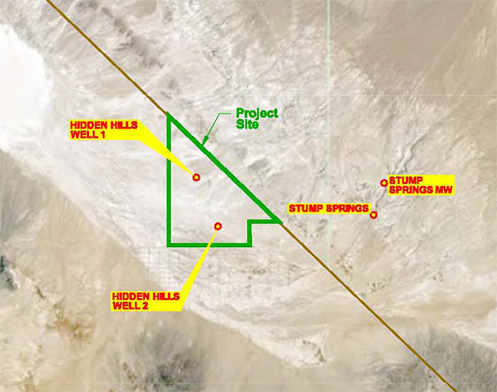
^Map showing the Hidden Hills SEGS project site in California, with two project wells. Stump Springs could be within the 30-year cone of depression as the water table is drawn down over the operational life of the solar thermal power plant.
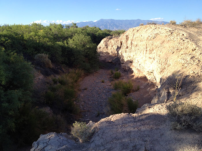
^Old channel coming from spring mounds.
^View to the West towards the proposed solar power tower project at Hidden Hills Ranch. Two 750-foot tall cement towers with brightly-glowing tops (from solar flux) would be visible in the distance.
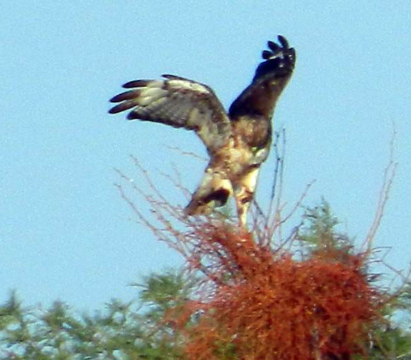
^A juvenile Swainson's hawk (Buteo swainsoni) perched on the mesquite at Stump Spring, seen during our visit. This uncommon hawk is a California Department of Fish and Game Threatened Species. It is a rare breeder, usually using riparian trees to nest in, and often hunting around wetlands and valley agricultural fields. The hawks winter in South America, undertaking a long migration. Declines have been severe in California in parts of its range due to habitat destruction for nesting. This raises the question of whether there is a nesting population somewhere locally in Pahrump Valley, and what impact 750-foot power towers will have on flying hawks. Solar flux can reach 1,000 degrees Fahrenheit near the tower receiver, a temperature which can burn birds flying into the solar field. These questions need to be addressed before the Hidden Hills solar project is approved.
See Point Reyes Bird Observatory for more information. This mitigation information should be applied to the solar project and the area within 10 miles surveyed for Swainson's hawk nests:
"Current management strategies for Swainson's Hawks in the Central Valley are focused on mitigation of habitat losses at known hawk territories (CDFG Mitigation guidelines), and habitat conservation under the USFWS Habitat Conservation Planning (HCP) process. Under CDFG draft mitigation guidelines, losses of suitable foraging habitats within 10 miles of a Swainson's Hawk nest site must be mitigated by protection or creation of equally suitable foraging habitat elsewhere within the territory's 10-mile radius. The ratio of loss/replaced habitat changes from 1:1 within 1 mile of a nest, to 1:.5 over 5 miles from the nest. These guidelines have been thoroughly reviewed by the Swainson's Hawk Technical Advisory Committee (SWTAC), an independent group of agency and private biologists with experience with Swainson's Hawks. The SWTAC has pointed out several flaws in the guidelines, and has judged them to be inadequate to conserve or recover the species in the Central valley (Estep, pers. comm.). The guidelines generally allow for losses of foraging habitat to occur throughout the remaining area populated by the species, and do not consider the potential habitat needs of additional territories with population recovery. The guidelines also fail to consider the cumulative effects of agricultural intensification and conversion to incompatible crop types, which occur independently from residential development. Development of 'final' mitigation guidelines by CDFG has been in progress since 1993 and continues today.
"Habitat Conservation Planning efforts under section 10 of the Endangered Species Act (Yolo County and Natomas Basin HCPs are examples) have been based primarily on the draft CDFG mitigation guidelines."
To protect and restore Swainson's hawks, landscape-level assessment of tree availability as well as distribution of suitable foraging habitat should allow identification of areas where trees are the primary limiting factor for the hawks. Many areas devoid of trees and restoration of even small stretches of riparian forest can provide habitat and mitigate for losses elsewhere. This indicates the importance of the mesquite groves at Stump Springs as possible nesting habitat as crucial to protect. Groundwater pumping could kill mesquite here.
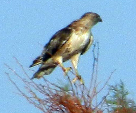
^Juvenile Swainson's hawk photographed in June 2012 during a visit to Stump Springs.
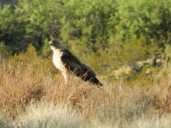
^Juvenile Swainson's hawk at Stump Springs. This area may be important habitat to this hawk, and should be preserved and protected.
![]()
^Mojave yucca along the Tecopa Road leading into Nevada. The Hidden Hills solar project would need a new transmission line along this road where no infrastructure mars the view currently.