Southern Nevada Renewable Energy Projects Update
June 9, 2022 - Las Vegas, NV - The Southern Nevada District of Bureau of Land Management released this slide deck in PDF form of a useful summary of all solar and wind applications in Clark County and Nye County south of Beatty. See the BLM Southern Nevada District Renewable Energy Program Update PDF.
SB Solar, Rigel Solar, and Trout Canyon Solar Projects south of Beatty, NV, are in the Southern Nevada District.
Bureau of Land Management Moves Several Solar Projects by Death Valley to Low Priority
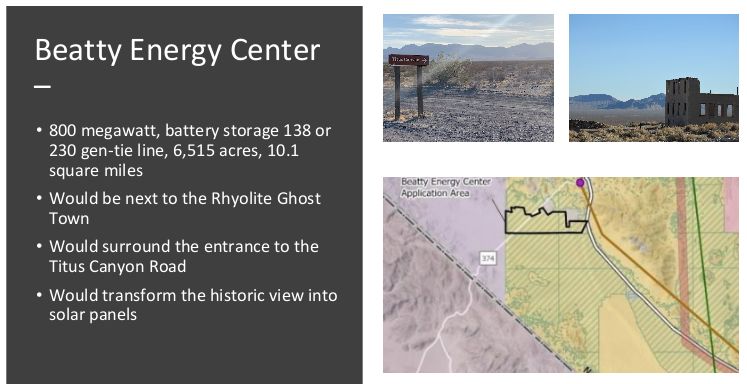
^NextEra Energy is proposing to build a large utilit-scale solar project right here in upper Amargosa Valley, in view of the Goldwell Open Air Museum and ghost town of Rhyolite. The Beatty Energy Center is the project application name. The Furnace Creek Range lies in the distance, in Death Valley National Park.
May 26, 2022 - Beatty, NV - At the request of the residents of the region working through their town, letters were sent to the Bureau of Land Management (BLM) Tonopah Field Office requesting the Beatty Energy Center application, Sawtooth Solar Project application, and Bonnie Claire Solar Project application be moved to Low Priority Status. We received the confirming letters from the BLM that this was done.
Low Priority Status letter - Beatty Energy Center (pdf)
Low Priority Status letter - Sawtooth Solar Project (pdf)
Low Priority Status letter - Bonnie Claire Solar Project (pdf)
Other solar project applications (SB Solar, Rigel Solar, Taranatula Canyon Solar) to the south are in the Las Vegas BLM Field Office, and need separate attention to keep them from marring the views of Beatty and Rhyolite.
Solar Projects Planned Near Death Valley Would Hurt Wildlife, Public Access and the Local Economy
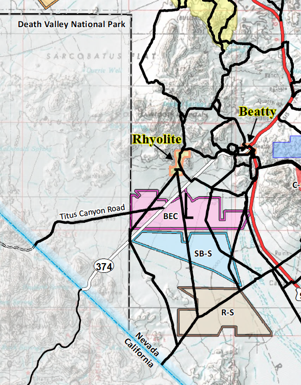
^Detail of map produced by the Town of Beatty showing solar project applications around Beatty, the ghost town of Rhyolite, and the Titus Canyon entrance road. BEC= Beatty Solar Energy Center; SB-S=SB Solar Project; R-S=Rigel Solar Project.
March 17, 2022 - A new land rush of large-scale solar project proposals have been filed for nearly 60,000 acres of public lands so far adjacent to Death Valley National Park in Nevada.
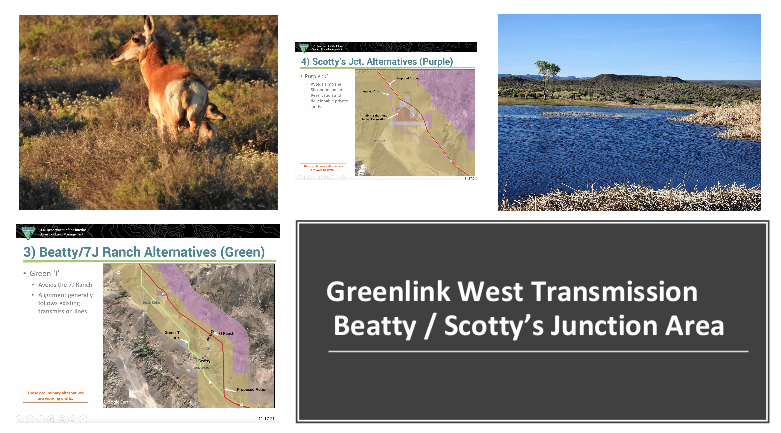
Two good articles came out recently concerning the many very large utility-scale solar projects in Nevada public lands on the east side of Death Valley National Park, next to Wilderness Areas in the park. These applications are enabled by the proposed Greenlink West Transmission Project that NV Energy is seeking to ship natural gas power generation from the Apex, NV area northwards to the energy-intensive "Silicon Valley" facilities of Reno/Sparks, NV--the Tesla Gigafactory, Amazon wharehouse, Google facility, Blockchain and others.
Good coverage by Scott Streater of E&E News:
https://www.eenews.net/articles/solar-boom-casts-shadow-on-death-valley-national-park/
Good local coverage by Scott King of the Sierra Nevada Ally:
https://www.sierranevadaally.org/2022/03/14/a-land-rush-for-renewable-energy/
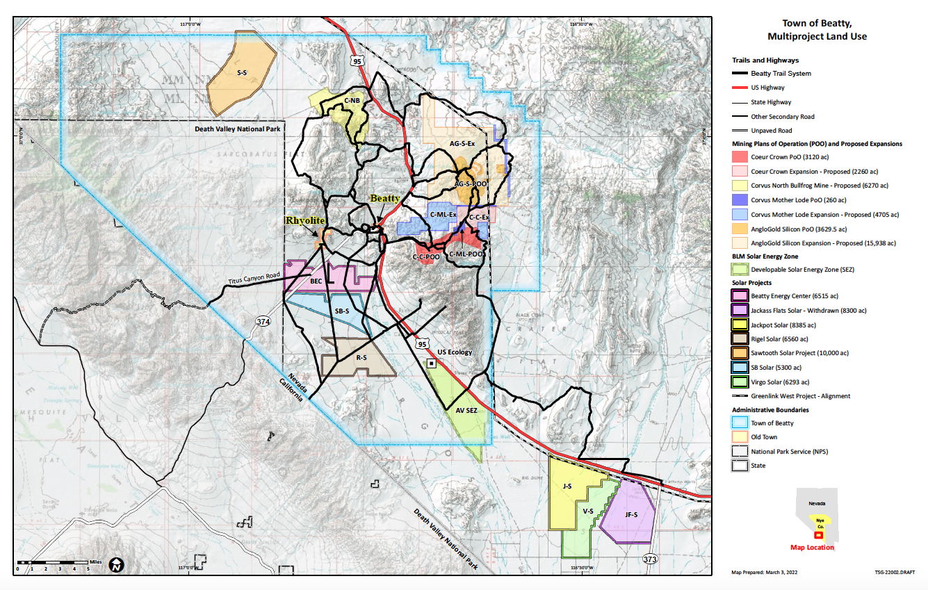
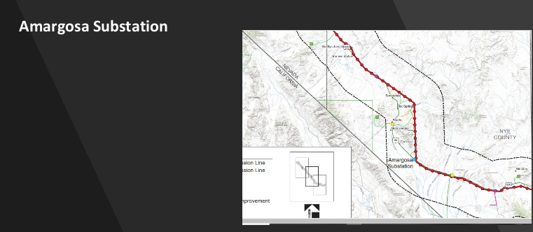
^Map of solar project applications, the existing Amargosa Valley Solar Energy Zone, the main alternative for the proposed Greenlink West Transmission Project, gold mine exploration areas, and existing routes by the Town of Beatty, Nevada. Source: Town of Beatty.
The east entrance of Death Valley National Park along Highway 374 has nearly 15,000 acres of solar proposals so far, one next to the famous ghost town of Rhyolite and hugging the border of Death Valley National Park.
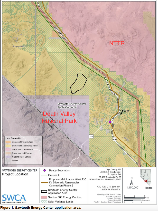
Another 44,000 acres or 40 square miles of solar applications have been filed for the region known as Sarcobatus Flat, directly adjacent to what is called the Nevada Triangle, the 150,000-acre section of Death Valley National Park added to the park unit in 1937 about ten miles from the community of Beatty. The Nevada section of Death Valley National Park protects high mountains, Joshua trees, wildlife and historic ranches.
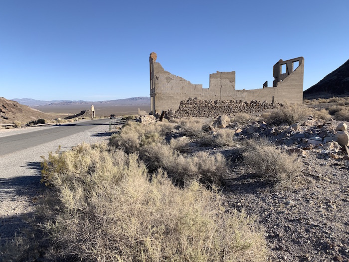
^Ghost town of Rhyolite, Nevada, which receives a huge visitation of tourists annually. The view in the distance, unchanged from historic times, would be filled by large-scale solar projects if these applications are approved by the Bureau of Land Management.
The latest big solar land rush is the result of two large transmission projects that are being aggressively pushed for approval in western Nevada on land managed by the Bureau of Land Management (BLM).
These are called Greenlink West and Gridliance. New proposed substations would allow very large energy projects to hook into these lines and export power to the north and out of state. Greenlink West would run from Las Vegas to Reno and power is intended to go to large tech factories like Tesla and Blockchain. Gridliance would export power from all Nevada projects to California.
The projects south of Beatty along Highway 374 are called the Beatty Energy Center at 6,500 acres, SB Solar at 5,300 acres and Rigel Solar Project just south of these. These projects would directly impact the view-shed of Death Valley National Park which is essential to the tourism economy of Beatty, Nevada. The projects would disturb so much soil that they would cause extensive fugitive dust. This would also impact the view-shed and endanger the health of Beatty residents. One project would be very close to the famous ghost town of Rhyolite and surround first part of the popular backcountry drive called Titus Canyon in Death Valley National Park. Rhyolite saw over one million visitors in 2020.
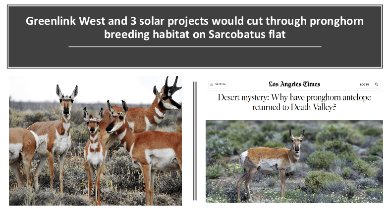
The projects north of Beatty take up most of the Sarcobatus Flat, the region directly east of Death Valley National Park. They are called Sawtooth Solar at 10,000 acres, Bonnie Claire Solar at 8,200 acres and Chill Sun Solar at 26,000 acres. The Sarcobatus Flat area is located next to the Grapevine Mountains in the Nevada section of Death Valley National Park, the first National Park unit in Nevada added to the California side of the monument in 1936. It contains sweeping vistas, abundant Joshua tree forests, pronghorn antelope, and a network of historic roads and artifacts.
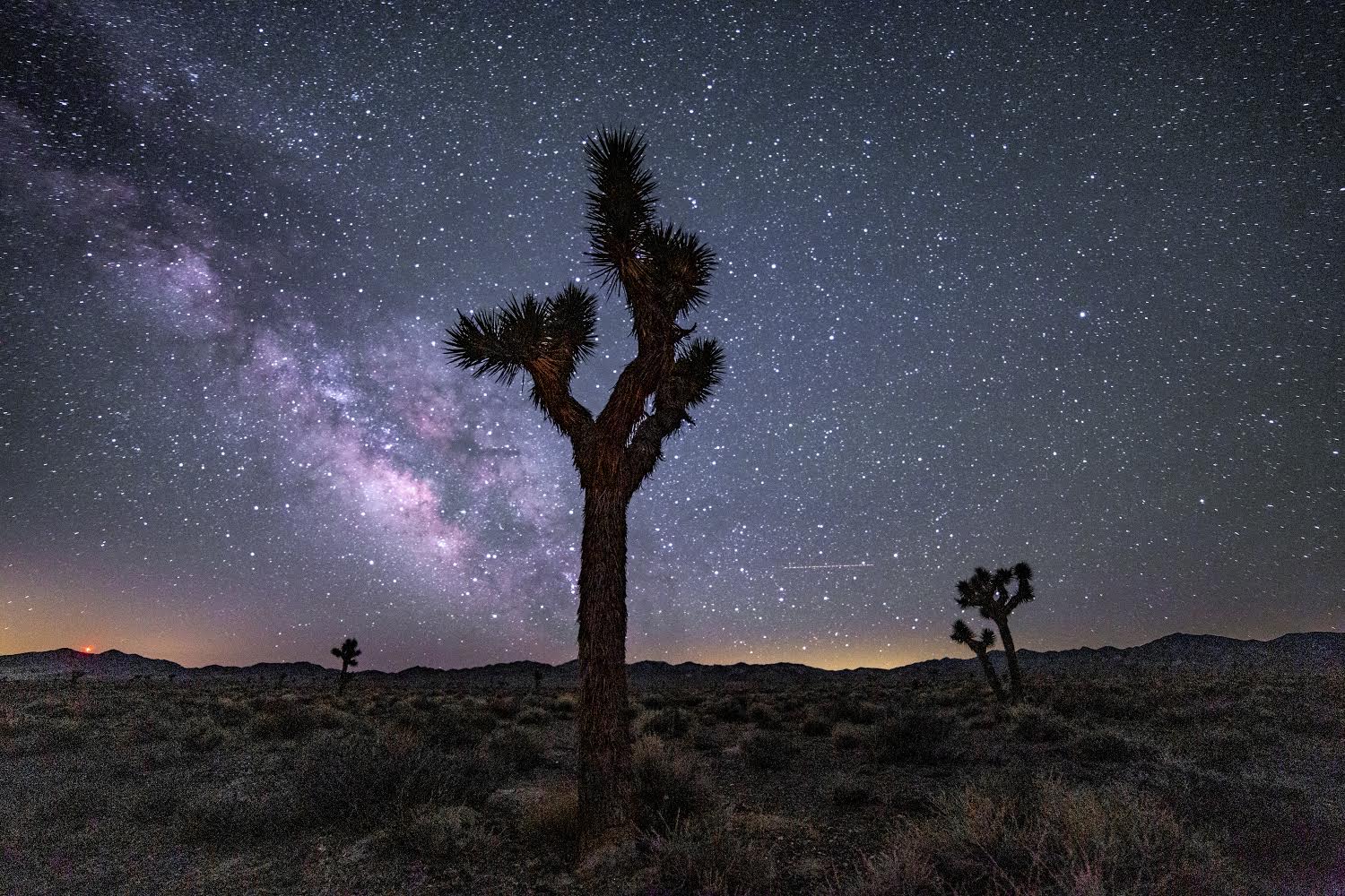
^Sarcobatus Flat, Nevada, north of Beatty: dark night skies with western Joshua trees, site of the proposed Sawtooth Solar Project. Photo: Justin McAffee.
““It would not be possible to maintain the spectacular viewshed, unique wildlife and fragile cultural resources if the entire region is turned into an industrial energy sacrifice zone,” said Kevin Emmerich, Co-Founder of Basin and Range Watch and a former National Park Ranger in Death Valley National Park. “Even if just half of these projects were to be built out, access to the public lands in the area would change for the worse. We need to look at previously developed sites, rooftops and the built environment to utilize our solar energy potential.”
We do not have all the map files from BLM, so not all solar project applications are on the maps we have. These are the current applications in Nye County, Nevada just around Beatty, NV:
Beatty Solar Energy Center: 800 megawatts (MW), 6,515 acres, 2.6 miles southwest of Beatty, south of Rhyolite in Amargosa Valley, by Boulevard Associates.
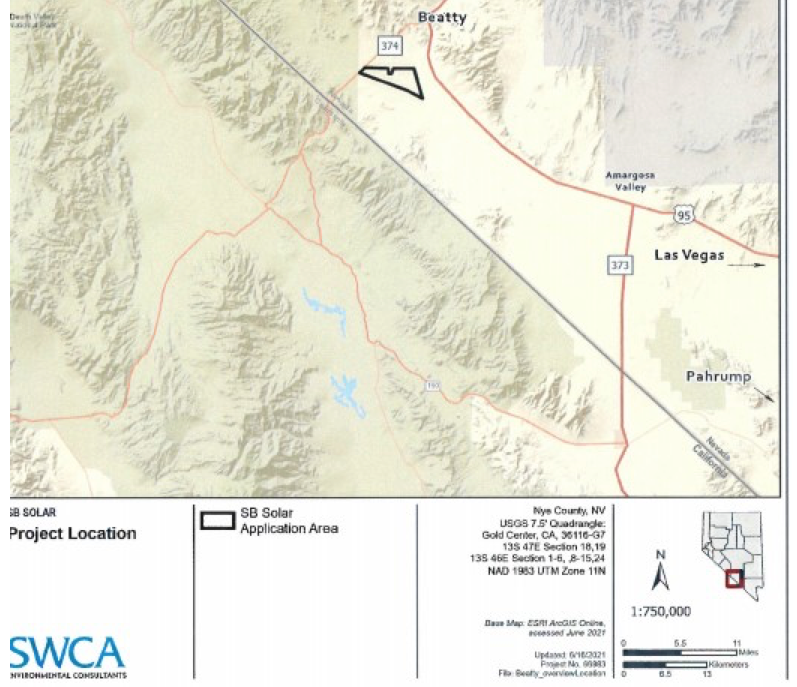
SB Solar Project: 500 MW with Lithium-ion battery storage, 5,300 acres, in Amargosa valley south of Rhyolite 5 miles southwest of Beatty, by EDF Renewables Development Inc.
Rigel Solar Project: 500 MW with Lithium-ion battery storage, 6,555 acres, 7.5 miles south south of Beatty, by EDF Renewables Development Inc.
Sawtooth Solar Project: 1,000 MW, 10,000 acres, 12.3 miles north of town of Beatty, Sarcobatus Flat, by Boulevard Associates.
Bonnie Claire Solar Project: 1,500 MW, 8,274 acres, 10 miles northwest of Beatty in Sarcobatus Flat, by Bonnie Claire Solar LLC.
Chill Sun Solar Project: 2,250 MW with Lithium-ion battery storage, 26,300 acres (!), 14 miles north of Beatty in Sarcobatus Flat, by Naturgy Candela DEVCO LLC out of Madrid, Spain.
The applications are filed with both the Bureau of Land Management and the Public Utilities Commission, Nevada (PUCN). The Tonopah BLM refuses to share any maps of solar project proposals in their district even though it is all on public owned land, but the PUCN posts them all. The links are here:
Beatty Solar Energy Center: 10291.pdf (state.nv.us)
SB Solar Project: 10809.pdf (state.nv.us)
Rigel Solar Project: 15798.pdf (state.nv.us)
Sawtooth Solar Project: 9100.pdf (state.nv.us)
Bonnie Claire Solar Project: 15008.pdf (state.nv.us)
Chill Sun Solar Project: 15464.pdf (state.nv.us)
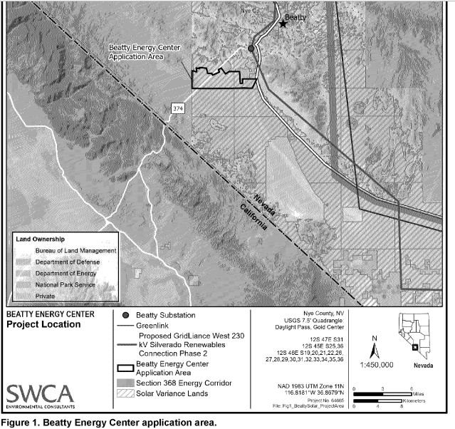
Proposed Beatty [Solar] Energy Center map. Source: BLM.
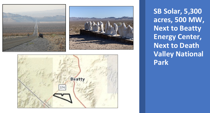
^SB Solar application map. Source: BLM.

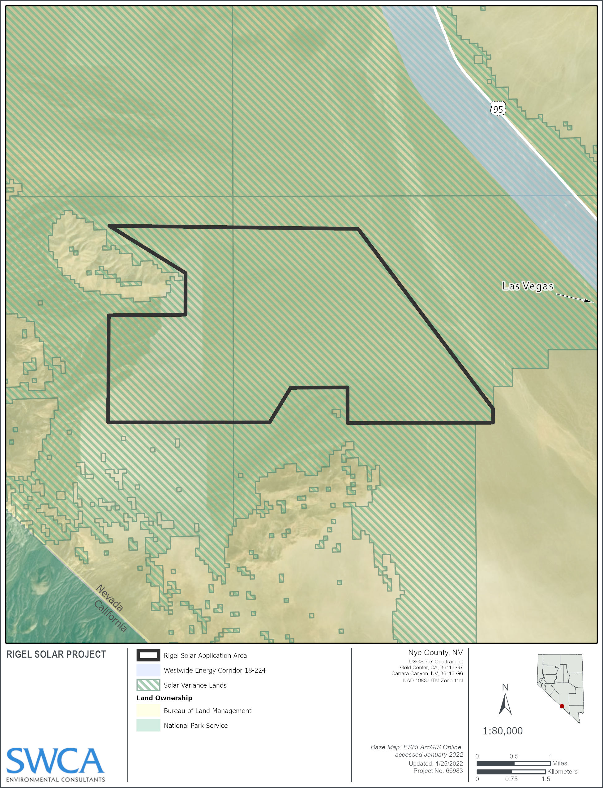
^Rigel Solar Project map. Source: BLM.
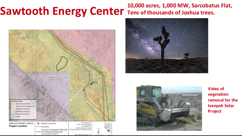
^Proposed Sawtooth Solar Project map. Source: BLM.
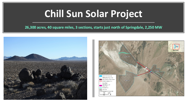
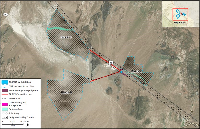
^Chill Sun Solar Project application map. Source: BLM.
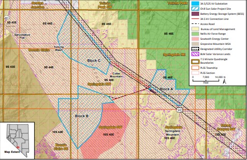
^Chill Sun Solar Project application map. Source: BLM.
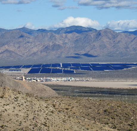
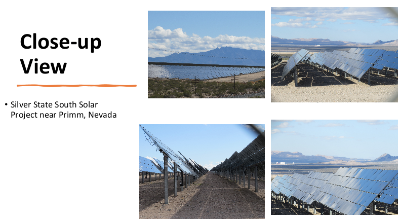
^View of Silver State South Solar Project built and operating in Ivanpah Valley, Nevada.

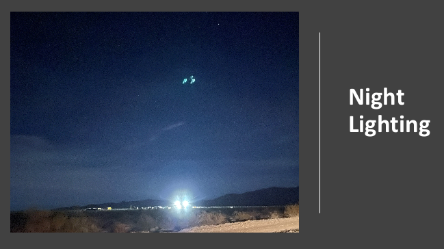
^Night lighting at construction lay-down area at Yellow Pine Solar Project, February 2022.
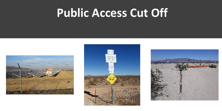
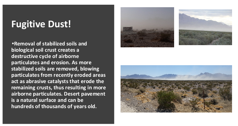
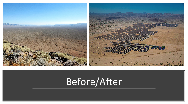
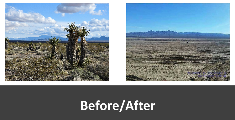
^All of these photos were taken at utility-scale solar projects under construction in Nevada and California.
Enabled by Proposed Greenlink West Transmission Project
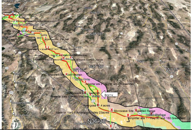
^Proposed path of the massive high-voltage Greenlink West Transmission Project which would open up the western Nevada Outback to solar energy industrial sprawl.
HOME.....Greenlink West Transmission Project.....Beatty Solar Energy Center.....Sawtooth Solar Project.....Film: Desert Apocalypse.....Amargosa Valley.....Sunshine Valley Solar Project in Amargosa Valley.....Esmeralda County Solar Sprawl