West Chocolate Mountains Proposed Renewable Energy Zone
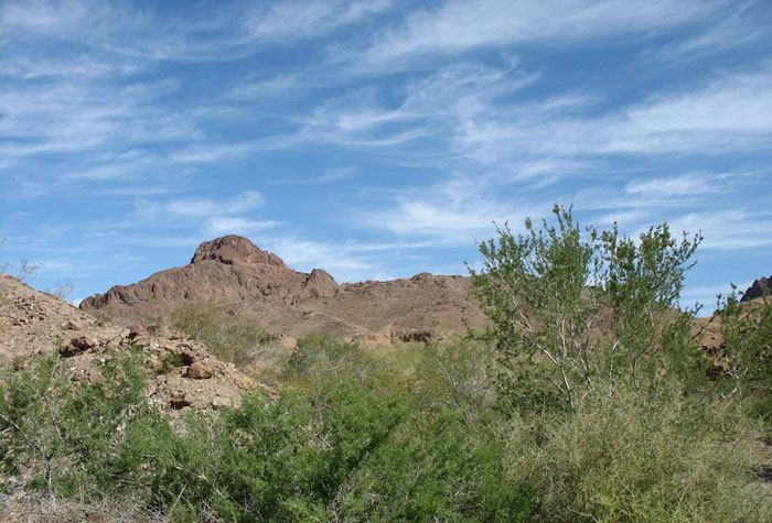
^Arid mountains and washes filled with Desert ironwood and palo verde, East Chocolate Mountains.
July 1, 2011 - Colorado Desert, Southern California - The Bureau of Land Management announced the release of a Draft Environmental Impact Statement that will analyze the potential impacts associated with amending the California Desert Conservation Act Plan to make available approximately 20,762 acres of BLM-managed surface lands (acquired lands included) for solar, wind and geothermal testing and development in a renewable energy evaluation area located near Niland, California. The Draft EIS also analyzes the potential environmental impacts of approving a pending geothermal lease application within the renewable energy evaluation area.
This CDCA Draft Plan Amendment/Draft EIS analyzes 6 alternatives, including (1) No Action Alternative (the CDCA Plan would not be amended, and existing plan decisions, stipulations, and allocations would not change as a direct result of this planning process), (2) No Development Alternative, (3) Renewable Energy Development Emphasis, (4)
Geothermal Development Only, (5) Solar Development Emphasis with Moderate Geothermal Development and No Wind Development, and (6) Geothermal Development Emphasis with Moderate Solar Development and No Wind Development. If an alternative is selected that establishes the evaluation area as available for solar energy development, it will be identified as a solar energy zone.
The principal issues identified thus far include Native American concerns; potential land use conflicts including recreation; cumulative impacts considering existing, proposed, and potential geothermal projects in the area; and potential impacts on cultural resources,
wildlife, visual resources, and surface and groundwater resources. The Draft EIS also addresses geology, mining, geothermal resources, vegetation, threatened or endangered species, air quality, noise, transportation, human health and safety, and social and economic issues, as well as other issues raised during the scoping process.
http://www.gpo.gov/fdsys/pkg/FR-2011-07-01/html/2011-16556.htm
The Draft Environmental Impact Statement can be found here:
http://www.blm.gov/ca/st/en/fo/elcentro/nepa/wcm.html
July 2011 Field Trip
By Terry Weiner - Desert Protective Council, Solar Done Right
My observation about the area I toured on Wednesday would be very problematic for prospective solar or wind developers because of the checkerboard ownership of the area, the steep slopes in the central portion of the Evaluation Area, the cultural resources, the dust, and perhaps the seismic activities among other things. The area is hugely appealing to me.
Wednesday July 21, 2011, 1PM, I headed east from the Brawley Inn and then turned north on highway 111 to scout out a portion of the West Chocolate Mountains Renewable Energy Evaluation Area. I had my Imperial County map and although I was not able to print out the DEIS map of the evaluation area boundaries, I spent a lot of time beforehand comparing the two maps and marking approximate boundaries on the AAA County map so I am fairly certain all of the photos I took were within the boundaries. I traveled and photographed from the southern boundary to the southeastern boundary following the west boundary as far north as Bombay Beach on the Salton Sea.

^Agricultural fields. (Photo by Terry Weiner)
Highway 111 north out of Brawley is flanked by mostly ag fields to the east and west as far as the eye can see, with areas of open salt bush-dominated-desert in between. Highway 111 travels through the small towns of Calipatria and Niland, past the Salton Sea, several wildlife refuges and the 14 mile stretch of the Salton Sea State Recreation Area. The farmers along the stretch between Brawley and Niland grow a lot of Sudan Grass and Bermuda Grass both crops of which are currently tall and lush and almost iridescently bright green. Alfalfa also is a large crop along this stretch of Imperial Valley. I passed one large geothermal plant west of 111 between Brawley and Calipatria, whose footprint includes acres and acres of tortuous above-ground cooling pipes around which not much of anything grows.
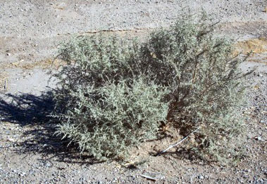
^Saltbush (Atriplex polycarpa), adapted to hot, arid, alkaline low deserts. The air temperature was 115 degrees Fahrenheit, and these shrubs thrive. (Photo by Terry Weiner)
Both the New River and the Alamo River wind their way in a serpentine fashion north along and under highway 111 toward the Salton Sea. The New River begins in Mexicali and the Alamo River's source is south of the border about 20 miles east of Mexicali. I passed the Finney-Ramer Wildlife Refuge on the Alamo River south of Calipatria. On separate tours October 2010 and in June with the CEC, I learned that there are functioning wetlands along most stretches of both of these Rivers and there are swaths of newly constructed wetlands along stretches of both rivers. The wetlands are refuges for a mind-boggling number of bird and other species of mammals. On my way back down 111, I stopped at the vast and beautiful Department of Fish and Game Wister Unit of the Imperial Wildlife Refuge, which lies between highway 111 and the Salton Sea north of Niland.
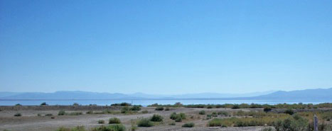
^Salton Sea. (Photo by Terry Weiner)
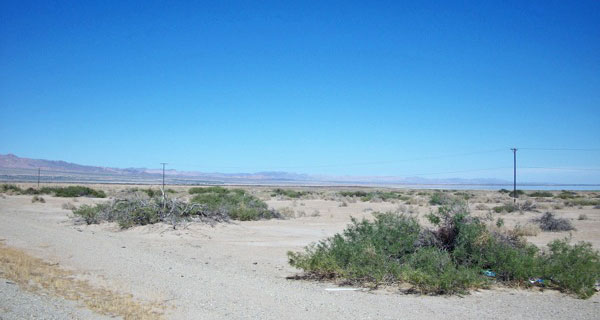
^Another view of the Salton Sea in the distance, looking over mesquite and saltbush flats. (Photo by Terry Weiner)
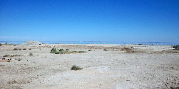
^Next to the Salton Sea. (Photo by Terry Weiner)
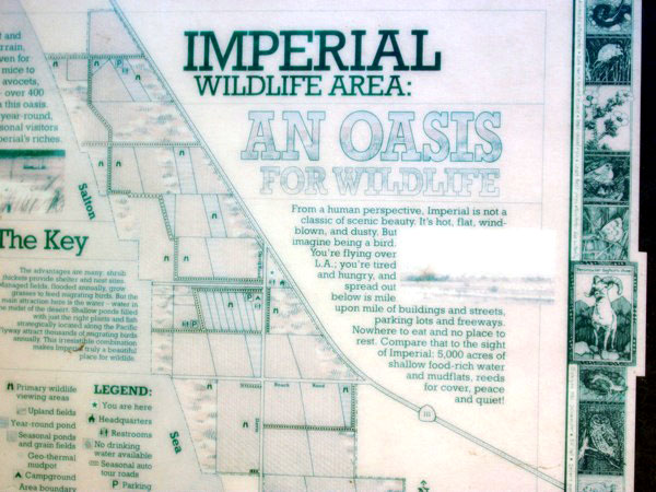
(Photo by Terry Weiner)
The southern boundary of the West Chocolate energy evaluation area begins in staircase fashion around Niland. I traveled east out of Niland on a road toward and past Slab City, ending at the West Chocolate Mountains Impact Area. About a half mile east of Niland is a huge Imperial Irrigation District Substation. The land east of Niland is a checkerboard of some small ag fields and very flat, sparsely covered desert habitat, some areas of large creosote mixed with Atriplex species (salt bush) and some cheesebush with splotches of a few palo verdes and ironwood trees. A small canal trends northerly and southerly across the Slab City Road. Along the canal there is a stretch of mature dense palo verde/ mesquite and ironwood habitat. There is a small IID transmission line running north/south along the canal. The road slightly ascends east of Slab City and continues east to the the Coachella Canal. The Chocolate Mountains Impact Area Boundary is bounded by the canal. The microphyll woodland east of the canal within the military area is mature and dense and quite beautiful. There is a very large IID transmission line paralleling the canal and the eastern boundary of the WCM evaluation area. The desert habitat along the road east of Niland is interrupted with Slab City trailer sprawl, with some land that has been farmed or is being farmed and land that is pretty denuded.
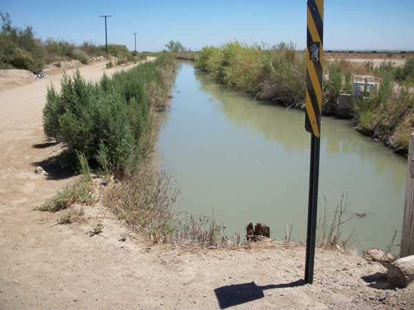
^Canal in Imperial Valley. (Photo by Terry Weiner)
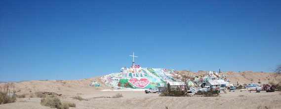
^Slab City. (Photo by Terry Weiner)
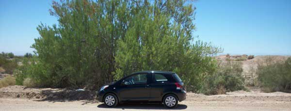
^Tall Screwbean mesquite (Prosopis pubescens). (Photo by Terry Weiner)
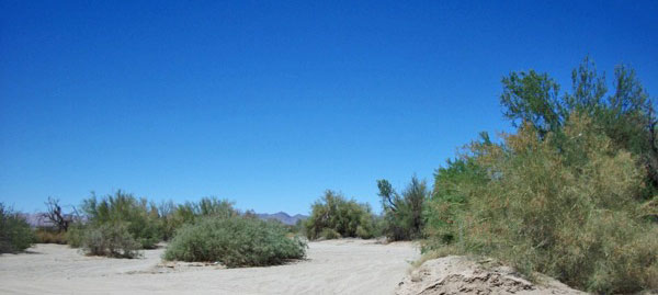
^Mesquite thickets and woodlands. (Photo by Terry Weiner)
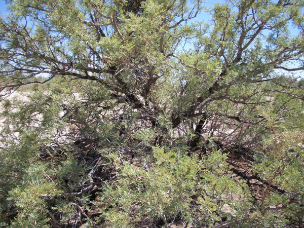
^Honey mesquite (Prosopis glandulosa). (Photo by Terry Weiner)

^Photo taken on the road to Slab City east of Niland to the border of the Chocolate Mountains military zone. This is within the Renewable Energy Evaluation Area. The dense microphyll habitat was not continuous but there were acres were it was very dense. (Photo by Terry Weiner)
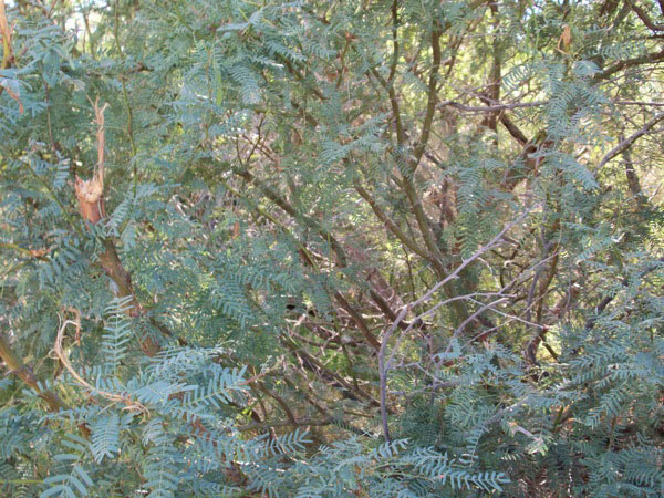
^Honey mesquite, Imperial Wildlife Refuge. (Photo by Terry Weiner)
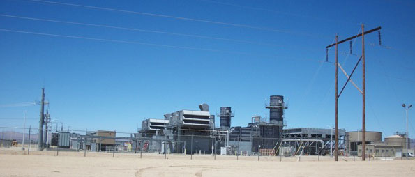
^Natural gas power plant. (Photo by Terry Weiner)
From Slab City, I found a road going north named Wilkins Road and followed it all the way north to Wister and back to highway 111 via a couple of dirt roads. I then proceeded north another 10 miles to Bombay Beach. The entire area I traveled lies within the evaluation area. Along Wilkins Rd heading north away from Slab City toward the Mineral Hot Springs, I passed citrus fruit orchards, date orchards, fields of Sudan grass, raggedy Colorado Desert with several Atriplex species, some creosote, some mesquite, lots of hard-packed clay, areas of tamarisk and more saltbush with an occasional palo verde or two. I stopped to photograph a geothermic test drilling operation at the junction of Wilkins and Gillespie Roads. This entire Evaluation Area is a total checkerboard of ownership. I don't know how solar developers will be able deal with the multiple land owners.
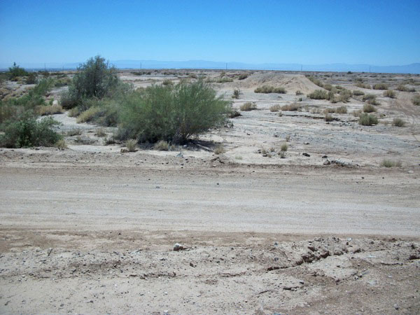
^Along the Slab City Road east of Niland. (Photo by Terry Weiner)
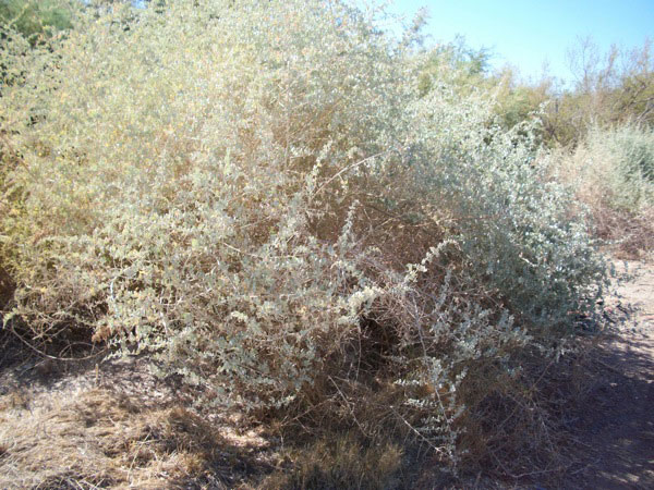
^Quailbush (Atriplex lentiformis), Imperial Wildlife Refuge. (Photo by Terry Weiner)
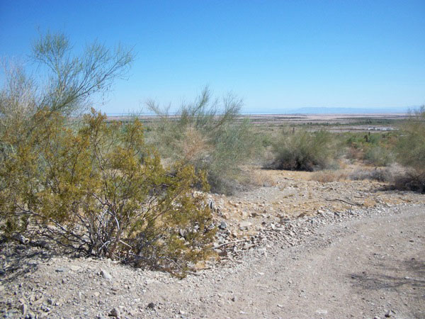
^Scattered Creosote (Larrea tridentata) and Palo verde (Parkinsonia florida), up Mineral Hot Springs Road. (Photo by Terry Weiner)
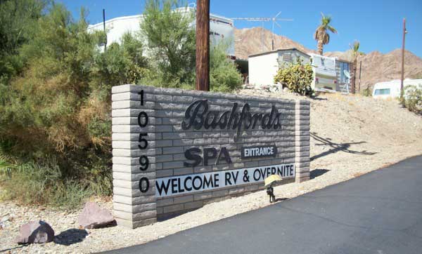
^Mineral Hot Springs Road. (Photo by Terry Weiner)
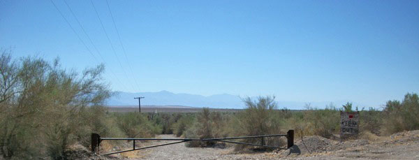
^The area south and east of Bombay Beach in the renewable energy zone above the mineral hot springs. The density of the microphyll woodland habitat can be seen from distance. The Santa Rosa Mountains are in the background. (Photo by Terry Weiner)
Daniel Steward, El Centro Branch Resources Chief confirmed that there is only one active project application within the Evaluation Area so far and it is a geothermal application. I found the site where the applicant has a test drilling operation and listened to the very loud machinery and observed that the drill site was adjacent to a canal.
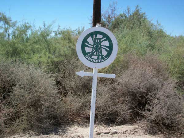
(Photo by Terry Weiner)
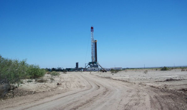
^Geothermal test drilling rig. (Photo by Terry Weiner)
I believe the eastern shore of the old Lake Cahuilla came up at least to this area and possibly all the way to the slopes of the Chocolate Mountains around Bombay Beach. There are bound to be cultural sites throughout the area. Daniel stated that cultural resources are a big issue throughout the area.
Highway 111 road surface is very undulating: related, I imagine, to the seismic activity of the area and soil subsidence
About 5 miles south of Bombay Beach, I passed (too quickly) a yellow road sign warning: "Flash Flood Area Next 14 MIles." There are dozens of washes coming out of the Chocolate Mountains starting about 10 miles south of Bombay Beach. The washes are major enough to require culverts under highway 111. The road is not elevated so any minor flooding would spread across the road.
I went east up Mineral Hot Springs Road which dead ends close to the boundary of the Impact Area and walked around. It becomes steep terrain up to the mountains. It is very rocky. The habitat is palo verde/ironwood/some smoke trees, some composite species and creosote. Pretty and dense.
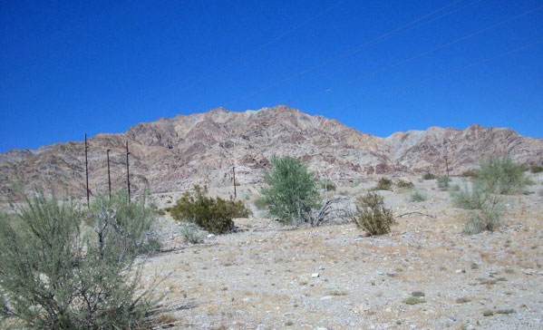
^Up against the Chocolate Mountains at the end of Mineral Springs Road. (Photo by Terry Weiner)
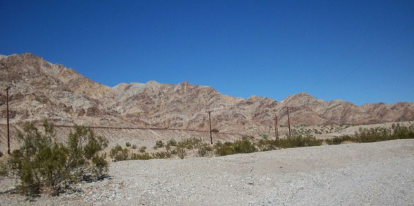
(Photo by Terry Weiner)
The Evaluation Area includes the land west of 111 along the shores of the Salton Sea north of the Imperial Wildlife Area to Bombay Beach. The soil is clay. The plant community is mainly Atriplex, some mesquite and tamarisk. Although hard-packed, it looks like this soil could dry out enough to become airborne with a high wind. In large stretches, there is very little visible plant life holding down the soil but .....there are several transmission lines already running through the area and IID is dying to "wheel" Imperial Valley Energy north to the Coachella Valley.
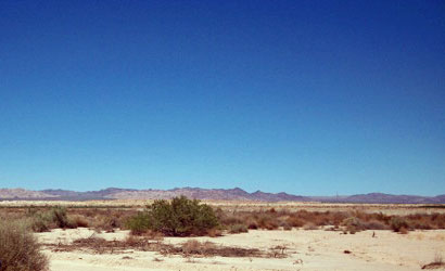
^The Wilkins Road area. (Photo by Terry Weiner)
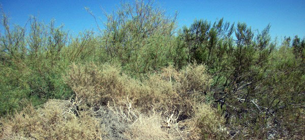
^Dense thicket of saltbush, mesquite, and creosote. Along the Slab City Road east of Niland. (Photo by Terry Weiner)

^View looking out towards the Salton Sea, back on highway 111 heading north. (Photo by Terry Weiner)

(Photo by Terry Weiner)
HOME.....Solar PEIS
