Our Comments on the Draft Dry Lake North Mitigation Strategy
August 14, 2015
To: Dan Netcher, Bureau of Land Management
Program Manager
775-289-1872
dnetcher@blm.gov
Subject: Please accept these comments on the Draft Mitigation Strategy for Dry Lake Valley North Solar Energy Zone.
Basin and Range Watch is a group of volunteers who live in the deserts of Nevada and California, working to stop the destruction of our desert homeland. Industrial renewable energy companies are seeking to develop millions of acres of unspoiled habitat in our region. Our goal is to identify the problems of energy sprawl and find solutions that will preserve our natural ecosystems and open spaces. We have visited the Dry Lake North Solar Energy Zone site and are concerned about the direct and cumulative impacts that large-scale solar energy development would have on the region. We submitted comments on the Programmatic Solar Environmental Impact Statement. We protested the Record of Decision with the Western Lands Project.
Compromising NEPA:
As quoted from the Abstract: The “Regional Mitigation Strategy for the Dry Lake Valley North Solar Energy Zone” presents a strategy for compensating for the residual impacts that are expected from the development of the Dry Lake Valley North Solar Energy Zone (SEZ) in southern Nevada.”
The Bureau of Land Management is streamlining the review of some solar and wind energy projects on public lands. In the case of large-scale solar projects, the BLM. In particular, the BLM recently reviewed three large-scale solar projects on the Dry Lake South Solar Energy Zone
(DOI-BLM-NV-S010-2014-0127-EA, Project # N-93306 NEPA# DOI-BLM-NV-s010-2014-0126-EA , Project # N-93337 and NEPA # DOI-BLM-NV-S010-2014-0125-EA Project # N – 93321) with
inadequate Environmental Assessments. The lack of information provided in the EA’s was justified by the programmatic review that took place during the Solar Programmatic Environmental Impact Statement.
The review for the Dry Lake South Solar Energy zone missed important information regarding biological, visual and air quality resources.
The PEIS was a very incomplete document. We analyzed the 5 Solar Energy Zones in the state of Nevada and the two in California. Many of the issues that were raised by Stakeholders in the Dry Lake South Mitigation workshops were simply resolved with adaptive management solutions which are not really solutions. Adaptive management is simply a way to streamline approval and has been over used by the Interior Department for energy projects in the past 5 years. Because the PEIS relied too much on Adaptive Management, we would like to request that all solar projects proposed for the Dry Lake North Solar Energy Zone be reviewed with a full Environmental Impact Statement.
Monetary Compensation for Loss of Resources:
The plan promises monetary compensation for the loss of resources, but again, provides very little specifics on how such funds would offset impacts. How, for example, would enhancing land offsite compensate for the loss of visual resources? We believe that the Dry Lake Mitigation Strategy should be rewritten to address more specific details before money is considered to be used as adequate mitigation for development.
The BLM plans for compensatory mitigation are quite numerous in the document, but largely unspecific to the region.
In California, the 149,000 acre East Riverside Solar Energy Zone was established by the Record of Decision for the PEIS. A few projects have been built in this solar energy zone and they have all been reviewed with a full Environmental Impact Statement. While the McCoy and Blythe Solar Project applications arrived before the approval of the PEIS, construction started well after. The same situation applies to the Palen Solar Project. In that case, the BLM said they had a choice weather to prepare and EA or an EIS in 2013, after approval of the PEIS Solar Zones. Similarly, a full EIS review is being conducted by BLM for the Desert Quartzite Project located in that same solar energy zone.
We believe and would like to request that any proposed projects for the Dry Lake North Solar Zone be reviewed with a full Environmental Impact Statement and not be streamlined with only an Environmental Assessment.
Inadequate Details:
On page 16 a lead paragraph states, "An example table showing the condition and trends of various coarse and fine filter conservation elements in the Central Basin and Range is shown in Table 2-3. Due to the large number of fine scale conservation elements (e.g., species) that could potentially be evaluated, the BLM determined that an evaluation of coarse filter conservation elements (e.g., Ecological Systems) would be a suitable habitat-based proxy for geospatial trends of fine scale conservation elements. In Table 2-3, coarse filter conservation elements evaluated include the Central Basin and Range landscape condition model, as developed in the Central Basin and Range Rapid Ecoregional Assessment (Comer et al. 2013), and the Southwest Regional Gap Analysis Project modeled land cover types.”
This is troubling because to us it shows the entire programmatic part of the environmental review is failing to do an adequate job because of the shear size of the landscape to be covered. BLM is recognizing that it is too large an area to do an adequate review. Conceptual models and gap analysis are a short-cut to avoid doing the time-consuming but necessary work of on-the-ground surveys and real-world assessments of resources. The coarse-grained approach is far too coarse to say much of anything about sensitive species and resources. This is why the older methodology of doing environmental reviews on a case-by-case basis is much better, the land area is smaller and a finer analysis is what is needed for the public to adequately understand what the impacts to resources are. using maps, models, flow charts. and filling in gaps is basically guesswork and leaves huge areas uncovered and resource impacts mostly unknown. This is a dangerous new trend in NEPA analysis that we strongly disagree with.
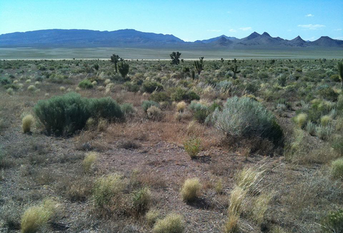
For example on page 21, the map of the Inter-Mountain Basins Semi-Desert Grassland is far too vague and coarse to me meaningful. Using whole watersheds as a broad unit based on one year (2010) and with the parameters of distance from urban centers or human activities is not an accurate system for analyzing the condition of Great Basin upland grasslands. We have traveled this year (2015) through many of the areas labeled red (poor) in this map, and this year most of the grasslands in these watersheds are flourishing with the above average summer rainfall; they are in good condition even in areas close to human settlement and use. Not all ranges are overgrazed, some areas are on old burns and thus in a state of successional upland grassland that is in very good condition. The idea that a snapshot in time over a watershed could act as a description for that landscape is completely inaccurate. This overly broad map of conditions says nothing about the state of the habitats during the year of a solar application, nor does it give accounts of which species are present, what rare plants are in the area, how rainfall patterns have affected the vegetation, and what local human influences may be. The map condition models are basically useless and should not be made part of an environmental analysis for the Dry Lake North SEZ.
More crucially, how does one mitigate for an entire watershed labeled “fair” condition with respect to these vegetation types. The maps and gap analyses are useless for determining on-site mitigation measures that would be meaningful to species and resources present.
Other maps such as on page 23 showing Future Bioclimate trends of saltbush scrub, are highly theoretical and utterly useless for developing mitigation measures. Such guesswork should not be included in environmental review. No scientist can know what will happen in 20, 50, or 100 years. Saltbush is exapted to arid warm climate patterns and may indeed expand during dry phases of climate; but future climate may become moister and cooler in the Southwest desert and saltbush might contract in range. Maps such as these are useless for developing mitigation measures for a particular solar project.
We would also ask that the following subjects in the Dry Lake North Draft Mitigation Strategy be reviewed more carefully and more time provided to consider this review.
All environmental review for any projects in the Dry Lake North Solar Energy Zone should detail the following subjects with far better specifics to the region:
Air Quality/Fugitive Dust:
Dry Lake Valley is remote, but lies close to smaller communities such as Pioche and Caliente. The document fails to acknowledge the risk of valley fever from the large amount of clearing that takes place for solar developers. If you build roads, transmission, large scale renewable projects and grade desert habitat, you will have fugitive dust potential. When deserts are scraped, a Pandora’s Box of air quality issues is opened. Biological soil crust, desert pavement and old growth vegetation will all be lost.
This can be an Environmental Justice issue. The health impacts that will arise from airborne particulates from construction dust could have very negative on the local residents of the area.
Valley fever cases have been recorded in Washoe County and nearby Clarke County, Nevada. Dry Lake is remote and the small population would make it plausible that the risk is low, yet the amount of land BLM will allow to be disturbed ins unprecedented. It is very possible this could be an issue here.
In San Luis Obispo County, 28 workers were sent home with Valley fever: Epidemiologists are investigating an outbreak of valley fever that has sickened 28 workers at two large solar-power construction sites in San Luis Obispo County: http://articles.latimes.com/2013/may/01/local/la-me-ln-valley-fever-solar-sites-20130501
The document fails to explain what a “vortex generator” is. These are generally used by aircraft to regulate airflow. The document does not describe potential noise or visual impacts from these generators.
The document states that large-scale solar projects are “good for climate change”, yet does not talk enough about construction emissions, the fact that many green energy projects rely on natural gas baseload and the potential heat index that can be caused by clearing so much vegetation.
Groundwater:
The mitigation document should estimate the maximum amount of groundwater that would be used for construction, operation and decommissioning of large-scale projects.
Mitigation should require all solar and transmission developers to truck in their water from elsewhere.
Avian Kills/Polarized Glare:
This has become a very big issue now with solar projects and even if the projects are photovoltaic only, there is a great potential for large-scale bird mortality for this development. Both the Mitigation Strategy and the PEIS failed to cover this issue adequately.
Large solar projects are creating a polarized glare or lake effect and are causing birds and insects to be deceived and collide with solar panels or simply dehydrate. The avian impacts are not fully understood, but everyone seems to agree that this problem was underestimated during the initial boom to fast track big solar on both public and private lands in the Southwestern US. The polarized “lake effect” is now well known from the Genesis, Desert Sunlight and Ivanpah Projects, all in California. Bird species that have collided (or dehydrated) with solar panels and heliostats include the Endangered Yuma clapper rail, peregrine falcon , American kestrel and a host of water birds. As far as we know, very few focused surveys are occurring in the state of Nevada. The Crescent Dunes power tower is conducting focused surveys, but will not release any information to the public. For three California Solar Projects, we have been informed that over 160 species of birds have been recorded killed with thousands of individual mortalities.
Executive Order 13186 (Responsibilities of Federal Agencies to Protect Migratory Birds, signed in January 2001) requires the BLM to evaluate the effects of federal actions on migratory birds. The lack of information regarding polarized glare bird collisions with solar panels in both the PEIS and the three Environmental Assessments show that BLM failed to adequately evaluate the effects of these proposed Federal actions on migratory birds. This puts the BLM in violation of the Migratory Bird Treaty Act. The cumulative impacts of polarized glare collision combined with electrocution and habitat loss increase threats to avian fauna. An EIS should be prepared for each project so these impacts can be better evaluated.
At this point, those California projects (and one in Nevada) are among the few that are reporting findings of dead birds at their sites. And although we have nothing in writing to confirm this, we have now been told by a few biologists working on these projects that they are discouraged by the developers from reporting incidental finds.
And indeed, the issue was mostly overlooked for the three EA’s and the PEIS regarding the Dry Lake South Solar Energy Zone.:
The Environmental Assessments briefly raised the issue of polarized glare when talking about threatened and endangered birds. The only three species mentioned were the southwestern willow flycatcher, the Yuma clapper rail, and the yellow-billed cuckoo which are all special status or Endangered Species. The EA’s claim that the “project area is not within a path that would connect any aquatic features”, but overlook the fact that Lake mead National Recreation Area is about 30-40 miles to the south and the Pahranagat National Wildlife Refuge is about 60-70 miles to the north. While the lake effect would not mimic riparian habitat, both the Southwest willow flycatcher and yellow billed cuckoo could be present at Pahranagat National Wildlife Refuge and could pass over the solar projects. There are many water birds that could pass over the project using it as a path between Lake Mead and Pahranagat which potentially could collide with solar panels. The effect may also increase risk of collision with transmission lines and electrocution.
Below is the letter we sent to BLM expressing our concerns that they overlooked impacts to the Yuma clapper rail:
January 22nd, 2015
To: Nancy Christ, Greg Helseth
BLM Southern Nevada District Office 4701 North Torrey Pines Drive, Las Vegas, NV 89130
Email: nancy_christ@blm.gov, ghelseth@blm.gov
Subject: Additional comments based on new information unavailable at the time for the comment period for the Playa Solar Project (Dry Lake SEZ Parcels 2,3 and 4) NEPA# DOI-BLM-NV-S010-2014-0127-EA, Project # N-93306. Comments on the Dry Lake Solar Energy Center Project NEPA# DOI-BLM-NV-s010-2014-0126-EA , Project # N-93337 and the Harry Allen Solar Energy Center Project NEPA # DOI-BLM-NV-S010-2014-0125-EA Project # N – 93321.
Basin and Range Watch submitted comments on the above listed Environmental Assessments for the three solar projects in the Dry Lake Solar Energy Zone. We have acquired some information from the US Fish and Wildlife Service that was recently obtained through a Freedom of Information Act Request concerning the geographic distribution of the Federally Endangered Yuma clapper rail, (Rallus longirostris yumanensis). We believe was missed by the EA’s and would like the BLM to consider this in these follow up comments.
All three EA’s state “The southwestern willow flycatcher, the Yuma clapper rail, and the yellow- billed cuckoo are riparian birds that require surface water, and no riparian habitat occurs in or near the project area. The project area is not within a path that would connect any aquatic features and the closest documented records for these species are 20 and 25 miles away (32 and 40 km away), respectively (personal communication, Susan Cooper, USFWS Las Vegas, and Melanie Cota, BLM Southern Nevada District, September 29, 2014).”
Dead Yuma clapper rails have been found at two California solar projects and a likely cause would be that the birds were deceived by the polarized lake effect, collided with the solar panels and died from blunt trauma.
As we pointed out in our first comments, the three EA’s for the Dry Lake Solar Projects have failed to recognize a potential flyway between Lake Mead/Muddy River and the Pahranagat National Wildlife Refuge, 70 miles to the north. The shiny polarized effect of the panels of the Dry Lake Solar Energy Projects could easily produce this lake effectand potentially injure or kill a YCR.
We have attached a report and a map from the Fish and Wildlife Service that document Yuma clapper rail presence at Pahranagat National Wildlife Refuge. Since these documents were not available before the comment deadline ended for the Dry Lake Solar EA’s, we believe you should add this information to our comments.
Thank you for your consideration,
Basin and Range Watch
We believe both the mitigation strategy and the PEIS overlooked the serious potential of this problem for the Dry Lake North Solar Energy Zone.
We have identified Yellow billed cuckoos in Meadow Valley Wash near Panaca, just one mountain range over from the Dry Lake North Solar Energy Zone. The BLM has failed to provide a potential list of species of birds that could be killed by these solar projects. While we are not aware of any Yuma Clapper Rail sightings outside of the Pahranagat National Wildlife Refuge, there are marshlands and wetlands that could potentially attract the species. The Meadow Valley Wash is close and eventually ends up in Lake Mead. There are many agricultural fields in the wash that attract birds. Beaver Dam State Park, the Wayne E Kirch Wildlife Management area and the Key Pitman Wildlife Management Area should all be considered as potential flyway stops. These areas will attract far more than potentially endangered birds. An entire list of bird species should be provided and considered as potentially impacted by an artificial solar “lake effect” or polarized glare.
The approved Blythe Solar Power Project is under construction will eventually be a 4,000 acre PV facility near the Colorado River near Blythe, California.
At a hearing for the California Energy Commission, there were interveners. LABORERS’ INTERNATIONAL UNION OF NORTH AMERICA had biologist Shawn Smallwood estimate a number of birds that would be killed for one of the Interveners to the project. He estimated that over 2,100 birds would be killed per year by the 4,000 acre Blythe Solar Power Project. The estimate can be viewed here:
A similar analysis should be made for the Dry Lake North Solar Energy Zone.
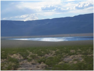
Visual Resource impacts can’t be mitigated on 25,000 acres:
If the zone is fully developed, the visual impacts would encompass close to 40 square miles. That would be visible from outer space. PV facilities would resemble large lakes.
There would be visual losses from the Big Rocks and Weepah Spring Wilderness Areas. The Mitigation Strategy does not mention the recent designation of the Basin and Range National Monument. If the Dry Lake North Solar Energy Zone is visible from the Weepah Spring Wilderness Area, chances are it would be visible from some higher elevations from the new monument. The North Pahroc Range would not block all of it. The strategy should be updated to consider the new monument.
The mitigation strategy should consider an alternative that limits the size of projects to 1,000 acres and under and space them a minimum of one mile apart.
The Environmental Impact Statements for solar projects on this zone should include -A strong conservation minded Purpose and Need Statement:
The Purpose and Need for any large-scale project in the Dry Lake North Solar Energy Zone should outline a need to maintain visual, biological and cultural resource integrity throughout the region. The Statements should recognize the controversy and impacts caused by industrial scale energy. The Statements should recognize that there are more environmentally friendly ways to produce solar energy.
-Offer a wide range of reasonable alternatives:
Following the guidelines of the National Environmental Policy Act, the final EIS should present the environmental impacts of the proposal and the alternatives in comparative form, thus sharply defining the issues and providing a clear basis for choice among options by the decision maker and the public. In this section agencies shall:
(a) Rigorously explore and objectively evaluate all reasonable alternatives, and for alternatives which were eliminated from detailed study, briefly discuss the reasons for their having been eliminated.
(b) Devote substantial treatment to each alternative considered in detail including the proposed action so that reviewers may evaluate their comparative merits.
(c) Include reasonable alternatives not within the jurisdiction of the lead agency.
(d) Include the alternative of no action.
(e) Identify the agency's preferred alternative or alternatives, if one or more exists, in the draft statement and identify such alternative in the final statement unless another law prohibits the expression of such a preference.
(f) Include appropriate mitigation measures not already included in the proposed action or alternatives.
We would like to request that the BLM consider the following alternatives for large scale energy in the Dry Lake Solar Energy Zone.
Brownfields and Degraded Lands Alternative:
The US Environmental Protection Agency has identified over 15 million acres of brownfields in the United States that would be suitable for utility scale solar development. See here:
http://www.wvbrownfields.org/conferences/2010/presentations/Evans%20Paul%20-%20Jobs.pdf
Distributed Generation Alternative:
Distributed generation in the built environment should be given more full analysis as a completely viable alternative. This project will need just as much dispatchable baseload behind it, and also does not have storage. But environmental costs are negligible with distributed generation, compared with this project. Distributed generation cannot be “done overnight,” but neither can large transmission lines across hundreds of miles from remote central station plants to load centers. Most importantly, distributed generation will not reduce the natural carbon-storing ability of healthy desert ecosystems, will not disturb biological soil crusts, and will not degrade and fragment habitats of protected, sensitive, and rare species.
Conclusion:
The review for all of the Solar Energy Zones in six western states was incomplete. All of the programmatic mitigation strategies we have looked at for the solar zones are filled with incomplete detail and tend to overlook specific resources on each site. In the past 6 years, experience has shown us that streamlining always ends up missing important information. In 2011, the BLM approved the Spring Valley Wind Project on 8,000 acres of public land next to Great Basin National Park with only a 30 day Environmental Assessment. This was not enough. BLM’s failure to properly evaluate the impacts of this project have resulted in more bats being killed by the project and two golden eagle kills – both of which were found incidentally. BLM is not really looking enough. Similarly, the BLM’s poor review of the three projects on the Dry Lake South Solar Energy Zone will no doubt result in surprises and unexpected loss of resources. For this reason, we would ask BLM to review any large-scale solar applications in the Dry Lake North Solar Energy Zones with full Environmental Impact Statements.
Thank you,
Kevin Emmerich
Laura Cunningham
Our Comments on the Supplement
January 25, 2012
Solar Energy Draft PEIS
Argonne National Laboratory
9700 S. Cass Avenue
EVS/240
Argonne, IL 60439
Sent via comment form on PEIS web site:
Please accept the following comments on the Supplement to the Solar Programmatic Environmental Impact Statement.
Basin and Range Watch is a group of volunteers who live in the deserts of Nevada and California, working to stop the destruction of our desert homeland. Industrial renewable energy companies are seeking to develop millions of acres of unspoiled habitat in our region. Our goal is to identify the problems of energy sprawl and find solutions that will preserve our natural ecosystems and open spaces. We have visited the site containing the entire Right of Way proposal for Silver State North and Silver State South. We have found several important resources on these sites including a healthy desert tortoise population.
Purpose and Need:
All alternatives are now defined by a Need reflecting the recent Secretarial Order 3283: Enhancing Renewable Energy Development on Public Lands.
The goals of Section 4 in Secretarial Order 3283 clearly state a need for environmental responsibility: “the permitting of environmentally responsible wind, solar, biomass, and geothermal operations and electrical transmission facilities on the public lands; The projects that would be associated with the solar PEIS would be utility scale and would demand anywhere from 2,000 to 10,000 acres. There is no way developments on that scale can be considered “environmentally responsible”.
The Purpose and Need Statement for both the BLM and DOE should include a need to site solar energy using distributed generation systems and on Environmental Protection Agency identified brownfields. By placing renewable energy in the built environment and on degraded lands, we can avoid conflicts involving biological resources, cultural resources, groundwater issues, altercation of floodwaters, air quality issues, impacts to wilderness areas and national parks, property values, visual resources and public health.
Alternatives:
A full range of alternatives should be considered in every EIS document. That is required by NEPA.
Following the guidelines of the National Environmental Policy Act, the final EIS should present the environmental impacts of the proposal and the alternatives in comparative form, thus sharply defining the issues and providing a clear basis for choice among options by the decision maker and the public. In this section agencies shall:
(a) Rigorously explore and objectively evaluate all reasonable alternatives, and for alternatives which were eliminated from detailed study, briefly discuss the reasons for their having been eliminated.
(b) Devote substantial treatment to each alternative considered in detail including the proposed action so that reviewers may evaluate their comparative merits.
(c) Include reasonable alternatives not within the jurisdiction of the lead agency.
(d) Include the alternative of no action.
(e) Identify the agency's preferred alternative or alternatives, if one or more exists, in the draft statement and identify such alternative in the final statement unless another law prohibits the expression of such a preference.
(f) Include appropriate mitigation measures not already included in the proposed action or alternatives.
Alternatives not within the jurisdiction of the lead agency:
These should include a Distributed Generation Alternative and an EPA Identified Graded Lands Alternative. As pointed out above, these alternatives are required to be considered under NEPA. Recent “mandates” by the Interior Department discourage these alternatives, but these are worded carefully using terminology like “recommends”. The fact is that there are no mandates that say that BLM can not consider an off- site alternatives to projects that will have major impacts to resources on public lands.
In its original scoping letter on the recent Solar Programmatic Environmental Impact Statement, The Environmental Protection Agency has identified hundreds of thousands of acres of degraded and contaminated sites around the country which could generate up to 920,000 MW of solar generation. This could easily replace and surpass any desire to develop 285,000 acres of untrammeled public lands.
Now that unlimited Federal subsidies for renewable energy projects are a thing of the past, the realities of feasible solar energy production are all on the table. Extreme cost and resource conflicts are eliminating the Concentrated Solar Thermal designs from the picture. BrightSource is one of the few survivors because their capitol was originally provided by federal subsidies. The rest appear to be falling like dominos. Almost all utility scale solar designs are now photovoltaic. While it is difficult to use CSP technology on the distributed scale, photovoltaics . In December, 2011, Germany installed 3,000 MW of rooftop, distributed energy. That is more MW in one month than all of the utility scale projects being built in the US would produce combined so far.
Even under the best case scenario, utility scale PV will lose ten percent capacity in the transmission journey alone.
Distributed generation in the built environment should be given much more full analysis, as it is a completely viable alternative. Environmental costs are negligible with distributed generation, compared with this project. Distributed generation cannot be “done overnight,” but neither can large transmission lines across hundreds of miles from remote central station plants to load centers. Most importantly, distributed generation will not reduce the natural carbon-storing ability of healthy desert ecosystems, will not disturb biological soil crusts, and will not degrade and fragment habitats of protected, sensitive, and rare species.
Alternatives should be looked at that are in load centers, not closest to the project site. There is a need to consider the “macro” picture, the entire state, to look at maximum efficiency.
A master comprehensive plan should exist before large expensive inefficient solar plants are sited and built out in the wildlands. This plan should carefully analyze the recreational and biodiversity resources of the southwest. A list of assumptions should be included detailing the plan for integrating various fuels mixes and technologies into each utility's plan, an overall state plan, and a national plan. Loads should be carefully analyzed to determine whether additional capacity is needed for peaking, intermediate, or baseload purposes. Unit size, which impacts capital and operating costs and unit capacity factors, has a direct bearing on the relative economics of one technology over another. A plan might recommend that smaller units built in cities and spaced in time offer a less risky solution than one large unit built immediately.
Right now there is no utility plan, no state plan, and no national plan. Large-scale central station energy projects have been sited very far from load centers out in remote deserts, with the only criterion being nearness to existing transmission lines and natural gas lines. Very little thought has been given to the richness of biological resources, the cumulative impacts on visual scenery to tourists, the proximity to ratepayers, or the level of disturbance of the site.
The California Energy Commission says they will be a need to build many new efficient natural gas peaker or baseload plants to back up the renewable projects planned. Instead, the renewables should be distributed generation in load centers, which will provide much more efficiency, rather than inefficient remote central station plants that reduce biodiversity and require expensive transmission lines. This reduces the risk, as distributed generation is a known technology and has been proven in countries like Germany where incentive programs have been tested. Incentive programs can be designed in an intelligent manner to vastly increase distributed generation. Incentives for large remote projects are unproven to lower risk and may actually raise debt levels with runaway costs associated with poor sighting and higher-than-anticipated operating and maintenance costs.
Many renewable project developers have failed to consider reasonable or viable alternatives that could serve as solutions that everybody could live with. In the case of this particular project, conflicts with endangered species, cultural resources, storm water drainage erosion, viewscapes from National Parks and wilderness areas could all be avoided with a distributed generation alternative.
Our Preferred Alternative:
Our preferred alternative for the PEIS would be to adopt a No Action Alternative and develop a policy that promotes renewable energy on a distributed scale. We would support policy that favors no solar development on public lands and examines solar development on brownfields and on a distributed scale.
Variance:
It has seemed unclear throughout this entire process what exactly BLM and DOE are attempting to do here. On the one hand, you want to create what seem to be one -stop approval zones for solar developers on a vast amount of public land – 285,000 acres, but you are still opening up 22 million acres to the business as usually solar energy review.
By creating 285,000 acres of one-stop approval Solar Energy Zones and keeping the “Priority Projects” along with variance in your preferred alternative, you are just giving more away to the solar industry at the expense of tax payers and public land owners.
Specific Comments on Solar Energy Study Zones:
We have made comments on the original PEIS, but we would like to provide the following additions to these comments on these 4 Solar Energy Zones.
Amargosa Valley, Nevada:
We believe the BLM took a step in the right direction by reducing this SEZ to 8,000 acres, but we still would like to point out the following issues:
Eight thousand acres still would be 12 square miles of development. Amargosa Valley, Nevada has historically had numerous conflicts regarding dust. There have been heated debates over the local dairy farm as well as BLM permitted off highway vehicle races running through the valley.
Public health issues with dust can include concerns about Valley Fever as well as elevated levels of radon being stirred up by dust.
Due to past underground atomic tests on the adjacent Nevada Test Site, soil radon levels are three times the national average in parts of Amargosa Valley. Will plowing up so much soil create health problems for local people as radon particulates are stirred up by construction and local wind gusts?
At this time, there have been a few large scale utility scale solar projects approved. The Desert Sunlight Project in Riverside County has been creating dust issues in spite of strict mitigation measures.
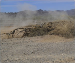
Controlling dust is difficult in arid environments and the following photos show how efforts to mitigate dust for recently approved energy projects under construction have mostly failed:
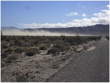
^Above is the lay down area for construction of the Sunrise Powerlink, Imperial Valley, California. Dust is commonly stirred up during windy weather. Mitigation efforts have not controlled this. (Photo by Parke Ewing)
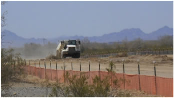
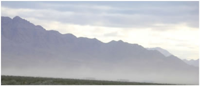
^The above two photos show the now bankrupt Solar Trust of America Blythe Solar Energy Project near Blythe, California. The Right of Way was approved. The company started construction and had to return their 2.1 billion dollar DOE loan when they went under. Efforts to control dust went on in spite of the fact that there is no future for this project. Water trucks were wetting the new roads everyday until September. To save water, the company laid down an acrylic on their new roads. It is not working. Residents are complaining that the wind commonly stirs up dust from the disturbance.
^The First Solar, Desert Sunlight Project located near Desert Center, California. The applicant is in violation of dust mitigation standards.
Vast amounts of water are needed to control dust. In the case of the Desert Sunlight Project, local water well levels are starting to fall due to all of the water needed to mitigate construction dust. The applicant has agreed to dig local wells deeper if this happened. The Desert Sunlight Project has only developed 200 acres of the 4,400 acres they plan to develop. How can there possible be enough water for this? Most desert aquifers are fossil aquifers. Water is left over from wetter climatic phases. They simply do not recharge water.
The Amargosa SEZ would be 8,000 acres or 12 square miles. The Amargosa Valley lies in Basin 230 in the Nevada State Engineer’s water jurisdiction. The Amargosa Valley is over-drafted by 17,000 acre feet. Even if solar energy plants are photovoltaic, this would still require thousands of acre feet for construction and dust control as well as 5 or 6 acre feet a year for panel washing. Solar applicants are often dishonest about how much water they would use for panel or mirror washing. First Solar has often falsely stated at public meeting presentations that they will not use any water to wash their solar panels. This is simply not true. They often build their projects next to dry lakes or other areas where dust is common.
The Amargosa SEZ would be 12 square miles and would create a large visual disturbance. This disturbance would be highly visible from the wilderness areas of Death Valley National Park.
Landscape-level analyses of cultural resources should be undertaken for each SEZ, as well as more detailed archaeological, ethnographic, and historic surveys. A greater effort should be made to contact and follow through coordinating with as many Tribes and local groups as possible.
The Amargosa Valley has a healthy population of Burrowing owls (Athene cunicularia). Burrowing owls are declining in much of their range. This is well documented in California:
http://articles.latimes.com/2010/sep/27/local/la-me-burrowing-owl-20100927
Removing 8 square miles of their habitat in Amargosa Valley would threaten this population.
The Amargosa Valley is not appropriate for a Solar Energy Zone.
Gold Point:
There is no transmission in this area, and it remains a very wild area in Nevada. Gold Point is a popular ghost town. There is no way to maintain the historic character of this area and develop it for industry at the same time.
There is even less water in this basin than there is in Amargosa Valley. It clearly has no infrastructure or water resources to be developed in an industrial fashion. It seems unusual that the BLM would have even considered this SEZ in the first place.
Millers:
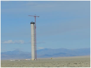
The Solar Reserve, Crescent Dunes Project is being built near the Millers SEZ. The issue of avian mortality was never resolved for this project.
Any more solar power towers of any height should be excluded from Millers SEZ. A potentially serious problem with this type of solar technology, not present in parabolic trough plants, is the superheated beams reflected through the air over the heliostat fields onto the central receiver towers. Migrating or foraging birds have been burned to death flying through these beams. Energy flux amounts as high as 600 kW/square meter at the central receiver. A bird flying through the air will heat up crossing the concentrated solar beams, and could be burned.
The paper AVIAN MORTALITY AT A SOLAR ENERGY POWER PLANT, by Michael D. McCrary, Robert L. McKernan, Raplh W. Schreiber, William D. Wagner, and Terry C. Sciarrotta, Journal of Field Ornithology, 57(2): 135-141, found that Solar 1 in Dagget, California, during 40 weeks of study caused 70 bird fatalities involving 26 species, most from collisions with both heliostats and tower, but thirteen (19%) birds (of 7 species) died from burning in the standby point. Heavily singed flight and contour feathers indicated that the birds burned to death. Six (46%) of these fatalities involved aerial foragers (swifts and swallows) which are apparently more susceptible to this form of mortality because of their feeding behavior. Large 750-foot power towers proposed currently will have more than a thousand standby points encircling the tower receiver, and temperatures should be measured to determine if these will be as dangerous as the two standby points at the former Daggett power tower.
A discussion of how negative affects of collisions and burning by towers during operation will be minimized and mitigated for raptors, migratory species, other birds, and bats flying during the day needs to be included in the FEIS.
Raptors potentially resident or migratory on the site that could be adversely impacted by towers:
Merlin
American kestrel
Prairie falcon
Peregrine falcon
Northern harrier
Swainson's hawk
Ferruginous hawk
Rough-legged hawk
Osprey
Bald eagle
Golden eagle
Sharp-shinned hawk
Cooper's hawk
Northern goshawk
In addition, waterbirds and shorebirds may use the ephemeral wetlands at the Millers SEZ area.
The Miller's Rest Stop is a nationally known birdwatching hotspot due to its character as an artificial oasis in a large arid region. Rare birds every year are seen at this spot, and ecotourists travel great distances to observe these rare migrants. Every year new species are added, often Neotropical migratory birds far off course from their usual range. Tourism in the Tonopah and Dyer areas is boosted by this and may contribute to local economies.
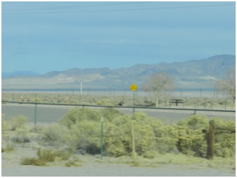
^The above photos show the Crescent Dunes Project under construction. The bottom photo shows how close it is to the Millers Rest Stop.
Polarized Glare:
The polarized, reflection appearance of large photovoltaic facilities assumes the appearance of a large body of water. This can potentially be a death trap. Birds and insects will use up energy to get to water and end up dying of dehydration.
The Nature Conservancy released their Mojave Desert Ecoregional Assessment. In the assessment, they discuss the impacts of polarized light pollution on birds and insects:
“Light and noise pollution associated with electrical power plants can be problematic for wildlife. Polarized light pollution from PV panels can attract aquatic insects and other species that mistake the panels for bodies of water, potentially leading to population decline or even local extinction of some organisms (Horvath et al. 2010). Nighttime lighting for security or other reasons may negatively impact a variety of Mojave Desert species, many of which have developed nocturnal behavior to escape the daytime heat of the desert. (Mojave Desert Ecoregional Assessment September 2010, The Nature Conservancy of California 201 Mission Street, 4th Floor San Francisco, CA 94105) p. 50.”
^Polarized “lake effect” from the Copper Mountain Photovoltaic Facility, Nevada.
East Riverside:
The East Riverside Solar Energy Zone is the biggest of the SEZ’s and even though the BLM reduced the size down from approximately 200,000 acres to 149,000 acres, there are still many unresolved conflicts. Development at this scale threatens biological, cultural, hydrologic and visual resources.
The BLM has modified this SEZ and concentrates most of the main development around the Blythe area. It is frivolous for the BLM to consider letting that much land be released for development.
The following resources would be irreversibly damaged if this much land were allowed to be developed.
Microphyll Woodlands:
The BLM and DOE received comments about the significance of McCoy Wash and how it contains ironwood trees that are close to 2,000 years old. As a result of this, McCoy Wash was excluded from this zone, but it appears that the BLM does not understand the concept of cumulative impacts, because the exclusion is literally only 1 quarter mile wide. All one needs to do is visit this area either by walking or driving on the backcountry roads and you will find that there are numerous microphyll washes that parallel McCoy Wash.
^This is one of countless clusters of micophyll habitat that has been approved for removal and replacement of solar panels in the Solar PEIS.
It is a mistake to remove so much of this habitat for photovoltaic panels. Alternatives to destruction of these irreplaceable resources should be examined.
The biological diversity of micophyll habitat should be recognized.
The presence of Desert ironwood in the Colorado Desert increases avian habitat by 62 percent. Over 150 bird species use ironwood. Ironwood also can protect frost sensitive native plants growing beneath them. More than 230 plant species have been documented starting their growth under the protective microclimate of ironwood nurse plants. The ironwood microclimate fixates nitrogen in the soil. Annual wildflowers are abundant under ironwood on wet years.
There are 62 reptiles and amphibians, and 64 mammals that use ironwoods for forage and cover. Close to 250 insects have been recorded using ironwood trees.
We would like the BLM to analyze and attempt to quantify the loss of biological diversity from their proposal. By protecting a narrow sliver of microphyll in the area, what percentage of species and habitat function will be lost and how much will remain with the one percent that is left alone by the BLM?
Birds:
The Solar PEIS designates a very large area by the Colorado River as appropriate for solar energy development. This part of the SEZ is in close proximity to 4 US Fish and Wildlife Service National Wildlife Refuges: Cibola, Bill Williams, Imperial and Havasu. It is also near two globally Important Bird Areas: Cibola National Wildlife Refuge and Important Bird Area north of the town of Blythe.
Some areas along the Colorado River are used for agriculture. A USFWS refuge manager on the teleconference pointed out that although some of the northern part of Cibola NWR adjacent to the project is currently grown in alfalfa and corn to feed thousands of wintering waterfowl, there is much riparian restoration happening now and planned for the future. This would include encouraging native willows, cottonwoods, and mesquite. Hundreds of acres of riparian tree restoration are planned here.
This part of the SEZ would be located in the Pacific Flyway, which is a migration corridor for diverse waterfowl reaching from the Sea of Cortez in Mexico, to the Salton Sea in Imperial Valley, California, northwards to the Central Valley marshlands, and eventually to Oregon wetlands where ducks and geese nest in summer. An offshoot of the flyway follows the Colorado River.
All large solar energy plants will require large tracts of land. The problems with power tower technology are being reviewed by BLM, Fish and Wildlife and the California Energy Commission for the BrightSource Rio Mesa Project. The fact that BrightSouce would like to build this project so close to the Colorado River will probably cause the agencies to reject their application.
Parabolic trough and photovoltaic technology could have negative impacts for foraging birds and the polarized effect could disorient avian fauna.
Permitting so much development next to the Colorado River is not appropriate.
Agricultural Lands:
Local people from Blythe have told us that they are worried about all of the agricultural lands being bought up by fly-by-night solar developers. If photovoltaic plants are built, only about 5 to 10 full time jobs are created. This could very well be an economic dead end for the community of Blythe. Boom and bust subsidized energy projects have very little potential to create a sustainable economy.
Cultural Sites/ Archeology Sites:
The East Riverside SEZ contains thousands of cultural/archeology sites. The area around Blythe, California is very rich in cultural resources. The amount of land that would be written off for solar development is not acceptable. It would be impossible to both develop this land and preserve the cultural integrity of the region.
The Blythe area can also be described as a “Living Cultural Landscape” of the Colorado River Tribes practice their tradition at these sites. We have asked them their opinion about proposed mitigation that would either avoid sites or surround them with development or relocating artifacts to museums and destroying artifacts but recording them first. In all cases the answer seems to be that the entire landscape is their “cultural sites” and any modifications, with or without mitigation is not appropriate.
A broad area is needed to analyze cultural resources, not just project sites. Landscape scale analysis is needed, including thematic resources: what are the important archaeological information in the landscape? Is the ethnographic landscape still used? Springs, dune systems, mesquite groves should be analyzed for evidence of cultural use, including prehistoric agriculture. Paleoecological data should be analyzed. Are landscapes rare or present in every valley? These would include unique combinations of springs and mesquite groves.
More detailed ethnographic studies are needed, including oral histories from local bands and Tribes of how these landscapes were used. Archival sources are often too limited. How did the Tribes use the resources present? Specific landforms may be considered sacred to local Native people in the area, such as mountains, dunes, and springs. Viewsheds may be important to keep intact. Areas may be part of Storyscapes and Songscapes that continue to be used. Local Native people should be consulted about these potential concerns.
Ivanpah Valley in Nevada and California:
Ivanpah Valley lies in both California and Nevada. It supports a variety of important resources including desert tortoise habitat and connectivity, several rare plants, a rich cultural history and spectacular visual resources.
We would like to request that BLM remove the Ivanpah Valley from all variance and future consideration of any solar projects. Below are some of our main reasons:
1. Ivanpah Valley contains a stronghold population of desert tortoises (Gopherus agassizii).
2. As defined in the original Desert Tortoise (Mojave Population) Recovery Plan (1994), the region was within the Northeastern Mojave Recovery Unit for the desert tortoise, one of six designated evolutionary significant units. This population was understood to be genetically the most distinctive unit of the desert tortoise in the Mojave Desert. Northeastern Mojave desert tortoises were recognized as the most genetically distinct population of California’s desert tortoises. The range of this population is limited in California and Ivanpah Valley contains a significant portion of this range. When the Recovery Plan was issued, some of the highest known tortoise densities were in southern Ivanpah Valley, with 200 to 250 adults per square mile.
3. In 2010, the US Fish and Wildlife Service recommended that no more large scale solar development be approved in the Ivanpah Valley.
The BrightSource Ivanpah Solar Electric Generating System is now under construction. The impacts to the desert tortoise population are alarming.
The following numbers have been determined by private and public biologists working on the Ivanpah Project. The Revised Biological Assessment for the Ivanpah Solar Electric Generating System (ISEGS) Project of April 19, 2011 (prepared for Bureau of Land Management by Sundance Biology, Inc., Kiva Biological Consulting, and CH2MHill) states that 3,344 acres of desert tortoise habitat will be permanently removed, 176 acres more temporarily disturbed.
The revised June 2011 Biological Opinion from USFWS estimates that 51 to 141 adult and subadult tortoises may be found on the ISEGS site while 91 to 391 subadult and adult tortoises may be found on recipient sites where tortoises will be translocated to, a total of 142 to 532 tortoises.
The total number of immature tortoises (under 160 millimeters shell length) that could be impacted may be 891 to 3,236. Juvenile tortoises will suffer an estimated 90% mortality on the project site. And 451 to 1,631 eggs and hatchlings may be impacted by the project activities on site and in the surrounding areas.
Basin and Range Watch has submitted a nomination of the Ivanpah Valley to be considered for an Area of Critical Environmental Concern. The nomination can be viewed here: http://basinandrangewatch.org/Ivanpah-ACEC.html.
The developer, First Solar, has two large applications for future solar development in Ivanpah Valley. The first is called the Stateline Project- a 2,200 acre proposed solar facility that would be sighted directly next to the BrightSource project. The second is the Silver State South Project which is a 13,000 acre Right of Way application. The actual size of the project is yet to be decided. BLM has informed us that only 4,000 acres of this ROW will be approved, but we are still looking at six square miles of solar panels which would limit or cut off the connectivity of the desert tortoise.
We are hoping that BLM will accept our nomination as an alternative to any more large solar projects located in the Ivanpah Valley.
The PEIS has provided the below map which shows connectivity for desert tortoise in the Ivanpah Valley. This alternative excludes all tortoise connectivity zones for solar development. We believe that the BLM should exclude all connectivity corridors from any consideration of future solar development.
Conclusion:
The PEIS is the wrong direction for land managers to go regarding solar energy. The Interior Department along with some environmental groups are supporting the whole “Smart from the Start” mentality. They want solar developed on they think are the most disturbed wildlands. It turns out that every solar developer with an application on public lands has exaggerated the level of disturbance on the site they want to build on. We have found valuable public land resources on every one of these fast tracked or prioritized projects. This is not how we should be managing public lands. Energy can go in the built environment and on degraded lands. Sacrificing public lands with multiple use mandates for one developer is inconsistent with the multiple use philosophy of the Bureau of Land Management. The PEIS is flawed because our alternatives of distributed generation and building solar energy on EPA identified brownfields have been ignored. Legally under the National Environmental Policy Act, you are required to consider these alternatives and you have not.
For a comprehensive description about the right and wrong way to use solar energy, please see Solar Done Right’s report, Wrong from the Start. It can be viewed here: http://solardoneright.org/images/uploads/WrongFromTheStart.pdf.
We do not believe the PEIS will work. Creating one stop solar energy zones will not solve transmission issues. Federal subsidies will no longer be available to these developers. The PEIS came about too late to be effective. We believe that the BLM and the DOE should adopt a No Action Alternative and explore a policy that sites solar energy in distributed generation systems and on EPA identified brownfields.
Thank you,
Basin and Range Watch
www.basinandrangewatch.org
HOME.....Solar PEIS