Riverside East Solar Energy Zone Mitigation and Monitoring Plans
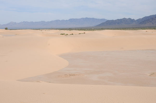
^Palen Dunes, Chuckwalla Valley, in the Riverside East Solar Energy Zone.
October 28, 2015 - Sacramento CA - A meeting of agencies and to discuss how to proceed with monitoring impacts of solar projects to resources in the Riverside East Solar Energy Zone (SEZ) in eastern Chuckwalla Valley occurred on October 28. This is an ongoing process to work out details of the massive Solar Programmatic Impact Statement (PEIS) developed and approved for federal lands in the western US. The webinar materials can be accessed >>here.
Comments may be submitted by email to lfox@anl.gov.
Bureau of Land Management (BLM) has developed a system of Indicator Sites and Control Sites to be able to monitor impacts of solar projects and compare with undeveloped sites. They do not have "before" sites, as this system was developed more recently, after solar energy zones were approved. A two mile buffer zone around solar projects will be monitored, and additional strata may be added. The detection of temporal changes of management significance will be quantified using methods still to be developed. Qualitative observations and photography will also be used. Ecophysical strata such as vegetative communities and sensitive soils, for example. BLM's National Assessment, Inventory and Monitoring Program (AIM) will be utilized (see for example information about AIM on this link), a method developed to measure the health of rangelands on public lands.
A list of items to be measured:
--Soil aggregate stability -- a measure of water erosion
--Soil texture
--Ephemeral stream erosion, hydrologic modification off site of the solar project: channel depth, width, changes in direction, ground and aerial photography.
--Dust -- indicates erosion. Monitor particulate matter downwind of the SEZ.
--Groundwater -- surface elevation and change in extent. Electronic probes and data loggers.
--Disturbance of desert pavement
--Alterations of sand dunes, wind flow patterns
--Remote sensing -- to detect desert pavement and sand dunes, still will require validation.
--Biological soil crusts -- methods to quantify are still being developed.
--Vegetative habitats -- rare and high-priority. Cover will be measured, using remote sensing with validation. Core AIM vegetation will be measured along line intercept transects. Some of the indicators to be measured:
Composition
Plot level inventories
Invasive species
Height of vegetation
Intercanopy gaps
Bare ground
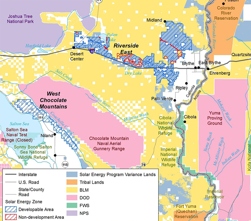
^Map of vegetation communities in the eastern portion of the Riverside East SEZ, showing the abundant microphyll woodland (in dark blue-gray color, apparently missing from the key as an oversight) on the alluvial fans. This area should be protected and not developed for energy.
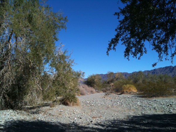
^Microphyll woodland of desert ironwood (Olneya tesota) next to the McCoy Mountains within the Solar Energy Zone.
--Wildlife indicators - measuring population can be expensive, so indicators will be measured, such as sand dune habitat.
Four Indicator species will be monitored directly (in part with point counts):
Loggerhead shrike
Black-tailed gnatcatcher
Verdin
Kit fox
Sensitive species will also be monitored (indirectly):
Desert tortoise -- uncommon in this zone; wash habitat will be monitored.
Mojave fringe-toed lizard
Bighorn sheep
"Invasive" species will also be monitored (species that increase with anthropogenic activity):
Raven -- using point count surveys
Coyote
Invasive plants will be monitored from AIM Core indicators.
--Visual resources -- These resources will be quantified using BLM's visual ratings from a 2011 baseline, using the Visual Resource Inventory Handbook.
Visual Resource Inventory (VRI)
Class
Visual contrast
"Visually Sensitive Areas" (VSAs) will be monitored.
Impacts on night sky will be measured such as sky glow, light clutter, using night sky meters, and charge-couple devices and automated camera systems.
--Socio-cultural resources to be measured:
Recreation -- such as the number of permits collected by BLM.
Changes in traffic in or near the solar facility, such as during maintenance activities, off-highway recreation, and traffic counts.
--Paleontological and Cultural resources -- the number of impacts to the integrity of sites, number of reported impacts to sites of Native American significance. Vehicular traffic, trash will be measured, for example, using volunteers, incident reports from Law Enforcement, reports from Native American monitors, and photographs.
--Cost -- The agencies are already collecting baseline data, developers will be responsible for applied monitoring. BLM said they will try to obtain funds from resource agencies and NGOs to continue monitoring protocols. Remote sensing can be more cost effective than on-the-ground surveys (but in our opinion not as accurate). All indicators listed above may not be used, and they may be prioritized, according to stakeholder concerns. High priority would include soil erosion, groundwater changes, vegetative impacts, and sand dune changes. Low priority would include socio-cultural impacts. Project developers would be responsible for stabilizing souls, and BLM indicators would be used to see how successful those measures were. Microphyll woodland would be a high priority indicator for vegetation communities, and would be measured in part with remote sensing.
A question on costs was asked, would this protocol change monitoring requirements for new solar projects entering the Solar Energy Zone? Would costs be capped for new projects? The agencies said they did not have a full understanding yet of impacts, so they were collecting data now. New projects would not be burdened with more costs, however. New developers will not be asked to fund all these surveys and monitoring efforts, BLM is funding a ,lot of it, and the use of indicator species reduces much of the costs. New costs will be "reasonable." The agencies want input from solar developers. Individual project level impacts will be looked at for 1,000 acre levels, not the entire Solar Energy Zone.
Developers asked if costs would be capped for new projects, all this monitoring seemed expensive. The agencies said new projects would not be asked to fund all this, BLM is funding a lot of it. The use of indicator species helped reduce costs. New costs will be "reasonable", and the agencies want input. Individual project level impacts will not fund the whole zone, more like 1,000 acres of the SEZ.
Further Concerns and Questions
A question was raised as to the relation of RETI 2.0 with the Desert Renewable Energy Conservation Plan (DRECP). Agencies said they mesh "very well." Long-term impact data can be gathered, which will aid in the DRECP process, as SEZ lands are what most developers are interested in. Mitigation requirements will be determined on a SEZ by SEZ basis; DRECP is defining this for the California Desert.
A question was asked about the BLM AIM Core data gathered during monitoring -- where will all this data be stored and will it be publicly available? The data has been collected over a couple of years, stored in a national database. It will soon be made public. It will be used to make a regional mitigation and monitoring strategy.
Soil moisture and groundwater will in part be measured by wells within the SEZ, and more wells may need to be bored for monitoring.
One question concerned climate change and how it would be monitored? BLM said it was hard to do a cause and effect. Any trends in migratory bird data, for example, is hard to measure as it fluctuates year to year.
A question was asked about increasing tribal participation and monitoring culturally significant landscapes. The agencies said they would try to work on tribal participation, but it would be too difficult to monitor cultural landscapes. They said they would look for indicators.
Our Questions
We asked how will direct mortality of birds at solar projects be monitored and how will this data be made available publicly? How will future mortality be monitored? The answer was on a project-by-project basis and trying to be more systematic. But BLM said "it is not our roll to dive deeply into this." We are not satisfied with this answer, and no answer about making bird kill data public.
Another question we have is whether environmental review will be done on two mile buffer zones for monitoring if they are on public lands outside the Solar Energy Zone? If monitoring wells are dug outside the SEZ, will they be approved by Categorical Exclusion? Public review should always be implemented.
The presentation included a few maps of cumulative impacts in the SEZ, which include pending solar project applications. The Sonora West SEGS project has been officially dropped, we note, and should be removed from the maps.
PDF of October 2015 Monitoring and Mitigation Presentations.
HOME.....Solar PEIS