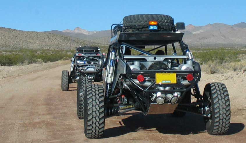
1,000 Mile Race Through the Desert
February 23, 2009
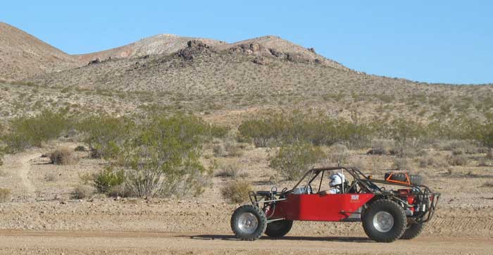
It's coming: this August hundreds of off-highway vehicles will gather at Lathrop Wells, Nye County, Nevada, to race north over small dirt tracks and pristine desert, through washes and over hills, by Beatty, Goldfield, Tonopah, Mina, Hawthorne, and ending at Dayton east of Carson City, Lyon County, Nevada. The race will take three days to complete. Organized by Best in the Desert Racing Association, the race has been an annual event for several years, and is called the TSCO Vegas to Reno Race, billed as the "greatest long-distance, off-road event in this decade on U.S. soil." 350 motorcycles, ATVs, UTVs, high clearance SUVs, 4x4 trucks, and dune buggies will compete. At points the race crosses US highway 95, and 24 pit stops are located along the route. See >>here for maps of the race route.
The Bureau of Land Management (BLM) permits the race, and we aplaud their efforts at working with all public land users. Our comments to them concerning this race follow.
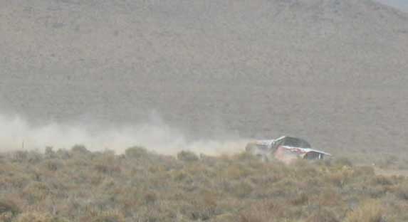
Environmental Review: The 2009 Vegas to Reno Best of the Desert Race will tear up 1,000 miles of public lands, yet BLM is only prepared to write a small Environmental Assessment. Given the new route, the amount of existing roads it will tear up, the amount of washes and cross country routes that will be created, impacts to air quality, wetlands, flora and fauna, an Environmental Impact Statement should be written. The EIS should be paid for in full by the Best in the Desert organization.
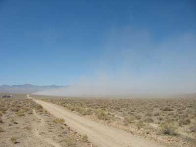
^Dust from the August 2008 race near Death Valley National Park east boundary.
Air Quality: The race as proposed would start at Lathrop Wells which is on the east side of Amargosa Valley. We were told by the BLM that this location was chosen to resolve dust issues for the community of Amargosa Valley. This will not prevent air quality issues from arising. From the amount of land that will be torn up by this race, any time there are windy days, the dust will be kicked up. This will impair the air quality of both Amargosa Valley and Beatty. Moving the race to Lathrop Wells on the east side will make very little difference in keeping dust under control. The entire race route is an air quality disaster. Air quality impacts arise from direct impacts of soils by the race helicopters following the racers and wind carrying dust particulates after soils are torn up. Last year's race was permitted exactly along the border of Death Valley National Park. The dust plumes seriously compromised the air quality of the park. The dust continued to be kicked up from winds months after the race was over.
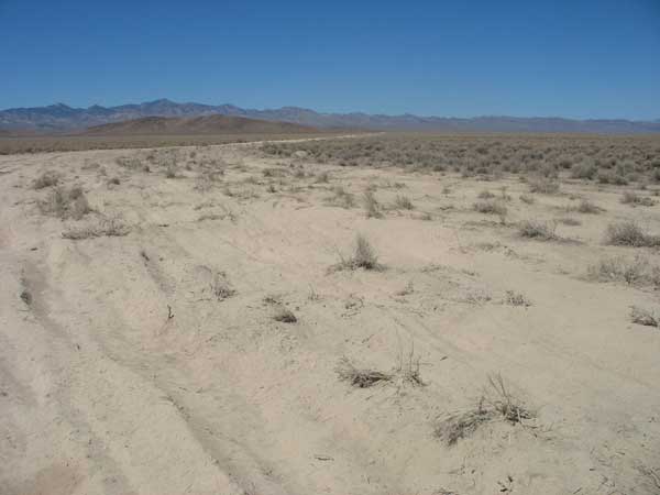
^Just after the race in August 2008, the powder from the torn-up desert soil was so thick that our feet sank in more than 15 inches. Ruts were deep.
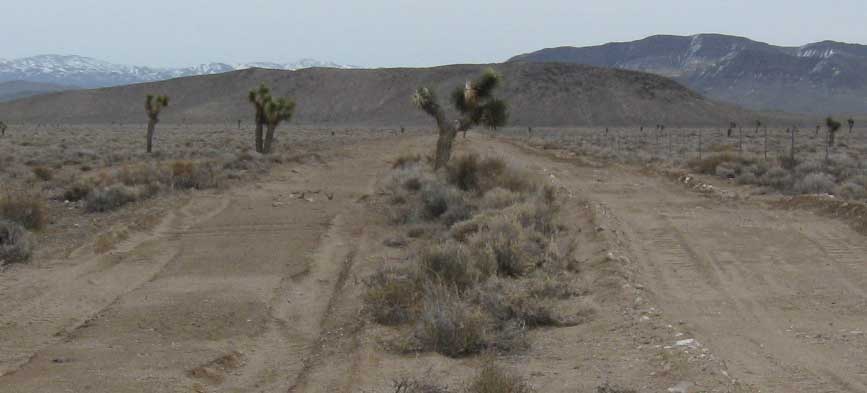
^New roads carved between Johsua trees along the boundary of Death Valley National Park, along a small pre-existing fence road that is now very rough, even though these roads were graded after the race by the county.
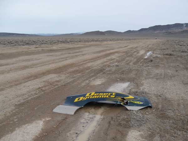
^Junk left over from 2008 race. February, 2009.
Destruction of Existing Roads and Litter: After the race in 2008, we took a look at the condition of the roads that were used between Beatty and Scottys Junction, Nevada, and many of the roads were in deplorable condition. Some were not even passable for four wheel drive vehicles. We also found that the Best in the Desert race created many cross country routes even though the BLM permit did not allow this. We also found much litter after the race including discarded tires and other garbage. We went back in February, 2009 and found the roads adjacent to Death Valley National Park were graded, but the deep erosion created by the extreme use of the roads by the race participants caused so much erosion that the roads are now permanently in a much more degraded state than before. The eroded depressions fill up with water after rain and erode the surface of the road even more. We found that one of the new cross country routes was graded into a road. The BLM should not allow Best in the Desert to create new roads for their race. The only way to really fix these roads would be to bring material in to level them out.
We also measured the width of the race route next to the boundary of Death Valley National Park and found that the route was 250 feet wide. The BLM needs to enforce a limit of how wide the route can become. There could be three times less resource damage if the width of the route were limited to 50 feet. On this route we found whole Joshua trees that were killed by vehicle impact.
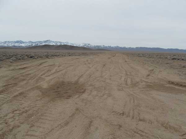
^Race route 250 feet wide, February, 2009.
The BLM also needs to fine Best in the Desert for creating new cross country routes for the race.
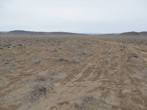
^New cross country route created by race, February, 2009.
Private Property: Although private property is rarely addressed in public documents like this, we feel that in the case of off road vehicle races, this is a very important issue. As personnel in the BLM are well aware, the activity of off highway vehicle use attracts a culture that seems to take pride in a somewhat lawless, Wild West mentality. We learned at the BLM's Great Basin Resource Advisory Council meeting in early February 2009 that BLM personnel have had dangerous encounters with off road vehicle users as well as participants and spectators of these organized races. Anytime one of these race events is scheduled anywhere near private property, it creates potential law enforcement problems with property owners. We have had OHV trespassers vandalize our property at the same time the Best in the Desert Race. We know others who have been threatened by people on ATV's and dirt bikes on their property. The 2009 race route goes right next to Coffer Ranch. It also will be taking place next to power lines that service electricity to the area. The high speed activity could damage these power lines causing repair work for the local electric company. The cost of these repairs would burden tax payers and rate payers. It does not make sense to permit such a destructive event that will have so little benefit for local people.
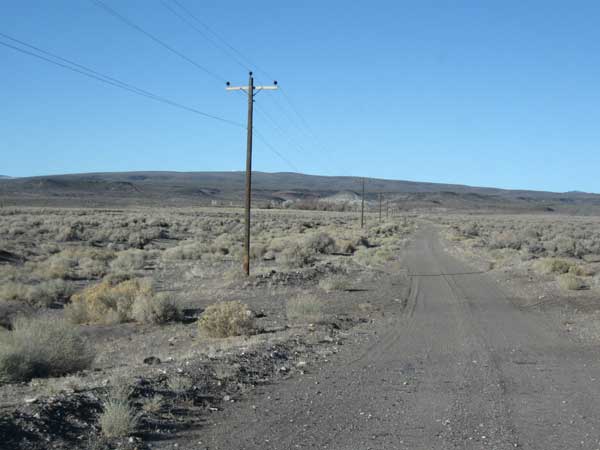
^The 2009 race will go along this ranch road for a mile, along a private property boundary.
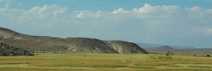
^The 2009 race route goes right next to this ranch in Oasis Valley which has Amargosa toad habitat, in Amargosa River meaodws and wetlands. The race crosses the river area.
Lawless Behavior and Safety: During the 2007 race, we witnessed race participants with open containers of beer at 10:00 a.m. before the race started. This was at the Pioneer Road Staging Area. We also had been run off of Pioneer Road by one of the spectators when trying to exit to Highway 95. These are not the kind of people that are desirable visitors in a small community. The Best in the Desert organization also allows minors to participate in the race as long as they sign a waiver. BLM should not allow such an unnecessary risk to children to take place on lands under their jurisdiction.
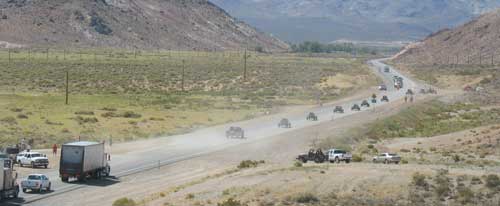
^2008 race crossing US Highway 95. Traffic was halted by police.
Economic Disadvantages: While the Best in the Desert organization will claim that these destructive races provide local economic benefit because racers will stay in local hotels, that always fail to recognize that their destruction of local roads causes obstructions to ranchers, miners and others that use these roads for their jobs. The destruction of these roads sometimes makes them impassible by cutting off access. For several weeks after the 2008 race, the main roads to Death Valley National Park via Strozzie's Ranch were not accessible. This takes tourism dollars away from local communities. Theses races usually only benefit one extreme user group. This is hardly multiple use.
Timbisha/Shoshone Homeland: The race will take place in the Red Cone area behind Bare Mountain. This is Timbisha/Shoshone Homeland. BLM needs to consult with the Timbisha before permitting this destructive event.
Wildfires: BLM will not even issue us a firewood cutting permit until the fall because of concerns that a spark from our chainsaw may ignite a wildfire. Yet BLM will issue a permit for hundreds of gas powered vehicles to run over 100 miles per hour in the same areas in the month of August. We think that is very possible that an accident from one of these vehicles could ignite a large wildfire that could damage public lands and cost tax payers potentially millions of dollars to control. If a wildfire is caused by the Best in the Desert Race, are the holders of the permit held financially responsible for the control of the fire? If not, they should be. If fire Is such a concern for BLM In the hot summer months, why is the race also not scheduled for the Fall? Erosion of soils also spreads invasive weeds such as Russian thistle (Salsola tragus) and halogeton (Halogeton glomeratus) which build up fuels that expedite the spread of wildfires in the region.
Amargosa River and Amargosa Toad Habitat: We were very surprised to see that the new race route parallels the Amargosa River for about one mile in the vicinity of Coffer Ranch and takes place in what the U.S Fish and Wildlife Service has designated as official habitat for the Amargosa toad (Bufo nelsoni). Permitting an off highway vehicle race in toad habitat will only expedite the listing of the toad as endangered. The race could run over and kill toads in burrows or directly kill toads on the ground if there is rain and humidity on the day of the race. Erosion of soils may impair water resources and allow invasive species of weeds to invade and alter the ecology of the Amargosa river bed. The high speed of the vehicles (often over 100 miles per hour) has the potential for accidents. A turned over vehicle could potentially release motor oil, gasoline, radiator fluid and other toxins into the Amargosa River ecosystem. How would BLM Insure that racers will not cut new routes along the Amargosa River? As BLM is aware, there is a petition being considered to list the toad as Endangered under the Endangered Species Act. Allowing an off road race in toad habitat will only insure this listing. The BLM should not even allow this race to cross the Amargosa River. Given the amount of habitat that has already been lost in the range of the Amargosa toad, we feel that the race should not even be considered anywhere near the Amargosa River in the Oasis Valley area.
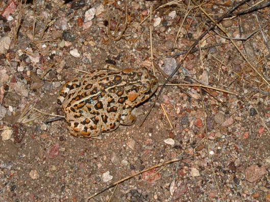
^Amargosa toad.
Desert Tortoise: The race runs through desert tortoise (Gopherus agassizii) habitat from Lathrop Wells to Scotty's Junction. The new route that is on the map follows many areas that do not have roads in them. Why would BLM allow cross country travel in tortoise habitat? How much of the new race route has been surveyed? Will tortoise monitors be hired on the day of the race? How many take permits will be issued for the race? We feel that BLM should hire tortoise monitors for all areas in tortoise habitat during the day of the race. This should not be paid for by BLM or the US tax payers. It should be paid for by the Best in the Desert organization. Direct kills of tortoises are a concern. Erosion of soils and loss of food plants in the habitat are also of concern.
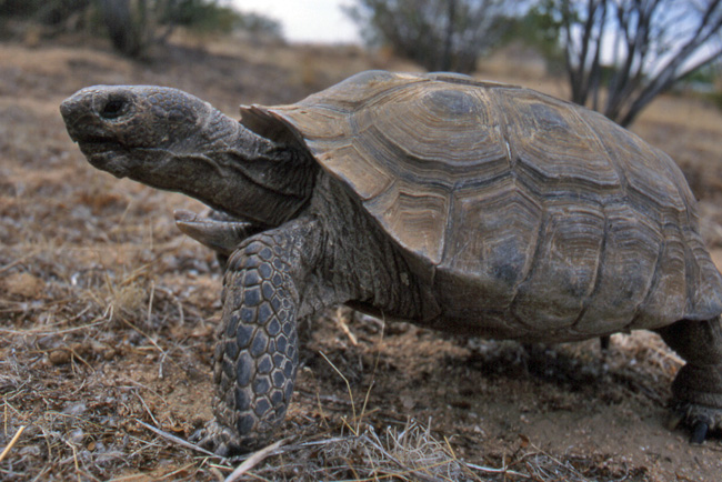
^Desert tortoise roaming through creosote brush.
Other Wildlife: The race will be close to wet lands along the Amargosa River. There is potential of vehicles and loud noise disturbing many species of birds. Bighorn sheep can also be driven away by vehicles and loud noise where the race crosses rugged, mountainous terrain. The race also has the potential to disturb and harass pronghorn antelope in the flat areas along the route.
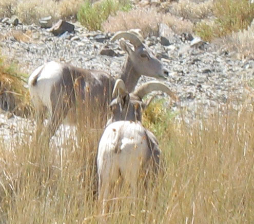
^Desert bighorn ewes.
Rare Plants: We did a thorough search of the Nevada Natural Heritage database and found the race has the potential to disturb the following rare plants that could occur in the Amargosa Valley, Oasis Valley, Bullfrog Hills, Bare Mountain and Sacrobatus Flat all located in Nye County. Most of the area has not been surveyed for plants, and should be before races are allowed:
Arabis shockleyi (Shockley rockcress)
Astragalus beatleyae (Beatley milkvetch)
Astragalus funereus (Black woollypod)
Astragalus serenoi var. sordescens (Squalid milkvetch)
Calochortus striatus (Alkali mariposa lily)
Castilleja martinii var. clokeyi (Clokey paintbrush)
Camissonia megalantha (Cane Spring suncup)
Centaurium namophilum (Spring-loving centaury)
Cordylanthus tecopensis (Tecopa birdsbeak)
Cryptantha tumulosa (New York Mountains catseye)
Cymopterus ripleyi var. ripleyi (Ripley biscuitroot)
Cymopterus ripleyi var. saniculoides (Sanicle biscuitroot)
Entosthodon planoconvexus (Planoconvex entosthodon)
Eriogonum concinnum (Darin buckwheat)
Eriogonum contiguum (Amargosa buckwheat)
Gilia nyensis (Nye gilia)
Gilia ripleyi (Ripley gilia)
Hulsea vestita ssp. inyoensis (Inyo hulsea)
Ivesia arizonica var. saxosa (Rock purpusia)
Lathyrus hitchcockianus (Bullfrog Hills sweetpea)
Penstemon albomarginatus (White-margined beardtongue)
Penstemon arenarius (Nevada dune beardtongue)
Penstemon fruticiformis ssp. amargosae (Death Valley beardtongue)
Penstemon pahutensis (Pahute Mesa beardtongue)
Perityle intricata (Delicate rockdaisy)
Phacelia beatleyae (Beatley scorpion plant)
Phacelia mustelina (Weasel phacelia)
Sclerocactus polyancistrus (Hermit cactus) (below)
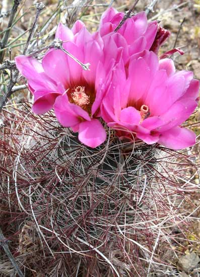
^Hermit cactus (Sclerocactus polyancistrus)
Most of these plants are either recognized as rare by the state of Nevada, or Species of Special Concern by the U.S. Fish and Wildlife service and the Bureau of Land Management. All areas near the race route need to be thoroughly studied for occurrence of these species. Results of the study should be listed in the EA or EIS. The study should be funded by the Best in the Desert organization.
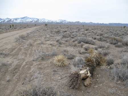
^Joshua tree killed by race impact, February, 2009.
Accountability of Best in the Desert Association: It would be helpful if BLM could send out a report to interested parties after each race that would list all of the violations, mitigations and actions taken to enforce regulations against the Best in the Desert Organization. Because we have witnessed and heard of several violations and conflicts that have arisen from the event, we feel there needs to be a public accountability record that keeps the race organizers, participants and spectators in check.
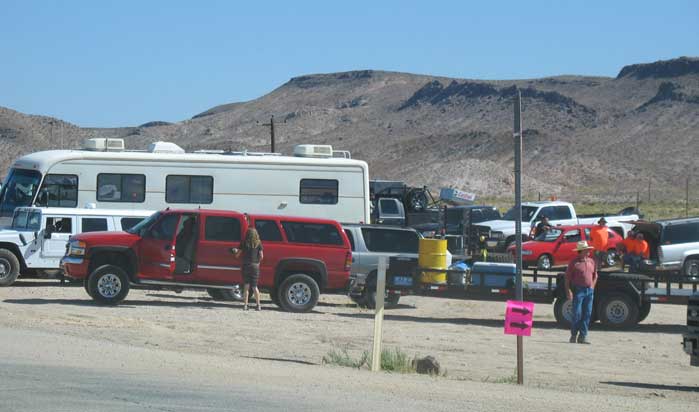
^Staging area for the 2008 race.
Conclusion: Since we have lived in Nevada, we have been witnessing and hearing other locals complains about the resource, private property and public property impacts of the Terrible's Vegas to Reno Best in the Desert Race. Given that the only real benefits have only been reported by those who participate directly or indirectly in this race, we do not feel that this is a multiple use activity. We feel that too many resources and tax dollars are compromised so one extreme user group can benefit. We would like to see this destructive event discontinued. We would like these issues closely examined in an Environmental Impact Statement.
COMMENTS NEEDED:
The Bureau of Land Management, Tonopah Field Office, will conduct an environmental review for the special recreation permit, and hold two public meetings to gather public comments on the proposed off-highway race.
The BLM will prepare an environmental assessment that analyzes the impacts of the proposed race and will accept written public comments until March 6, 2009.
The agency also plans to gather comment at two public scoping meetings to be held in Beatty and Goldfield. Both meetings are scheduled from 6 p.m. to 8 p.m.
February 24, 2009, from 6:00 PM to 8:00 PM at the Beatty Town Hall, Beatty, NV.
February 25, 2009, from 6:00 PM to 8:00 PM at the Goldfield Community Center, Goldfield, NV.
If you would like your name placed on the project's mailing list, please contact Eric M. Williams, BLM Planning and Environmental Coordinator, at (775) 482-7800.
The BLM prefers that written comments be mailed. Written comments on the scope of the EA must be post-marked or delivered by 4:30 p.m. on March 6, 2009.
Below is a letter you may copy and paste, and print out to send to Eric Williams of the Tonopah BLM office, for the area of the race that covers the Mojave Desert. (In the future we will be examining the Great Basin habitats affected by the race). Please feel free to add your comments to this letter to send to BLM before their deadline of March 6, 2009.
Dear Mr. Williams,
I would like to submit the following comments to the Bureau of Land Management (BLM) on the proposed Vegas to Reno 1,000 mile off road race.
Because the race is 1,000 miles long and considering the amount of resource damage it will cause, an Environmental Impact Statement should be written instead of a short Environmental Assessment. The Environmental Impact Statement should be paid for by the Best of the Desert Racing Association (BITD).
Air quality will be an issue for the entire race route. Destruction of soils will keep dust blowing on windy days for years in arid regions. Views of Death Valley National Park, wilderness areas and all open spaces have been compromised. BITD should be required to restore and revegetate the entire race route.
The race route will be going through desert tortoise habitat from Lathrop Wells to Scotty’s Junction. BLM should have tortoise monitors stationed in these areas if the race occurs in desert tortoise habitat. These monitors should be funded by BITD.
The race route will follow the Amargosa River for over a mile in the northeastern region that the Fish and Wildlife Service has designated as Amargosa toad habitat. The vehicles will erode and degrade soils. Accidents could potentially cause hazardous fluids from vehicles to leak into the river ecosystem. The race should not be permitted anywhere near the Amargosa River.
BLM should require BITD to pay for a rare plant survey along the race route. Many species may occur in the path of the race. These species are documented on the Nevada Natural Heritage Database.
The 2008 race route is 250 feet wide in some areas. The race should not be allowed to disturb an area more than 50 feet wide.
The BLM needs to strictly enforce regulations that restrict BITD from going cross country and cutting new race routes.
All public roads damaged by the race should be repaired within three days after the race is completed at the expense of BITD. All trash left by the race participants should be removed within three days after the race is completed.
BLM should not allow the race to be 1,000 miles long. It should avoid wetlands, rare plants and desert tortoise habitat.
BLM should double the amount of law enforcement rangers on duty for this entire race. The amount of incidents caused by this event makes it one of the most dangerous events to the public in the western United States.
To hold BTID in better accountability, BLM should send out a report made available to the public after each race that would list all of the violations, mitigations and actions taken to enforce regulations against the Best in the Desert Organization.
Thank you,
Your name and address
Mail to: Bureau of Land Management
Attn: Eric M. Williams
Tonopah Field Office
1553 South Main St.
PO Box 911
Tonopah, NV 89049
HOME.....2008 Vegas to Reno Race.....OHV Update in Mojave Desert.....OHV News
