Solar Projects Planned Near Death Valley Would Hurt Wildlife, Public Access and the Local Economy
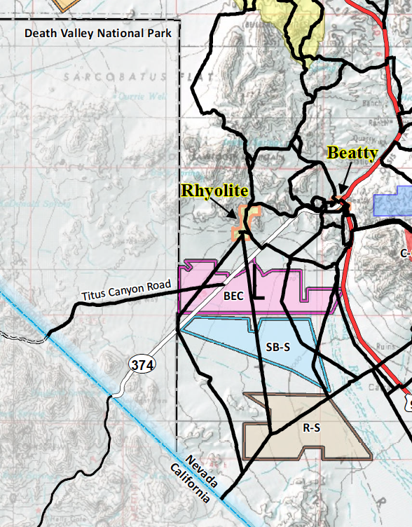
^Detail of map produced by the Town of Beatty showing solar project applications around Beatty, the ghost town of Rhyolite, and the Titus Canyon entrance road.
March 17, 2022 - A new land rush of large-scale solar project proposals have been filed for nearly 60,000 acres of public lands so far adjacent to Death Valley National Park in Nevada.
Two good articles came out recently concerning the many very large utility-scale solar projects in Nevada public lands on the east side of Death Valley National Park, next to Wilderness Areas in the park. These applications are enabled by the proposed Greenlink West Transmission Project that NV Energy is seeking to ship natural gas power generation from the Apex, NV area northwards to the energy-intensive "Silicon Valley" facilities of Reno/Sparks, NV--the Tesla Gigafactory, Amazon wharehouse, Google facility, Blockchain and others. More >>here.
Good coverage by Scott Streater of E&E News:
https://www.eenews.net/articles/solar-boom-casts-shadow-on-death-valley-national-park/
Good local coverage by Scott King of the Sierra Nevada Ally:
https://www.sierranevadaally.org/2022/03/14/a-land-rush-for-renewable-energy/
Vast Utility-scale Solar Projects Threaten Rhyolite and Death Valley National Park
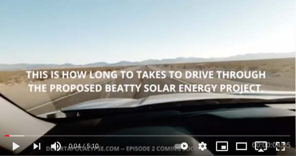
August 28, 2021 - Beatty NV - This is how long it takes to drive through the proposed Beatty Solar Energy Center project. Film-maker Justin McAffee (of Desert Apocalypse fame) followed Basin and Range Watch on a drive from ribbon to ribbon placed by Beatty townspeople along State Route 374, just west of town, for miles and miles, to the entrance of Death Valley National Park in Amargosa Valley, Nevada (YouTube video here: https://youtu.be/Box7yod7kdo). We wanted to give people an idea of how vast and gigantic these utility-scale solar projects truly are, on the gound, in the real world. Not maps or acreage figures.
Another large solar project, SB Solar, also is proposed for this region of the northern Amargosa Valley on public land in Nevada next to Death Valley. The proposed Greenlink West Transmission Project would open up this remote and beautiful northern Mojave Desert region for large-scale energy development, and the local town and many visitors say No!
The Amargosa Valley is an intact and undisturbed desert region, home to Mojave desert tortoises, burrowing owls, and kit foxes. The local communities are supporting eco-tourism, exploration of remote desert landscapes, 4x4 tours of the history and geology of this fascinating region, bird-watching, camping, wildflower-viewing, mountain biking, and more; there are hundreds of miles of designated routes on pubic lands that visitors can explore through historic mining districts, the famous Bullfrog Hills, Tonopah & Tidewater Rail history, ancient Native American cultural landscapes, and beautiful biodiverse Mojave Desert habitats--all threatened by these large-scale solar projects.
We support renewable energy, but not on high-value lands such as these, next to Death Valley National Park and the ghost town of Rhyolite.
Proposed Solar Project Would Ruin View From Rhyolite Ghost Town
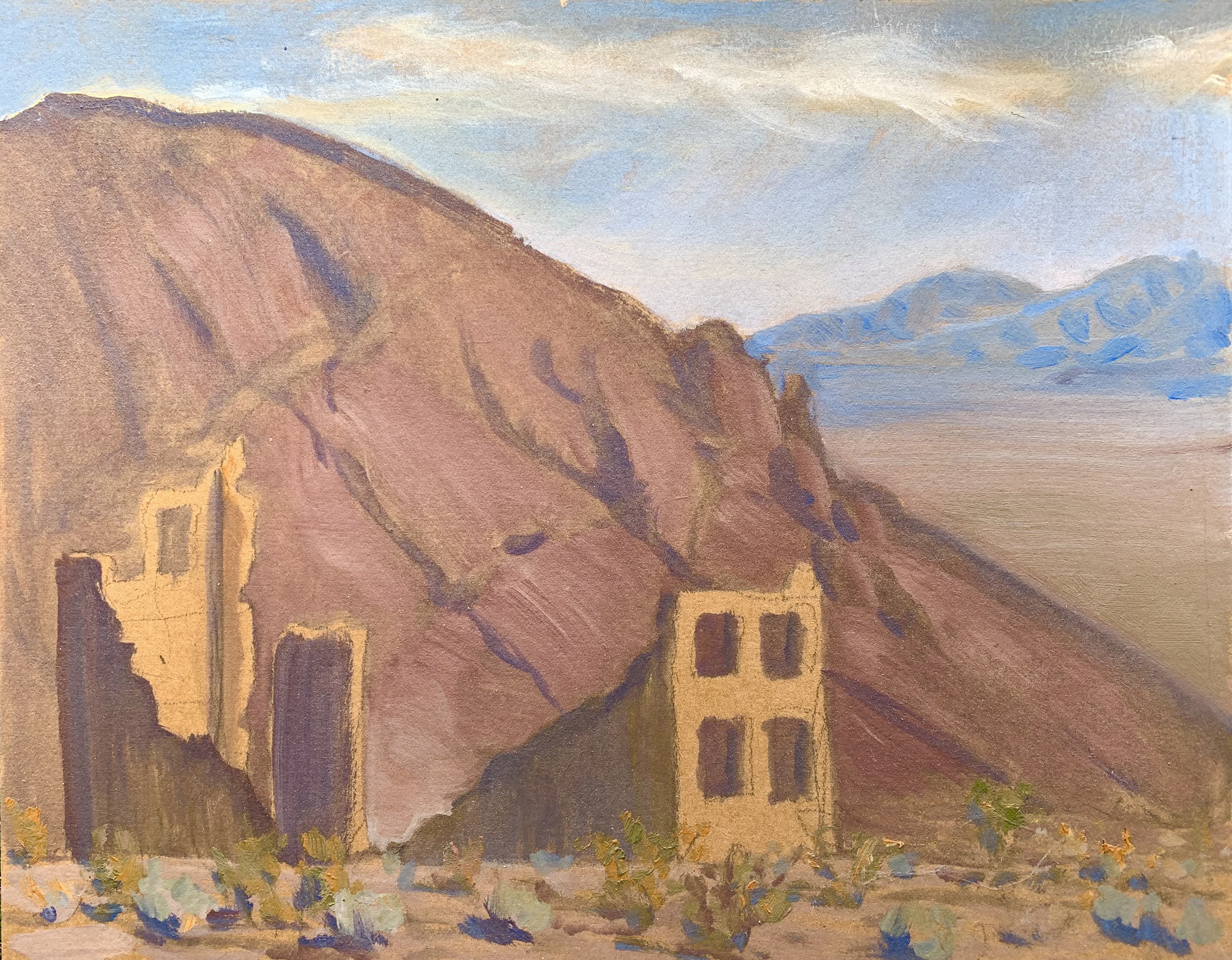
^Plein air oil painting by Laura Cunningham, 2019, of the ruins of Rhyolite, looking towards Amargosa Valley in the distance exactly where the proposed Beatty Solar Energy Center is proposed. The mountains in the distance ar the Funeral Range inside Death Valley National Park and are designated Wilderness.
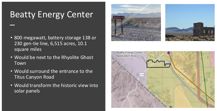
June 5, 2021 - Rhyolite NV - NextEra as Boulevard Associates is proposing a utilty-scale solar project of 6,500 acres next to the famous Rhyolite Ghost Town, along the boundary of Death Valley National Park, and the project would surround the Titus Canyon Road entrance. It can't get much worse thnt this for how to locate energy sprawl.
See the Plan of Development.
This is in Variance land under the Solar Programmatic Environmental Impact Statement, and is outside of a Solar Energy Zone.
NextEra is also building the Yellow Pine Solar Project on top of 90,000 Mojave yuccas, and owns the Silver State South Solar Project in Ivanpah Valley.
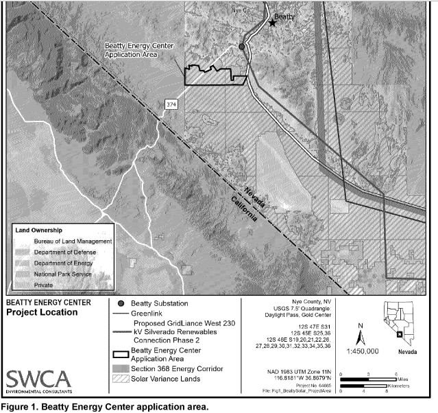
According to the Bureau of Land Management (BLM) there are about 7 additional large-scale solar applications in the area so far. The substation for the proposed Greenlink West Transmission line would go by the US Ecology plant and there is an additional high-voltage line from NextEra proposed. Right now there is no existing transmission infrastructure to support the solar projects, as the area is remote and far from load centers.
The BLM state office is withholding information so we are having to send in a request under the Freedom of Information Act.
Viewscapes Would Be Ruined
June 6, 2021 - Rhyolite, Nevada - We took a field trip to the ghost town of Rhyolite, near Beatty, Nye County Nevada, and the adjacent Goldwell Open Air Museum. The view into the distance of upper Amargosa Valley is integral to the feel of history at Rhyolite. And the wild, remote, undisturbed desert vista is absolutely integral to the outdoor art installations at Goldwell Open Air Museum.
This large-scale solar project would also surround the entrance road to the famous Titus Canyon, a gorge and slot canyon in Death Valley National Park. The one-way tour route starts outside of the park on land managed by the Bureau of Land Management (BLM), and the solar project is proposed on either side of this scenic dirt road.
We cannot think of a more poorly planned location to mar and industrialize significant viewscapes for historic, artictic, and natural resources--right along the Nevada Triangle boundary of Death Valley National Park. When we asked the BLM Filed Office about this, we were told BLM does not recognize a "buffer" designation. See the photos below of these important vistas of the remote Mojave Desert, Nevada.
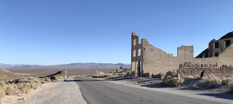
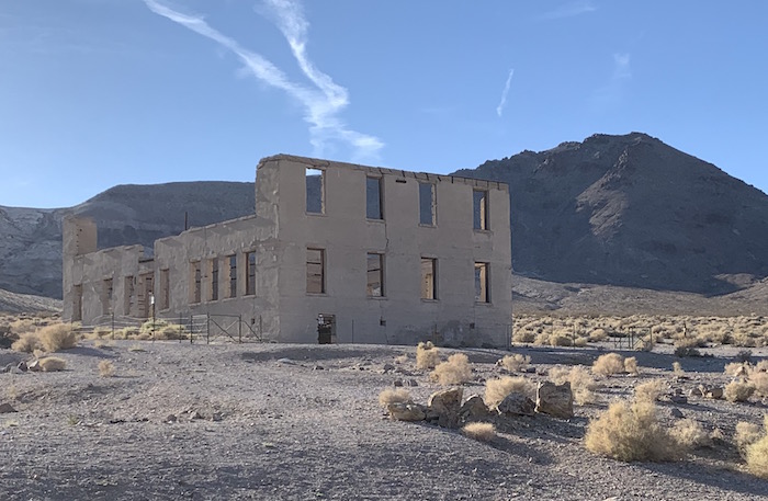
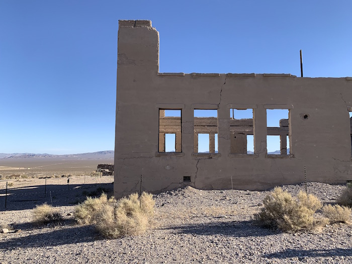
The Ghost Town of Rhyolite
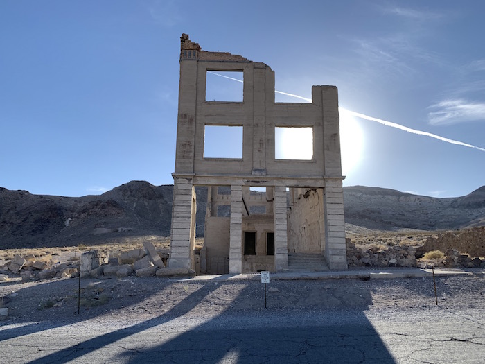
^The famous Cook Bank Building in Rhyolite.
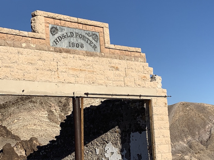
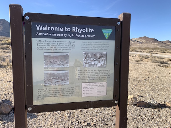
Rhyolite is a ghost town in Nye County, Nevada, in the Bullfrog Hills, adjacent to the eastern boundary of Death Valley National Park. A gold rush began in 1905 as gold-containing quartzite veins were discovered in the surrounding hills. Thousands of gold-miners, developers, and service providers flocked to the Bullfrog Mining District.
Industrialist Charles M. Schwab bought the Montgomery Shoshone Mine in 1906 and invested heavily in infrastructure, including piped water, electric lines, and a rail transportation system. By 1907, Rhyolite had electric lights, water mains, telephones, newspapers, a hospital, a school, an opera house, and a stock exchange. Published estimates of the town's peak population vary widely, but scholarly sources generally place it in a range between 3,500 and 5,000 in 1907–08.
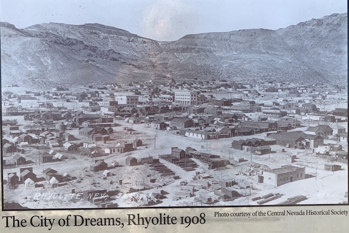
Rhyolite declined almost as rapidly as it rose. After the richest ore was exhausted, production fell. The 1906 San Francisco earthquake and the financial panic of 1907 made it more difficult to raise development capital. By this time, many out-of-work miners had moved elsewhere, and Rhyolite's population dropped well below 1,000. By 1920, it was near zero.
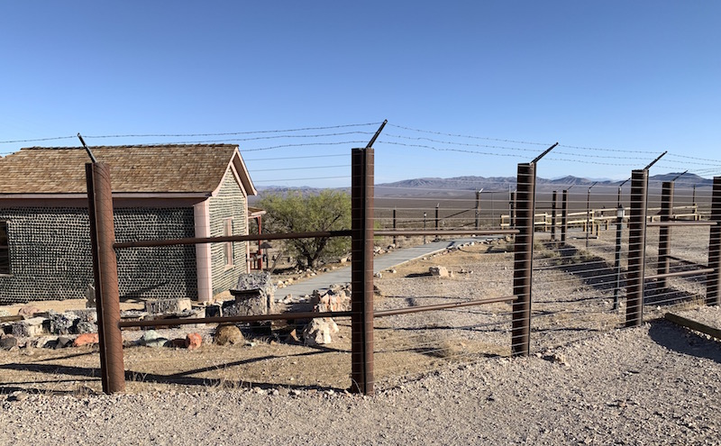
After 1920, Rhyolite and its ruins became a tourist attraction and a setting for motion pictures. Most of its buildings crumbled, were salvaged for building materials, or were moved to nearby Beatty or other towns, although the railway depot and a house made chiefly of empty bottles were repaired and preserved.
^View from the Cook Bank Building would be destroyed by an industrial solar project in the valley desert beyond.
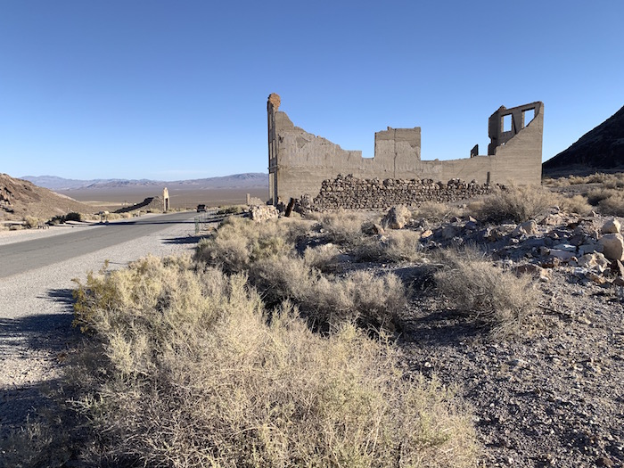
The Bureau of Land Management manages and protects the ruins as the Rhyolite Historic Area. The Cook Bank Building is one of the most photographed ghost town buildings in the West, and the Amargosa Valley viewscape beyond is integral to capturing the feel of the area a century-ago. Little has changed in the Mojave Desert vista, yet the view would be destroyed by a utility-scale industrial solar project with accompanying substation, battery banks, and transmission lines.
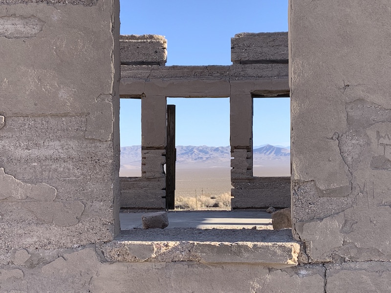
^View through a window of a ghost town building. This precise view would be filled with glittering solar panels across 6,500 acres in Amargosa Valley if the developer got their way.
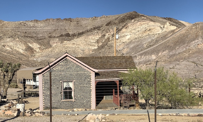
^The old Bottle House at Rhyolite.
^The protected senstive Bottle House, with view of Amargosa Valley beyond--the site of the proposed Beatty Solar Energy Center.
Goldwell Open Air Museum
Adjacent to Rhyolite is the private non-profit art museum showcasing various artist's installations in the open desert, the Goldwell Open Air Museum.
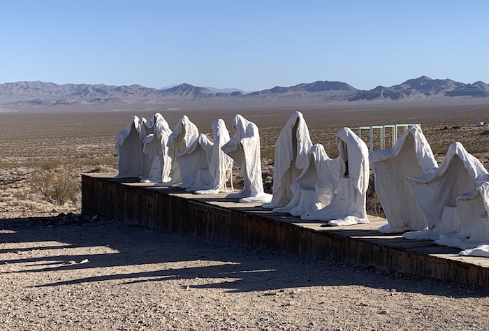
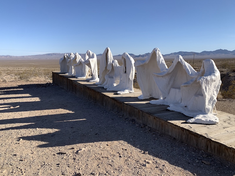
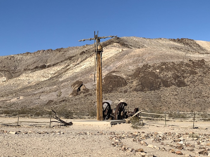
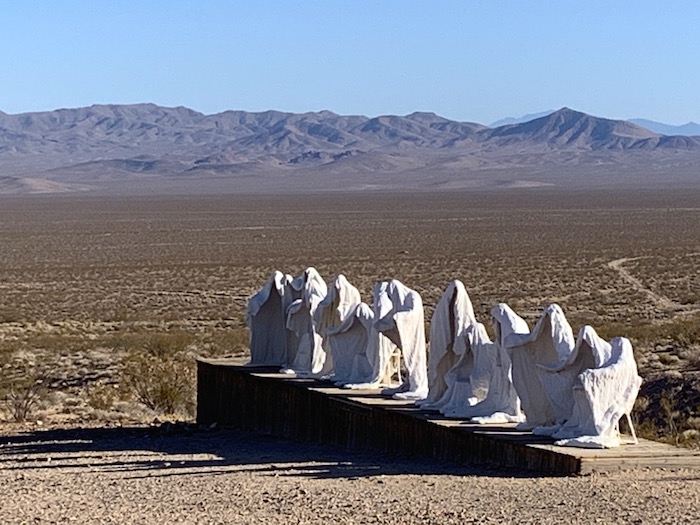
^The Last Supper 1984.
Albert Szukalski came to the Nevada desert in 1984 to create what is perhaps the most unique piece of his career. Originally designed to endure a mere two years, “The Last Supper” sculpture became the centerpiece of the museum.
The Goldwell museum webiste tells how the open, undisturbed desert vistas were critical to Szukalksi's vision, and are actually part of the artwork:
"Albert was attracted to the Mojave Desert for many reasons, not the least of which was the Mojave’s resemblance to the deserts of the Middle East. To construct a modern day representation of Christ’s Last Supper, especially so close to Death Valley (where he originally wanted it sited), is eerily appropriate. Working essentially from Leonardo Da Vinci’s fresco of the Last Supper within the desert environment, Szukalski succeeded in blending the two disparate elements into a unified whole.
"Maintaining the staging of the figures in Leonardo’s work and placing it in the American Southwest allowed the artist to meld Western Artistic tradition with the vast landscape of the New World. Albert Szukalski followed up 'The Last Supper' with two other pieces at the site, 'Ghost Rider' in 1984 and 'Desert Flower' in 1989." (https://www.goldwellmuseum.org/charles-albert-szukalski)
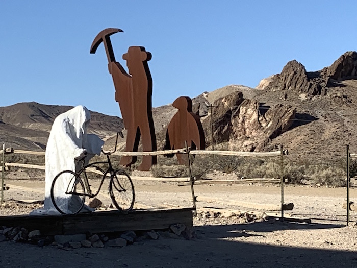
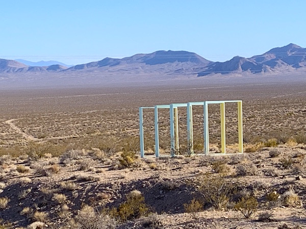
Since then, other artists have added new sculptures, each in its own way showcasing the arid landscape and stark desert vistas.
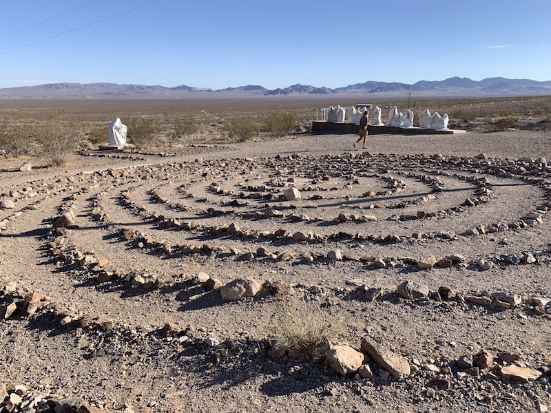
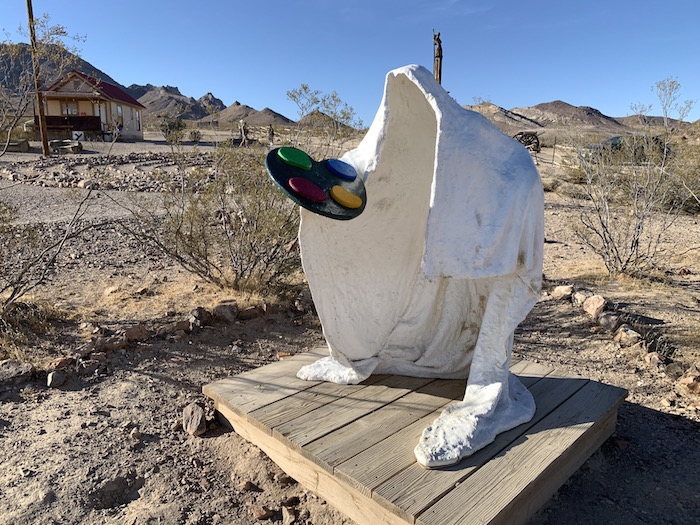
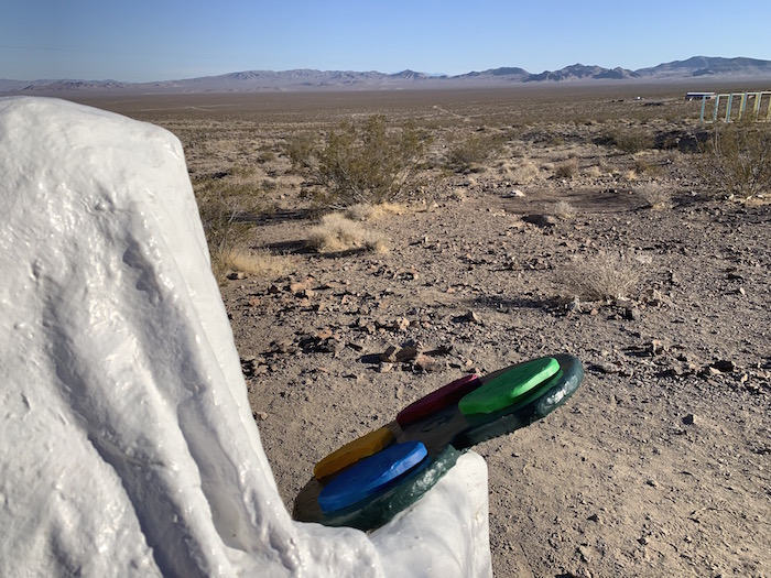
^The view is integral to the sculptures here.
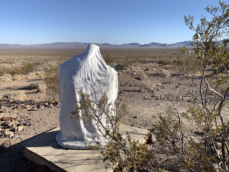
^The artist paints the view and the desert landscape. A massive solar project should not be at this location.
^Beatty Solar Energy Center would fill the desert with an imdustrial solar project in thus exact view.
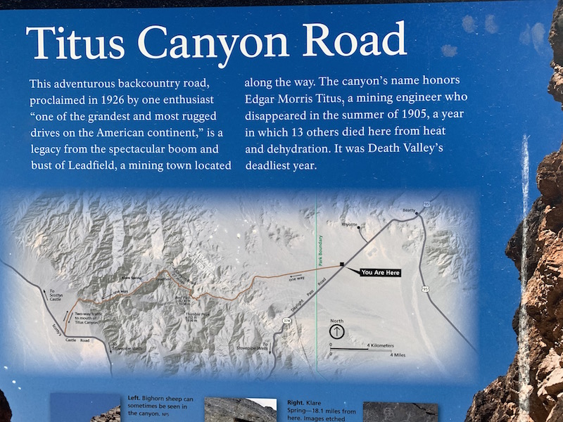
Titus Canyon Route
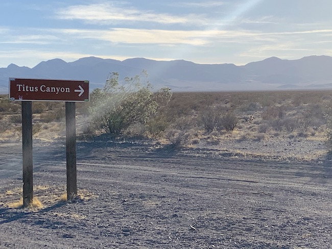
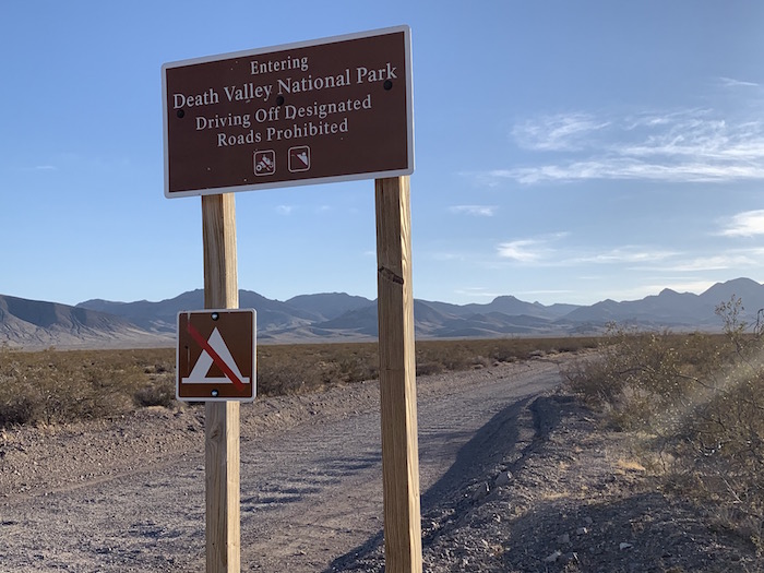
From Highway 374 a one-way dirt road heads from Amargosa Valley into the Grapevine Mountains in Death Valley National Park, along the Nevada-California border. After ascending Red Pass the route descends into Titus Canyon. This is a popular day-long exploration for park visitors, and we object to industrializng the entrance route with energy sprawl.
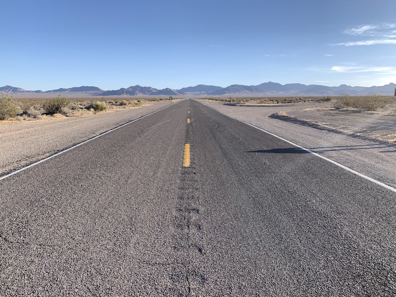
^Highway 374 in Nevada heading from Beatty to Death Valley National Park at Daylight Pass. To the right is the exit route to Titus Canyon. The solar project would fill these scene.
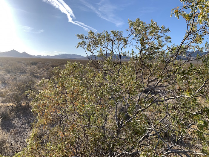
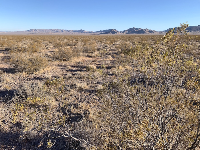
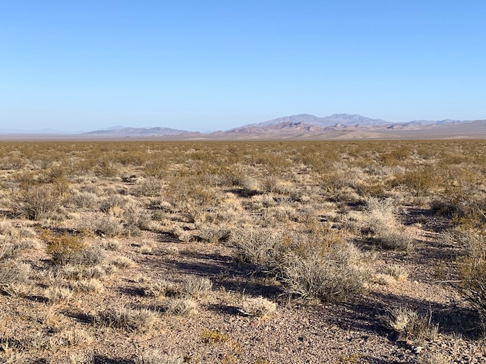
^Creosote bush in open Mojave Desert scub along the Titus Canyon entrance route. This is on the site of the proposed giant solar application on BLM land.
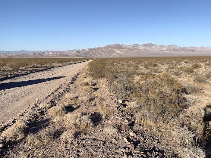
The route to Titus Canyon on BLM land in Amargosa Valley, Nevada, looking back towards the Bare Mountains.
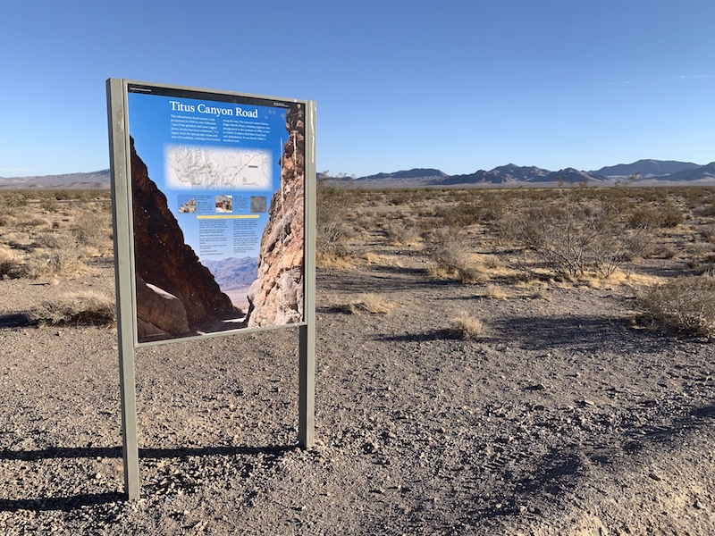
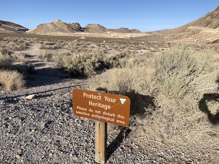
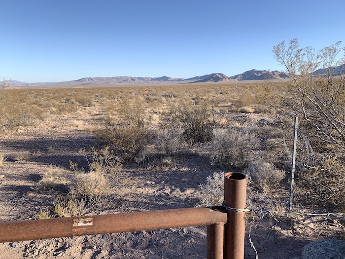
^Interpretive sign along the entrance road to Titus Canyon. The surrounding desert is in the solar application.
^Solar application site by the Titus Canyon Road, Nevada.
^Amargosa Valley along Highway 374, site of the Beatty Solar Energy Center application. The distant Funeral Range is inside Death Valley National Park.
^The Nevada Triangle boundary of Death Valley National Park, along the Titus Canyon Road.
Home.....Death Valley Solar Projects.....Greenlink Transmission Lines.....Amargosa Desert